Significant coastal storm could affect the area this weekend

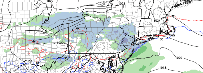
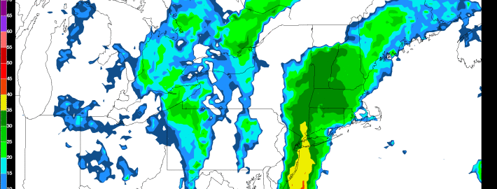
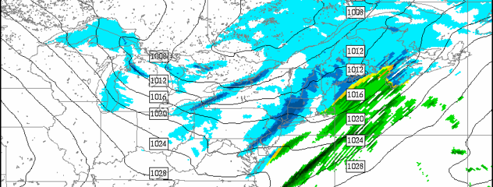
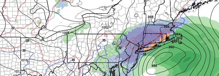
If you hung your hat on a quiet and benign winter after the slow start to December and January, you may want to rethink things. Forecast models are in good agreement on a significant coastal storm — yes, a Nor’Easter — impacting the area this weekend. The storm is likely to form as a result of a significant mid level atmospheric disturbance, which will shift from the Four Corners region of the United States northeastward through the Mississippi Valley and eventually off the coast of the Mid Atlantic States.

The disturbance will force the development of a strong low pressure system, which will shift from the Carolina coast to a position off the Mid Atlantic States and eventually a position near the 40/70 Benchmark on Saturday evening. Forecast models, however, remain somewhat undecided as to the evolution of the energy in the mid levels of the atmosphere — and the evolution and strength of the surface low as it moves up the coast. Obviously, this will have a major impact on the conditions that our area experiences including precipitation type and intensity.

Read more

Clipper could bring light snow accumulations Wednesday

In a winter which has generally been defined by light snow events and fluctuating temperatures, this coming Wednesday could provide a continuation of the theme. A clipper system dropping south and east from Canada is likely to bring the potential for light snow on Wednesday as it moves through the Mid Atlantic states and eventually to a position off the Mid Atlantic Coast. Precipitation is expected to be generally light, but the potential exists for a few inches of snow before all is said and done.

What will become more difficult to forecast is the areas where bands of more steady snow will develop. Forecast models have jumped around considerably in regards to the area where these bands will set up. Confidence, currently, is highest in snowfall totals from 1 to 3 inches throughout the forecast area, with an outside chance of higher amounts underneath those steady bands.

Read more

Heavy rain to impact our area today

Last night and early this morning, many areas, especially north and west of NYC had quite the icing event. Saturday’s Arctic air was a bit more stubborn to leave than forecast, as only a light southerly flow was not enough to escort it out. However, temperatures aloft were able to warm more easily, since wind flow above the ground is stronger. This means that precipitation would melt when it hit the warm air aloft (into rain) but then freeze when it hit the colder ground, giving a lot of the area freezing rain. We are starting to see a transition to plain rain in Westchester county and other immediate NYC suburbs, but most other further north and west suburbs could continue to have ice until around noon or slightly longer. Even as we write this, it is in the 40s in most of Long Island, but only 30 degrees in Danbury airport.

In its wake will be heavy rain for this afternoon. The rain is mostly light across the area, but should become moderate around 11:00am, and will get heavier after 1:00pm. The heaviest rains for our area will be between 2:00pm and 6:00pm, particularly between 3:00pm and 5:00pm, before ending between 8:00pm and 9:00pm. For further east suburbs like Suffolk county, you can push these timeframes back an hour or two.

Read more

Snow showers tomorrow, chilly and potentially active next week

After this morning’s brutally cold weather with single digit temperatures and Wind Chills between -10 and -20, we have warmed up relatively nicely and are approaching 20 degrees. Still, though, it is quite chilly, and with that comes another chance of snow tomorrow morning.

Behind our strong cold blast is another Arctic cold front and shortwave in southern Canada, which will move towards our area tonight. Out ahead of that system, our winds will turn to the SW this evening. This is good news because the SW flow will actually allow our temperatures to slowly rise later this evening and through the overnight. Temperatures will be in the low to mid 20s tomorrow morning — still cold — but not nearly as brutal as this morning.

However, the system will be strong enough to promote a strong SW flow throughout a decent chunk of the atmosphere with a nicely carved trough, leading to an increase in winds once again. Winds could increase to between 20 and 25mph tonight, with gusts over 30mph. This means that Wind Chills will still be in the teens.

As the Arctic cold front approaches as well as its associated potent shortwave, an organized area line of snow showers is possible for the area, generally between 5:00am and 10:00am.

Read more