First week of Spring looks to only be a technicality

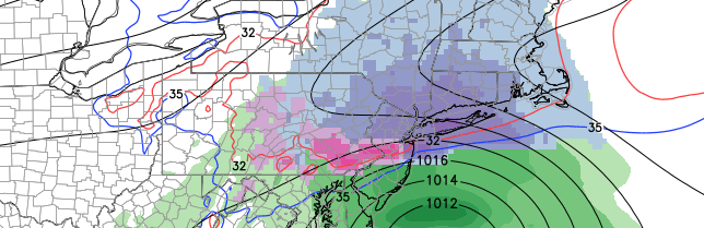
Happy Spring, everyone! Well, sort of. Most of the area was blanketed with between 4 and 7 inches of snow on Friday, which was the first day of Spring. This has helped to bring many official weather stations in our area to over double their average snowfall.

Central Park: 4.7″ on March 20-21, 18.6″ of snow in March, 50.3″ seasonal total.

LaGuardia: 4.6″ on March 20-21, 17.2″ of snow in March, 53.8″ seasonal total.

Islip: 5.5″ on March 20-21, 17.9″ of snow in March, 62.2″ seasonal total.

The snowiest March on record was a whopping 30.5″ in 1896, which is unlikely to be broken this year. But snowfall nearing 20″ this month, combined with temperatures averaging between 3 and 4 degrees below average so far has certainly helped to contradict the fact that March is “Meteorological Spring”.

Unfortunately, the cold pattern looks to be continuing, with perhaps even another chance or two of snow over the next ten days.

Read more

Live Blog: Spring starts with moderate snowstorm

No spring for you! Mother nature has other ideas today — and it seems she hasn’t realized that Winter is over. A mid level disturbance moving from the Ohio Valley to the Northeast States will force the development of a surface low pressure system off the Mid Atlantic Coast. Light snow will spread from southwest to northeast today, becoming moderate and steady during the afternoon. Periods of heavy snow are anticipated this afternoon and evening. When all is said and done, most areas will see between 1 and 3 inches of snow — but a band of 3 to 5 inches of snow is likely from Eastern PA through Central NJ toward New York City.

Follow along with our Live Blog today as our meteorologists update with the latest information, data, observations and forecast:

Read more

Spring begins Friday…with another snowstorm

A disturbance in the mid levels of the atmosphere shifting from the Ohio Valley to the East Coast will force the development of a surface low pressure system, which will move off the East Coast on Friday. Terminology like this has become all too familiar over the past several months, hasn’t it? Nevertheless, this surface low will develop close to the Mid Atlantic coast on Friday, aiding in the development of enhanced mid and upper level atmospheric lift for precipitation. With cold air in place over New England, anchored by a high pressure shifting northeastward, the result will be: More snow.

Snow is expected to spread from southwest to northeast throughout the area on Friday morning. Initially light, it will quickly increase in intensity as a band of enhanced lift moves through the area. Moderate snow is expected to continue through Friday afternoon and evening, when it will accumulate up to 3 to 5 inches throughout the area. The higher amounts of that tier will be more common in bands of heavier precipitation — where heavy snow continues for prolonged periods of time.

Read more

Solar storm causes dazzling aurora display

A large solar storm, owing to a CME (Coronal Mass Ejection) from the sun, caused a dazzling display of Aurora Borealis on Tuesday evening throughout the high and mid latitudes. More commonly known as the Northern Lights, the phenomenal display was one of the best in recent memory — with the color along the horizon visible as far south as Pennsylvania and parts of Long Island. Thousands ran to their cameras and took incredible long-exposure shots of the colors, which danced throughout the northern sky as a result of the aforementioned geomagnetic storm.

The aurora is visible as a result of energized solar particles flying toward Earth from the sun. When they reach Earth, the Earths magnetic field and atmosphere react. These energized particles “excite” atoms and molecules — causing them to light up and create the amazing colors we see. Yes, this is a “bare minimum” explanation, but we’ll keep things simple for now. The solar storm on Tuesday was quite strong — one of the strongest in recent memory with direct impacts on earth. The kP index, used to measure the impacts of these storms on Earth, rose to 8 for a prolonged period of time — which is quite anomalous. Typically, values of 7 or higher are required for our area to see visible aurora.

Read more