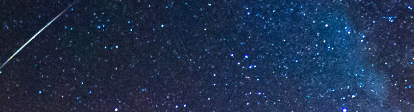
Annual Orionid meteor shower peaks late tonight

Favorable viewing conditions are anticipated for the peak of the Orionid meteor shower tonight, as Earth passes through the debris field of Haley’s comet. The annual meteor shower occurs with varying intensities, but astronomers struggle to differentiate between individual “Forecasts” for the amount of meteors streaking through the night sky. Instead, the shower remains relatively variable and dependent on the density of debris that the Earth passes through.

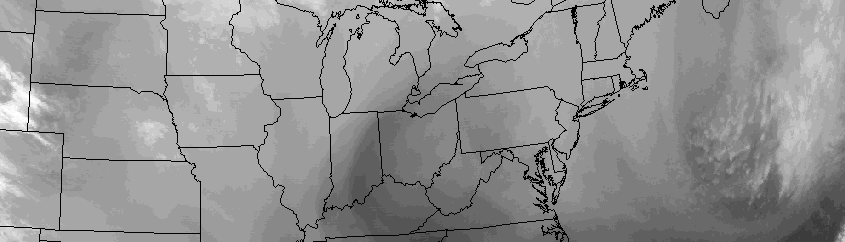
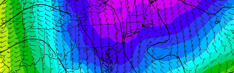
Regardless, the weather tonight is expected to cooperate. A frontal boundary will be situated well to our north, and our area will remain generally under high pressure. While there could be a few clouds moving in and out of the area, there certainly won’t be any overcast conditions — or low clouds, like the ones that obscured our view of the lunar eclipse last month.

Read more

In Autumn, many eyes drawn to the North Pacific

With Autumn very obviously and officially underway (have you been outside the past few days?), the questions have begun to surface regarding the upcoming winter — and if the Autumn pattern will foreshadow it. Unfortunately, it isn’t quite as simple as “A cold October means a cold winter” or ” A warm November means a warm winter”. If that were the case, we’d have long range forecasting figured out by now, and there would be much less urgency to winter outlooks. The best we have for now are correlations, analogs, and pattern drivers. When used together, the summation of these factors provide a higher probability of success in medium to long range forecasting. But these methods are far from perfect. The evolution of these different atmospheric oscillations during the autumn season can often give us substantial clues into the ensuing winter’s dominant index modalities.

Read more

Monday Overview: Warming trend throughout the week

While the frost remains on car windshields and grassy surface this morning, there is some brighter and warmer news in the future. Temperatures by the middle part of this work week will warm quite dramatically, with high temperatures again approaching and exceeding 70 F in many locations. As we look ahead, however, the rest of Monday will remain quite cold and blustery.

Low temperatures on Monday morning bottomed out in the 20’s throughout much of the interior, with a hard freeze occurring in many locations. Even in New York City, low temperatures approached freezing — although we are still awaiting official numbers. Islip, NY unofficially broke their daily low temperature record when they reached a temperature of 30 F shortly before sunrise.

Read more

Surge of cold air, first interior freeze this weekend

A winter-like weather pattern across the Continental United States will bring the coldest air of the season to much of the Northeast this weekend. Temperatures are expected to fall below freezing during the evening and early morning hours across parts of the interior on Sunday and Monday mornings, with the first frost and freeze of the season looking increasingly likely in those areas.

The surge of cold air is being enabled by a large upper level trough, which will amplify from Canada into the Northeast States this weekend. As is typical during the winter months, a large ridge over the West Coast of the United States will help cold air dive southward to its east, into the Eastern United States. Temperatures at the surface (where we are) are expected to fall 15 to 20 degrees below normal by Monday morning.

Read more