-2")
Cool start, unsettled trend by midweek
The week will begin, to the disappointment of many, with colder weather behind a front which shifted through the area on Sunday morning. The anomalously warm, and almost spring-like, airmass which settled into the area during the latter half of last week and this weekend will have been shunted southward. Behind the front will come cooler, less humid air. Monday morning is likely to be quite crisp, with low temperatures in the 20’s and 30’s away from the coast and in the mid 30’s even in the city.
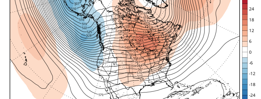
The week will be marked by a transitional weather pattern, beginning with cold air and ending with a gradual warming trend. In between, periods of rain and unsettled weather are expected during the middle part of the week. A low pressure system moving through the Mississippi Valley and eventually reforming off the East Coast will be to blame, with increasing moisture and lift for precipitation by Tuesday and Wednesday.