Brutal cold likely to start the work week

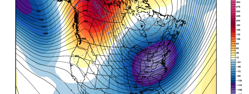
Winter will mark its arrival with a bang on Monday and Tuesday mornings. The warm, humid days of December may very well seem like a distant memory as an arctic airmass seeps into the Northeast United States, first on Sunday and again Monday with the passage of an arctic front. Very cold mid and upper level atmospheric temperatures will dive southward into the region from Canada, as high pressure builds in overhead.

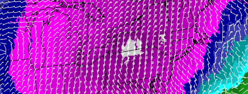
With the passage of an arctic cold front on Monday will come very cold air, blustery winds, and the potential for a few snow showers or squalls. While these snow showers aren’t expected to bring any notable accumulation, they may be just enough to reduce visibility at times on Monday.

Read more

Colder, more wintry pattern ahead: First storm on the horizon? 

Winter is — still — coming. As we move into the New Year, forecast models and ensemble guidance continues to show changes in the mid level atmospheric  pattern that will support much colder temperatures for January than what we saw in December. As explained in our previous post post, the very anomalous Kara Sea Ridge and ridge over Western Canada will cause splitting of the polar vortex at 500mb. This will support polar jetstream shortwave energy diving on the downstream side the Western Canadian ridge (like a slide), carving out a trough over the Northeastern United States.

This pattern will bring a seasonably cold airmass into our region this weekend and early next week. Temperatures will run near or several degrees below normal. An Arctic front on Monday will make Monday afternoon through Tuesday feel bitterly cold, especially when compared to the lack of cold we’ve seen so far. Afterward, temperatures will moderate to several degress above average as the Western Canadian ridge starts to roll over and the trough shifts east later in the week. But this warm up is temporary, as the pattern starts to reshuffle in the higher latitudes.

Read more