Colder air is on the way, but how about the snow?

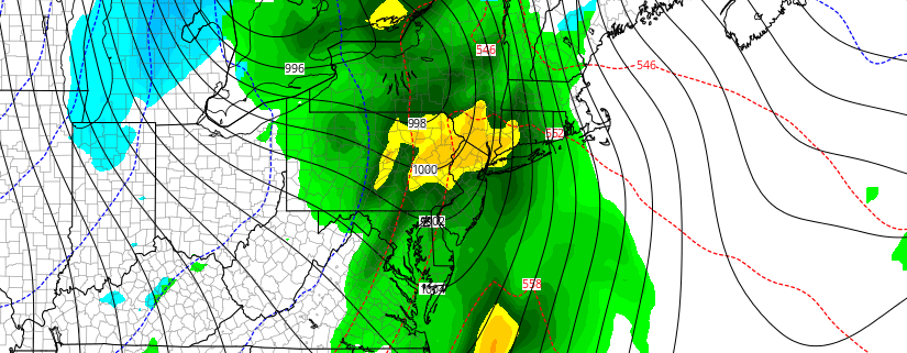
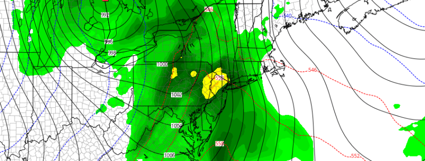
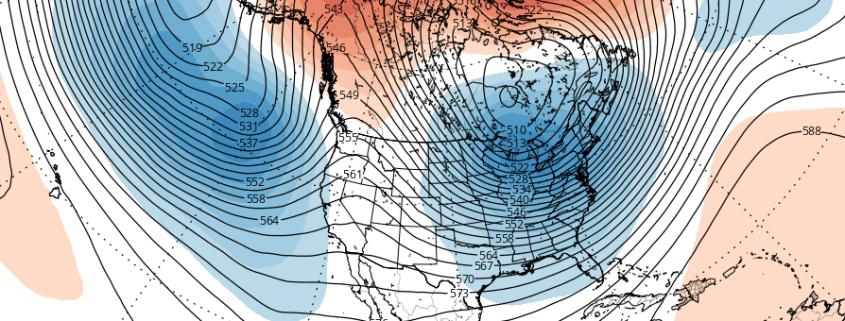
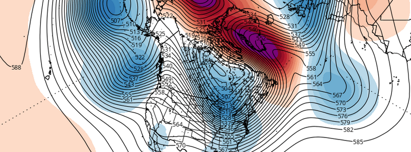
Winter has finally arrived. Despite potentially record breaking warmth for one day this weekend (Sunday), and the return of rain this weekend as well, we will continue to transition into a colder pattern with an arctic frontal passage on Monday. The atmospheric global circulation pattern is trending much more favorably for winter weather lovers — with teleconnections favoring cold being dislodged into the Northern 1/3 of the United States. With high latitude blocking also in the forecast on all medium range models — the question now becomes: What about the snow?

Read more

Wintry mix in the interior, heavy rain and wind this weekend

The coldest airmass of the young winter season is on its way out of the area today, as  temperatures moderate above average into middle and upper 40s for today and Friday. A large high pressure area centered over Quebec will remain in control of our weather for now. Things will start to trend downhill by Friday Night and Saturday with the threat of light wintry precipitation across the interior and higher elevations. Thereafter, a much larger and more intense storm system will impact the area from late Saturday night into Sunday.

Before that storm, a 500mb shortwave and a weak warm front from area of low pressure over Great Lakes will approach southwest on Friday night and Saturday. Significant precipitation is not likely in this region with this system — but there could be enough lift and moisture with these features to produce some light and intermittent precipitation.  At the same time, the high pressure will be slow to lose control and could cause some cold air damming near the surface. Another low will also begin organizing over the Central Plains.

Read more

(Premium) Heavy rain, gusty winds possible this weekend

Forecast models have come into better agreement on the eventual evolution of a low pressure system, which will track from the Mississippi Valley into the Northeastern United States this weekend. Setting the stage for the surface low pressure development will be a mid level atmospheric disturbance, which will eject from the Southwestern United States into the Central United States during the latter half of this current work week. In our area, mid level heights will rise (and temperatures will moderate) ahead of its approach.

Eventually, by Saturday, moisture is expected to stream toward our area as a result of increased southerly winds and a developing low level jet. Initial concerns develop as forecast models show a stout low level cold air signal at the surface, but warming air aloft. This may cause the development of some light frozen precipitation initially in the suburbs or interior. The main hazardous weather threat will come later on Sunday, however, once a significant low pressure system develops into the Great Lakes. A strong low level jet and forcing is likely to bring the potential for heavy rain, as well as gusty winds.

Read more

Does the tropospheric pattern change have staying power?

Winter has arrived. The first shot of arctic air in the young winter season will arrive this week — and it will be brutal, with temperatures in the single digits and teens on both Monday and Tuesday. This cold air will be short-lived, however, as temperatures will warm to above average late this week, as a mid and upper level atmospheric ridge starts to build back over the Eastern US.

Subtropical jet disturbances will be ejecting out of the Southwest United States later this week as the pattern ramps up in activity. The first of these disturbance arrives Friday and Saturday. At the surface, the primary low tracks into the Great Lakes region, while another secondary low forms over the Mid-Atlantic. A warm antecedent airmass and a lack of high latitude blocking should put a serious cap on any wintry weather potential; although some frozen precipitation remains possible in the far interior and higher elevations.

Read more