Multi-hazard system will affect the area midweek

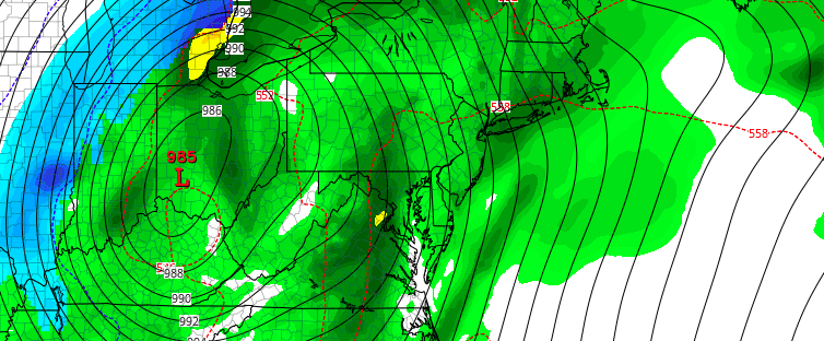
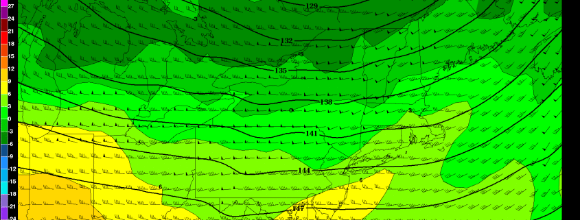
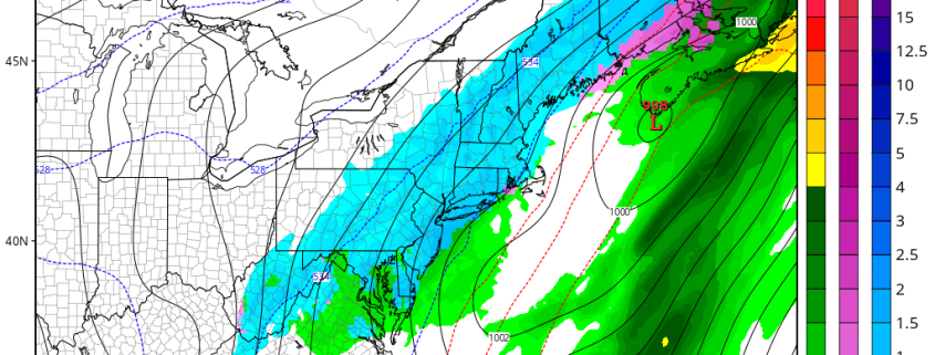
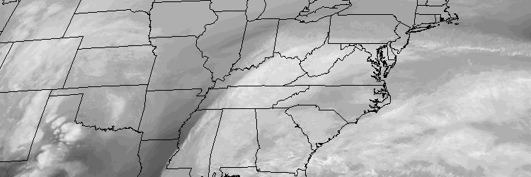
A large and intense low pressure system will form over the Mississippi River Valley and move northward toward the Ohio Valley and Southeast Canada this week, as a result of an impressive phase in the mid and upper levels of the atmosphere. In our area, two distinct areas of low pressure will actually impact our weather; the first from Tuesday into Tuesday Night, and the second from Wednesday into Thursday. Both will feature wildly differing weather conditions, with snow possible across the interior on Tuesday and then heavy rain, warm temperatures, and thunder on Wednesday Night from the second storm system.

Read more

Major storm likely to be more wet than white, this week

A large, powerful storm system is expected to develop from the Mississippi River Valley into the Ohio Valley during the early to middle part of this upcoming week, as a significant phase in the mid levels of the atmosphere occurs. A strong low pressure system will drive northward through the aforementioned areas, allowing a deep southerly flow to draw warm, moist air toward our area during the middle part of the week. Initially there might be enough for cold air around for some frozen precipitation at the onset. But eventually warmer temperatures with periods of heavy rain, gusty winds, and possibly even thunder, will be possible as the storm impacts our area.

Read more

Friday Chill Gives Way to a Warm Weekend

The chilly high pressure system to the north will have one more day of influence before it finally gives way to a very mild weekend. The high pressure is currently sliding out to sea, which will shift our winds to the east and south, but with ocean temperatures so cold this time of year, it can still lead to chilly temperatures. As this high pressure slides further east and away from us, a warm front will approaching the area from the west. This combination will lead to high and thin clouds increasing as the day goes on. Generally, high temperatures will be around 40 degrees.

The warm front will be moving through the area tonight. A weak area of moisture out ahead of it may be able to trigger a few rain and snow showers during the overnight, but we are not expecting any accumulations — a slight chance for a slushy coating in some cold surfaces north of the city. Temperatures will generally hold in the 30s tonight as a much milder mid-level airmass moves in once the warm front swings through.

Read more

(Premium) Upcoming storm has many possible solutions

While we currently are basking in clear skies and chilly northerly winds, the main talk in the meteorology community has been on the potentially  large storm system to affect the eastern half of the US between February 23-25. A few days ago, there was pretty significant model agreement on the storm and the general details — which is quite surprising given the lead-time. Not surprisingly, this agreement has completely reversed and now we have wildly different solutions on every model, all of which have validity.

Let’s get to it.

Read more