(Premium) Record Breaking Cold Possible Sunday Morning… Another Storm Next Week?

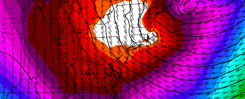
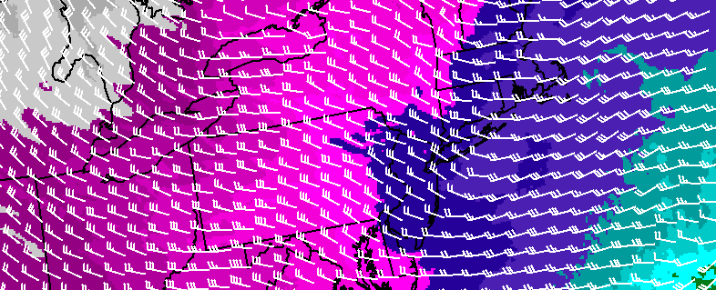
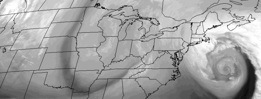
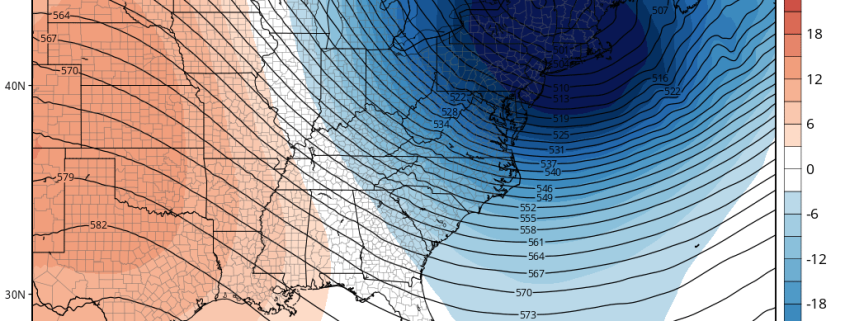
A piece or lobe of the Polar Vortex will swing south over the Great Lakes and Northeast. This supports an Arctic front passing through Friday night. Some snow showers or snow squalls are possible again tomorrow night with this front. Behind this front will be a potentially historic cold airmass for parts of Northeast. Saturday will see temperatures fall from the lower 20s to teens and single digits during the afternoon hours. Winds will also be increasing, as wind gusts between 30mph to 40mph are possible during the day. Thus, windchills will drop to near or below zero and may approach dangerous levels by Saturday evening.

Read more

Coldest air of winter to arrive this weekend

A large arctic airmass, owing to a piece of the polar vortex, will drop southward late this week and weekend from Canada into the Great Lakes and Northeast United States. With it will come the coldest air of the winter — and the coldest air in quite some time, especially aloft. Temperatures at 850mb, or roughly 5000 feet, will drop to nearly -30 degrees celsius, challenging some records for temperatures at that level in the Northeast US for the date.

Read more

(Premium) Weekly outlook and hazards information

A powerful coastal storm will shift east/northeast this afternoon, toward the Northwestern Atlantic Ocean, with lingering impacts expected in our area. This will be especially true for coastal sections of Eastern Long Island, where bands of snow may linger until the evening hours of Monday as the coastal low pulls away. Elsewhere, relatively benign weather will take over with gusty winds in the wake of the storm system — but no further accumulating snow.

Despite the departing storm, there are several other weather events to speak about during the upcoming work week. They begin with a weak coastal storm from Tuesday into Wednesday, and end with bitter cold and a possible coastal storm threat this weekend.

Read more

Behind coastal storm, more snow possible Tuesday

Two atmospheric disturbances within a relatively short distance of one another will impact the area early this week, with the first and more powerful storm grazing the area on Monday. That storm system will strengthen off the East Coast and shift northeastward, bringing periods of heavy snow to Long Island on Monday. The bands of steady snow should graze New York City and the NJ Coast, as the fringe of precipitation sits near the area.

Behind this storm system, precipitation will remain in the forecast — not the typical dry air and clearing that we often see behind Nor’Easters. Instead, another atmospheric disturbance will drive southeastward from the Great Lakes to a position near the Mid Atlantic on Tuesday, and a surface low pressure area will develop off the coast of the Northeast US yet again.

Read more