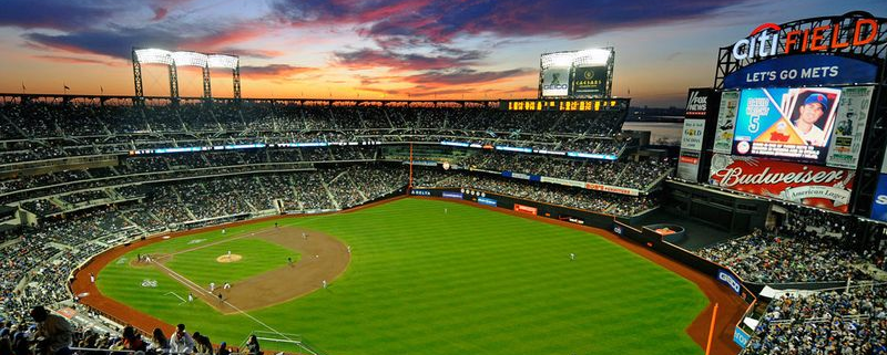
Attention Mets fans! We have a bit of bad timing with an upper-level disturbance moving through that could cause some rain for the Mets vs Giants Game at Citifield tonight at 7:05pm. We suggest you take an umbrella and jacket for the game. Since rainfall looks mostly on the light side, we think they will probably get the game in, but there might be a delay. Stay tuned for updates on our SportsCast page throughout the day.
https://www.nymetroweather.com/wp-content/uploads/2016/04/Mets.png600800Miguel Pierrehttps://www.nymetroweather.com/wp-content/uploads/2024/02/Empire-2000-x-300-px-2.pngMiguel Pierre2016-04-29 15:00:322016-04-29 19:01:59SportsCast: Rain Could Impact Mets vs Giants Games Tonight and Sunday
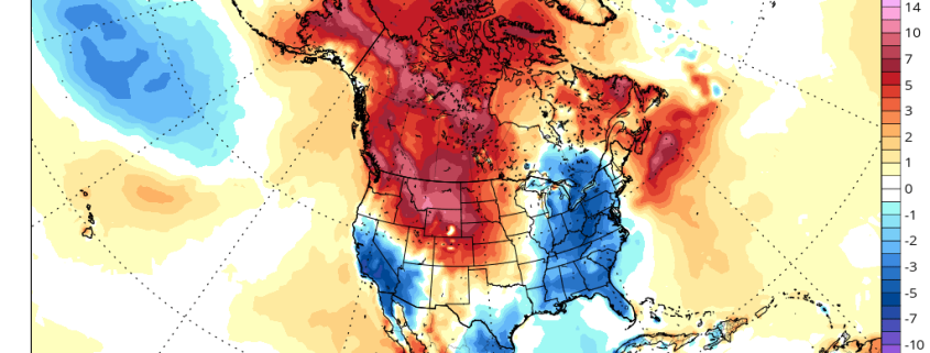
High-latitude blocking returned this week. After a warm start early this week, confluence from an upper-level over Southeast Canada forced a frontal boundary south of the region. This produced cooler than normal temperatures for the rest of the week. As a result, April will likely finish near or slightly below normal on average. It appears that May will start not only cool, but also wetter. So will May also be a cooler and wetter month as a whole? Or will a warming, drier trend occur again later in the month?
For next week, high-latitude blocking over the AO and NAO regions will start to weaken and an upper-level low moves out of Southeast Canada. But an active split flow pattern with Pacific energy undercutting the West Coast ridge remains into next week. This pattern will keep a succession of troughs moving over the Central and Eastern United States for the next week or two. These troughs will supports airmasses coming down from Canada with mostly below normal temperatures. There is still the potential for backdoor cold fronts and cut-off lows with this pattern as well.
https://www.nymetroweather.com/wp-content/uploads/2016/04/gfs-ens_T2ma_namer_34.png6381024Miguel Pierrehttps://www.nymetroweather.com/wp-content/uploads/2024/02/Empire-2000-x-300-px-2.pngMiguel Pierre2016-04-28 23:30:192016-04-29 11:01:11(Premium) Will May Be Cooler and Wetter Than Normal?
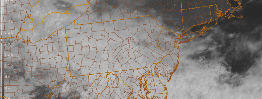
While we ponder over today a stunning new report on the Blizzard of 2016, we’re also looking at the weather over the next few days. It appears that we are entering a cooler and unsettled pattern going into this weekend and beyond. Although we are not looking at any complete washouts yet–at least through Saturday.
For the rest of this afternoon, sunshine will gradually fade behind increasing and thickening clouds. This happens as a wave of low pressure moving east over the Mid-Atlantic region causes the frontal boundary lift northward. Strong confluence underneath an upper-level low over Southeast Canada will keep this frontal boundary south of the region. But some showers will spread north over parts the region later today and early tonight. Generally, light rainfall amounts are anticipated. Temperatures should reach the upper 50s to lower 60s for highs this afternoon.
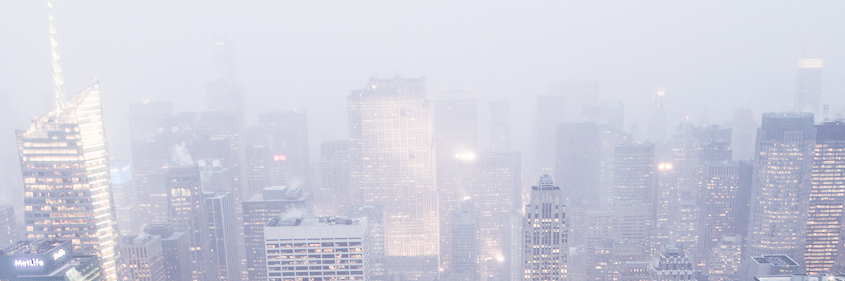
Three months after the last snowflake from the prolific Blizzard of 2016 fell, it has ascended to become the #1 snowfall in New York City’s recorded history. The storm passes February 12th, 2006 which was the previous record holder. The announcement comes after weather enthusiasts and professionals were left disappointed by a 26.8″ measurement which brought the snowfall total just 0.1″ short of the February 2006 record. But a new publication from the National Weather Service says the total will be changed to a whopping 27.5″, adjusting the total well higher and making the Blizzard of 2016 the largest in the city’s history.
It wasn’t additional snow that fell a few minutes after a measurement, or a last minute snow band that was added on to the snowfall total. It was, apparently a “miscommunication between the NWS WFO and Central Park Conservancy”. Or, more likely, a disturbing lack of communication between the two offices at all. The report also says that the Central Park Conservancy, which measures snowfall officially for Central Park, provided a worksheet with snowfall totals which was deemed “accurate”. The official worksheet recorded 0.2″ of snow on January 22nd, 27.3″ of snow on January 23rd, and a trace of snow on January 24th. How a snowfall total of 26.8″ was reported on the night of January 23rd, then, becomes a real head scratcher.
https://www.nymetroweather.com/wp-content/uploads/2015/12/nycwinterheader.png281917John Homenukhttps://www.nymetroweather.com/wp-content/uploads/2024/02/Empire-2000-x-300-px-2.pngJohn Homenuk2016-04-28 11:09:482016-04-29 07:41:123 months later, Blizzard of ’16 becomes largest in NYC history
Hi friends! Our website uses cookies to provide an optimal browsing experience for you. New "Cookie Consent" laws mandate us to inform you of this. As long as you're cool with it, just hit OK. You'll only see this message once.
We may request cookies to be set on your device. We use cookies to let us know when you visit our websites, how you interact with us, to enrich your user experience, and to customize your relationship with our website.
Click on the different category headings to find out more. You can also change some of your preferences. Note that blocking some types of cookies may impact your experience on our websites and the services we are able to offer.
Essential Website Cookies
These cookies are strictly necessary to provide you with services available through our website and to use some of its features.
Because these cookies are strictly necessary to deliver the website, refusing them will have impact how our site functions. You always can block or delete cookies by changing your browser settings and force blocking all cookies on this website. But this will always prompt you to accept/refuse cookies when revisiting our site.
We fully respect if you want to refuse cookies but to avoid asking you again and again kindly allow us to store a cookie for that. You are free to opt out any time or opt in for other cookies to get a better experience. If you refuse cookies we will remove all set cookies in our domain.
We provide you with a list of stored cookies on your computer in our domain so you can check what we stored. Due to security reasons we are not able to show or modify cookies from other domains. You can check these in your browser security settings.
Other external services
We also use different external services like Google Webfonts, Google Maps, and external Video providers. Since these providers may collect personal data like your IP address we allow you to block them here. Please be aware that this might heavily reduce the functionality and appearance of our site. Changes will take effect once you reload the page.
-2")