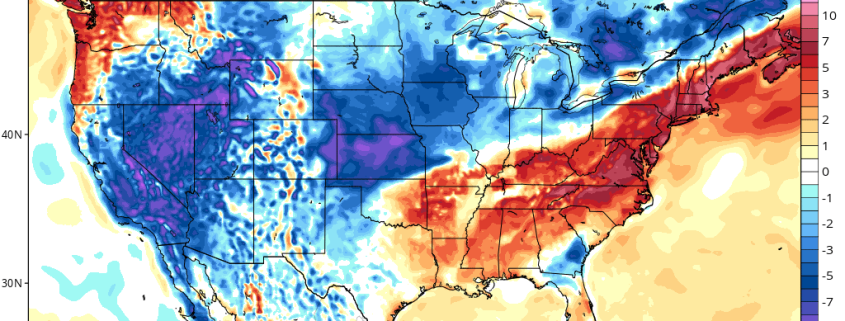
Synopsis: Autumn air in the Northeast US late week

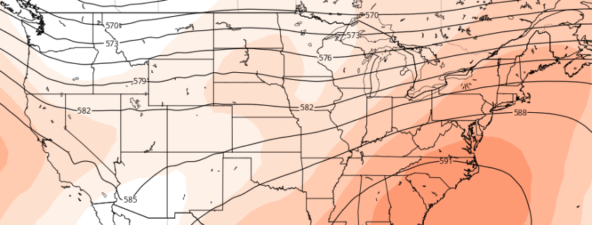
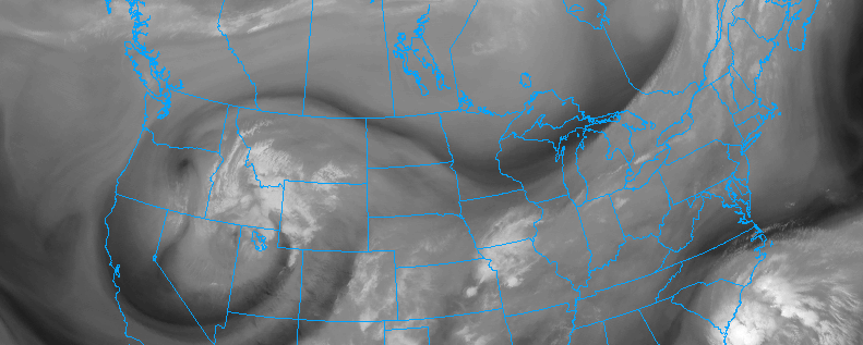
A powerful cold front and thermal gradient, associated with a northern stream atmospheric disturbance, will move toward the area later this week. Along with some showers and storms, the front will bring a much cooler and drier airmass, with origins in Canada, allowing temperatures to fall fairly dramatically on Thursday and Friday. This will come in stark contrast to the overall warm and moist regime which our area has been settled in for quite some time now.

The front will move through later Wednesday, without too much fanfare. Lingering through Wednesday night, a few showers and storms will be possible, but overall limited atmospheric instability will preclude any threat for organized thunderstorms or hazardous weather. Instead, the main story will be a wind shift and temperature drop, as very cool air aloft rapidly shifts into the region and winds turn west-northwesterly.

Read more

Premium Weekly Outlook: Unseasonable warmth bookended by tastes of fall

Another relatively calm and dry week looks to be in-store, as we’ll start off with a taste of fall, moderate to unseasonably warm temperatures, and then again experience a taste of fall. A cold front that moved through on Saturday night has completely cleared the area, giving way to a broad area of high pressure across the region. This has helped dropped humidity substantially, bringing us very comfortable temperatures — we started in the 50s in many locations —  as well as a lovely crisp morning. This high pressure will be in-control for today, with light winds, mostly sunny skies, and temperatures rising into the upper 70s to around 80. The weak wind flow may allow for some seabreezes to develop, but without a big difference in temperature between the land and ocean, these seabreezes should not be too strong, nor penetrate too far inland.

Read more

Long Range: Autumn cold blasts, southeast ridge

Meteorological Autumn technically began 9 days ago now. Although Hermine took much of the focus off its start and placed it on tropical weather, the first 9 days of the meteorological season have offered an ironically similar pattern to what had been observed over the last month or so of summer. Warmer temperatures have dominated in the East — especially the Mid Atlantic. Much of this owes to a Southeastern US ridge, which has built back continually over the past 2 months, even when forecast models have suggested otherwise.

Meanwhile, back west, cold fronts and disturbances have continued to drop southward through the Northern Great Plains and into parts of the Great Lakes and Mississippi and Ohio Valleys. By and large, however, the colder than normal temperature anomalies associated with these disturbances have remained west of the Mississippi River. Airmass modification has essentially nullified any below normal temperature anomalies as they move east of there.

Read more

ENSO state in limbo as La Nina struggles

Much fuss has been made over the past several months in regards to the development of La Nina this year, coming on the heels of one of the strongest El Nino’s on record. There is a propensity for these things to occur, after all, and a significant cooling of Nino-region pacific temperatures led many to believe that a La Nina was not only on its way — but could be moderate or strong by the time cold season arrived in the Northern Hemisphere. Those ideas will not come to fruition.

The lack of La Nina development has, instead, been notable — with a significant lack of depth to any cooler sea surface temperature anomalies. Trade winds aren’t cooperating (we’ll get into that more later) and tropical forcing seems to favor this pattern continuing through the next few months. It appears likely, now, that La Nina will never truly get off the ground. Forecast models have responded, with monthly and seasonal data now pointing to a Neutral (La Nada) pattern through at least the first half of North America’s calendar Winter.

Read more