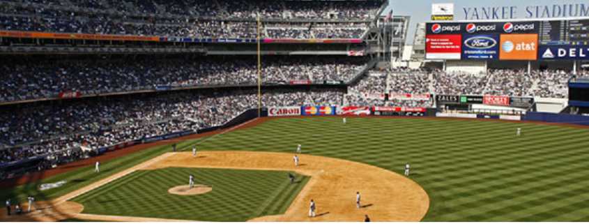
Hey, Yankee fans it looks like showers will taper off mostly in time for the game tonight. If you are going to the game, you might still want to take an umbrella this evening. Some of the latest guidance shows some showers that could move through the early innings. Our forecast from our SportsCast page is below.
https://www.nymetroweather.com/wp-content/uploads/2016/05/MLB-Yankees-Stadium-Pic-1.png337947Miguel Pierrehttps://www.nymetroweather.com/wp-content/uploads/2024/02/Empire-2000-x-300-px-2.pngMiguel Pierre2016-05-13 16:20:082019-06-20 19:15:14Sportscast: Showers Taper off For The Yankees Game Tonight
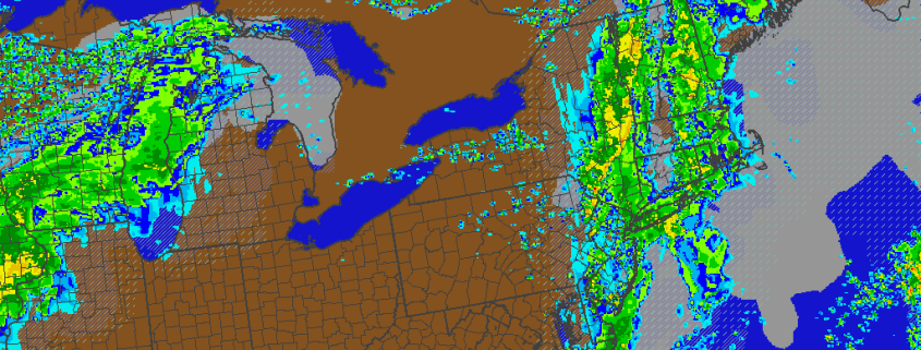
After a little sunshine to start early this morning, it has turned more dreary and dismal. A warm front south of region, has more clouds to increase and thicken over the area with few scattered showers and drizzle. An occluded frontal boundary will move through region later today, with more showers increasing in coverage this afternoon. Skies will remain mostly cloudy with south to southeast winds, ahead of this boundary and keep temperatures mostly the in the 60s this afternoon.
Heaviest showers are most likely with forcing along the shortwave trough be northwest of the region. Precipitable water values range from 1.50″ to 1.75″. So heavy downpours with localized flooding is possible. Some elevated instability this afternoon with MUCAPE values near 500 J/KG. So there is also chance for some rumbles of thunder. But models are also showing a marine stable layer with CINH, that could cause any thunderstorms to weaken as they approach the coast.
https://www.nymetroweather.com/wp-content/uploads/2016/05/HRRR-Today.png8191024Miguel Pierrehttps://www.nymetroweather.com/wp-content/uploads/2024/02/Empire-2000-x-300-px-2.pngMiguel Pierre2016-05-13 12:30:122016-05-13 16:24:03Occluded front with showers this afternoon, Strong T-storms possible tomorrow
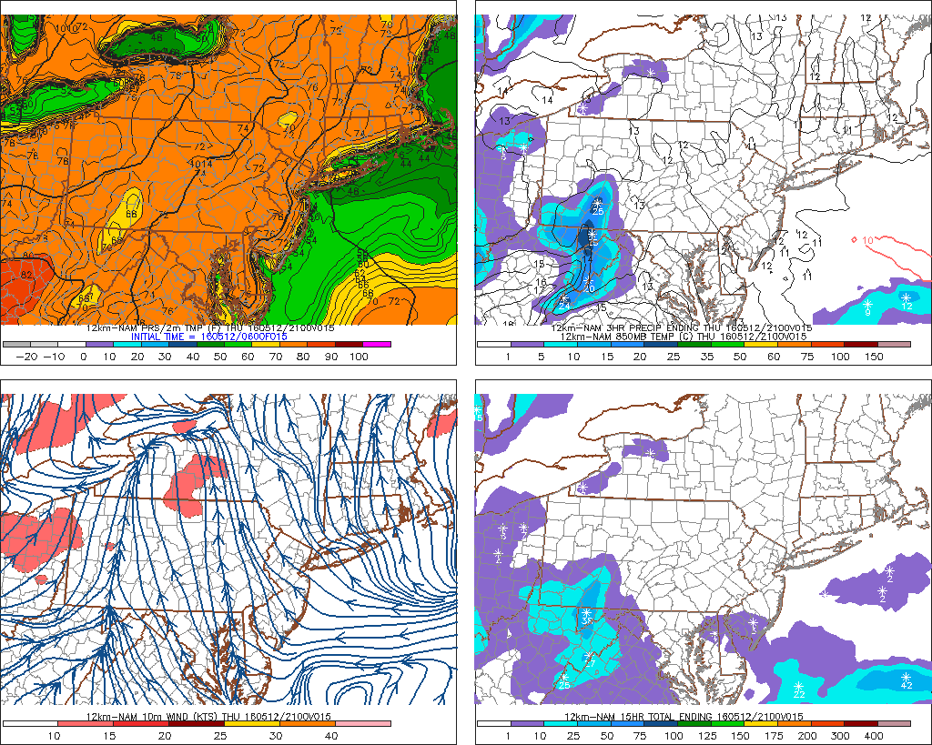
Another beautiful day is in-store for the region today. An upper-level ridge over the region will provide the region with clear blue skies and plenty of sunshine today. Temperatures should reach the middle to upper 70s across inland sections of the area. However, light southeast winds will keep temperatures cooler along the coast this afternoon. Temperatures will likely reach upper the 60s to lower 70s by early this afternoon closer to coast, especially over Long Island, New Jersey shore and Coastal Connecticut. Then temperatures will slowly fall along coastal sections for the rest of the day, as a seabreeze looks to develop.
The NAM showing temperatures in middle to upper 70s inland and upper 60s to lower 70s with light SE winds later today (Image credit: PSU Ewall)
Skies will remain mostly clear into early this evening, then become mostly cloudy later tonight as low-level moisture increases with onshore flow and a marine inversion. But it will likely remain dry overnight, with temperatures dropping into the middle to upper 50s. Then the region will be under the influence of large upper-level low traversing through the Great Lakes and Northeast over the next several days.
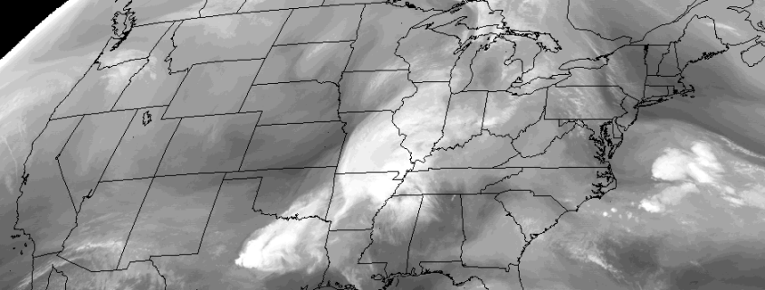
https://www.nymetroweather.com/wp-content/uploads/2016/05/Visbile-image.png571938Miguel Pierrehttps://www.nymetroweather.com/wp-content/uploads/2024/02/Empire-2000-x-300-px-2.pngMiguel Pierre2016-05-12 12:30:522016-05-12 13:03:11Beautiful weather today, some showers and t-storms around Friday & Saturday
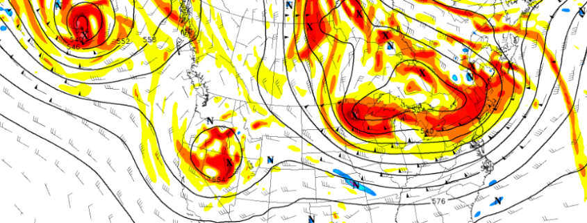
It’s May 11th, which means it’s getting in the late meteorological Spring season. Many of us often look forward to even warmer weather as we approach Memorial Day weekend and the beginning of meteorological summer. But the seasonal trends with blocking causing cool air intrusions are continuing over the last couple weeks, with omega blocking becoming a dominant presence. Now some high-latitude blocking is returning again for another cooler week of weather. But how cool will it actually be? And when will warmer weather return? We discuss more details on the overall pattern evolution for the rest of this month.
We start with a -EPO blocking ridge over Alaska. Shortwave energy coming downstream of this ridge will phase into a closed upper-level low over the Great Lakes later this week. Initially, this will cause heights to build over the Northeast. At the surface, high pressure will build over the Western Atlantic. More southerly flow around this high pressure will cause temperatures to rise near or slightly above normal for this coming Wednesday and Thursday.
Hi friends! Our website uses cookies to provide an optimal browsing experience for you. New "Cookie Consent" laws mandate us to inform you of this. As long as you're cool with it, just hit OK. You'll only see this message once.
We may request cookies to be set on your device. We use cookies to let us know when you visit our websites, how you interact with us, to enrich your user experience, and to customize your relationship with our website.
Click on the different category headings to find out more. You can also change some of your preferences. Note that blocking some types of cookies may impact your experience on our websites and the services we are able to offer.
Essential Website Cookies
These cookies are strictly necessary to provide you with services available through our website and to use some of its features.
Because these cookies are strictly necessary to deliver the website, refusing them will have impact how our site functions. You always can block or delete cookies by changing your browser settings and force blocking all cookies on this website. But this will always prompt you to accept/refuse cookies when revisiting our site.
We fully respect if you want to refuse cookies but to avoid asking you again and again kindly allow us to store a cookie for that. You are free to opt out any time or opt in for other cookies to get a better experience. If you refuse cookies we will remove all set cookies in our domain.
We provide you with a list of stored cookies on your computer in our domain so you can check what we stored. Due to security reasons we are not able to show or modify cookies from other domains. You can check these in your browser security settings.
Other external services
We also use different external services like Google Webfonts, Google Maps, and external Video providers. Since these providers may collect personal data like your IP address we allow you to block them here. Please be aware that this might heavily reduce the functionality and appearance of our site. Changes will take effect once you reload the page.
-2")