2/9 PM Zones: Storm exits, more to come in New England

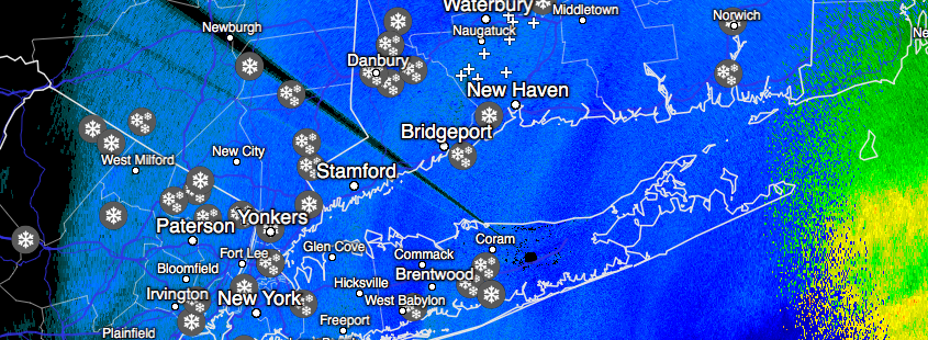
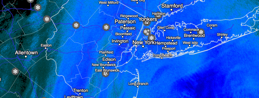
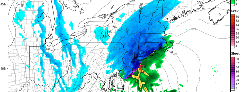
Snow is wrapping up from west to east throughout the area this evening, including parts of Long Island where snow has lingered for the longest today. A low pressure center moved from the coast of New Jersey to a position south of New England — in fact, quite close to the 40/70 “Benchmark” for impactful storm systems. Impactful snow moved from Northeast NJ and NYC through Long Island and Connecticut, and now is positioned near Southern New England.

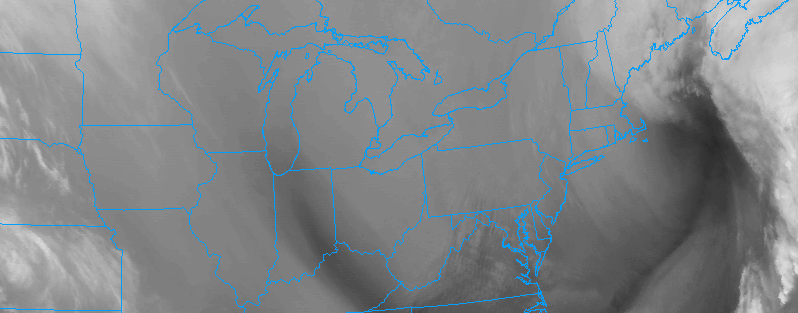
The storm system will continue wrapping up and pulling further eastwards as the evening goes on tonight. As low pressure moves away from the Northeast US, northwesterly winds will gradually allow drier air to move into the region. A developing pressure gradient between the low pressure center and an incoming high pressure will lead to the potential for gusty winds through the evening. This will be especially true near the area coasts, where gusts may exceed 35 miles per hour at times.

Read more

Zone 2/8 (LI/CT) Update: Heavy snow continues today

Bands of heavy snow will continue moving into the region late this morning and into this afternoon, as a low pressure system develops and continues to strengthen offshore. This low pressure will shift from a position off the New Jersey coast towards a position south of Southern New England as the day goes on today — strengthening quite significantly as it does so.

In the mid and upper levels of the atmosphere, dynamics will continue to become more impressive this afternoon. This will be most notable in the mid levels, where temperature and wind gradients will enhance a phenomenon known as “Frontogenesis”. This occurs when temperature and wind gradients create enhanced lift — leading to very heavy precipitation.

Read more

All Zones Free Video Update: Significant snowstorm continues

A free mesoscale update this morning for those of you who may possibly be looking for additional information on the evolution of the storm system. The low pressure system continues to develop as expected and only minor tweaks were made to our forecast from yesterday! Snow continues throughout the majority of the area for the next few hours while beginning to gradually taper from west to east around noon.

Heavy snow will develop over Long Island and Connecticut with blizzard conditions and rapid snowfall accumulation expected there from late morning into the early afternoon hours. Our latest video discussion below covers the latest developments and analysis of mesoscale features:

Read more

AM All Zones Update: Major Snowstorm Underway for Much of the Region

An area of snow, sleet and rain overspread the region overnight. Precipitation started as some sleet and rain in some areas, because temperatures at the surface and aloft were warmer. But as low pressure strengthens near the Delmarva coast, the airmass will be turning colder with increasing northerly winds this morning. This cause precipitation will changeover to snow in all areas by 8am. It has already changed over to all snow from C NJ and north as of 7am.

Then snow will be moderate to heavy at times for rest of this morning through the region. Temperatures will be dropping into the 20s. So this snow will begin accumulate more rapidly on roadways this morning and reducing visibilities.

Read more