AM All Zones Update: Cold Weekend, Tuesday & Wednesday Storm

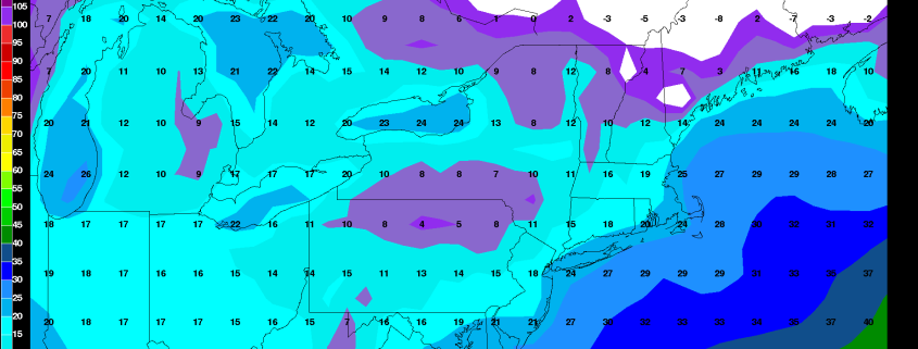
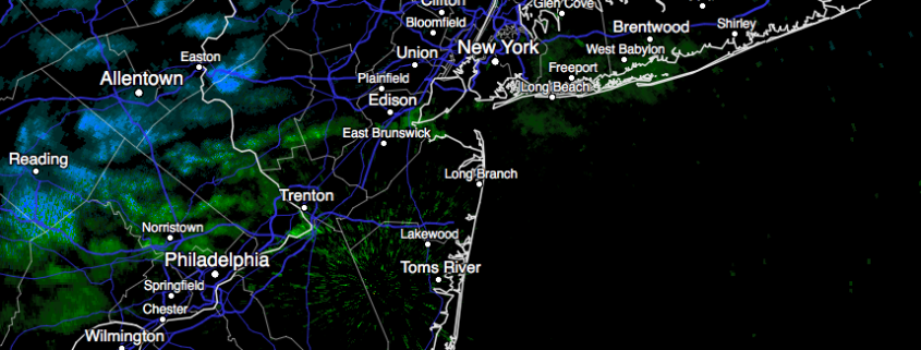
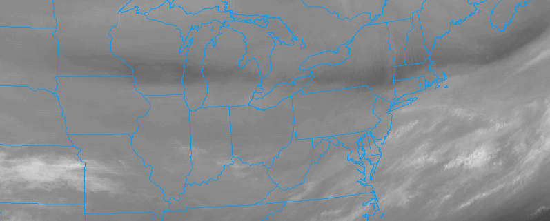
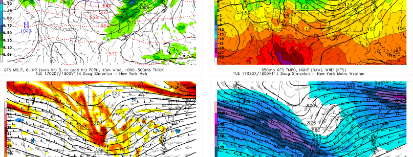
A colder than normal airmass will be over the region through at least Saturday night. Some more clouds will be around later today and early tonight with weak shortwave trough and cold front moving through the region. A few widely scattered snow showers can’t be ruled out again, especially over the Interior. But high pressure over the Ohio Valley and Mid-Atlantic regions will largely be in control with dry weather over the next few days.

Read more

2/2/17 AM All Zones Update: Colder Trend Late Week, More Active Wx Early Next Week

Some cloud cover and perhaps some flurries will be around this morning, as a cold front passes through region. Then skies will clear for more sunshine this afternoon, with drier westerly winds. Temperatures will rise into upper 30s to lower 40s over most of the region, by early this afternoon. Then begin falling later in the afternoon, as a colder airmass begins moving into region. Winds could also be gusty, behind the cold front this afternoon, from between 30 to 40 mph.

Read more

PM All Zones Update: Snow showers, colder weekend ahead

Scattered snow showers are moving through the area this afternoon, in response to a disturbance in the mid and upper level of the atmosphere and favorable lift in the area. These will continue to shift from northwest to southeast today, towards the coast, impacting parts of the region with brief periods of snow. Very light accumulations are possible, but impacts are expected to remain limited.

These snow showers will wane as the evening approaches tonight, especially near and after sunset, with improving conditions expected as the evening goes on. Temperatures will be colder than they were last night, but still warmer than normal for this time of year. This won’t last long — as a strong cold front is approaching the area and will bring a notable change in temperature on Friday.

Read more

2/1/17 Evening All Zones: Colder weather arrives late this week

Scattered snow showers, associated with a mid and upper level disturbance, began to wane this evening right around sunset — and improving weather conditions are expected tonight. Clouds will remain, however, as the aforementioned mid level disturbance will still be traversing the area overnight tonight. This will be especially true in Southern portions of the forecast area which will see the most maintained cloud cover tonight.

Some blustery winds will also continue near the coast, while diminishing inland. The overall theme of the weather tonight will be pleasant, with temperatures 7 to 10 degrees above normal lows for this time of year — thanks half in part to the airmass itself, and the other half in part to the cloud cover which will linger over the region.

Read more