-2")
Public Analysis: Relatively Cool and Unsettled Memorial Day Weekend Likely
Good Evening and Happy Friday!
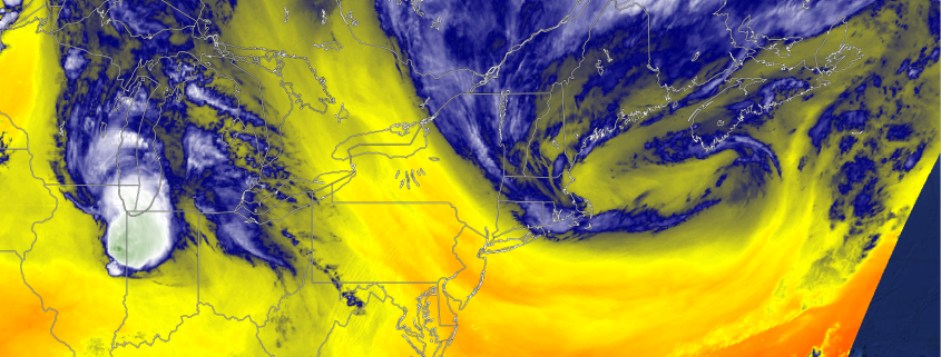
The area of low pressure that was previously located over the Ohio Valley during the day Thursday that brought moderate to heavy rainfall over much of the area, died off as was forecast back on Monday, while a more powerful and impressive area of low pressure began to develop off of the New Jersey coastline late last evening due to strong upper level energy rounding the base of a large trough located over the Mid-Atlantic coast. This secondary area of low pressure brought more steady rain overnight, especially for locations north and east of New York City. As this system began to wrap up and move along the coast, it brought some lingering showers this morning and through portions of the afternoon, many of which were light to moderate in nature.
These residual showers were mainly fueled by the very cool upper level temperatures high up in the atmosphere, combined with clearing skies which lead to surface heating. As some locations began to see prolonged periods of sun and as their temperatures rose, that warmer air near the surface began to quickly rise into the cooler upper levels, which caused that warm to quickly condensate, and form cumulus clouds, with some isolated showers. As the low pressure off of the New England coast began to move away late this afternoon, it began to draw in more dry air from Canada which helped to mitigate any widespread shower development. These Northwesterly winds also ushered in a new Canadian air-mass that allowed temperatures to rise into the low to mid 70’s across much of the region, which made it feel quite pleasant compared to the past few days.
As we progress into the evening hours, the vertical temperature gradient will begin to level off, and when combined with drier air in the mid levels of the atmosphere, this should make for rapidly diminishing clouds. Light Northwesterly flow, a new dry air-mass from Canada, and clear skies will be quite favorable for any leftover surface heat to rapidly radiate back into the atmosphere, which is what is often referred to as “radiational cooling”. This should allow temperatures to quickly dip into the 50’s for urban and coastal sections, with 40’s possible for locations removed from the coast.
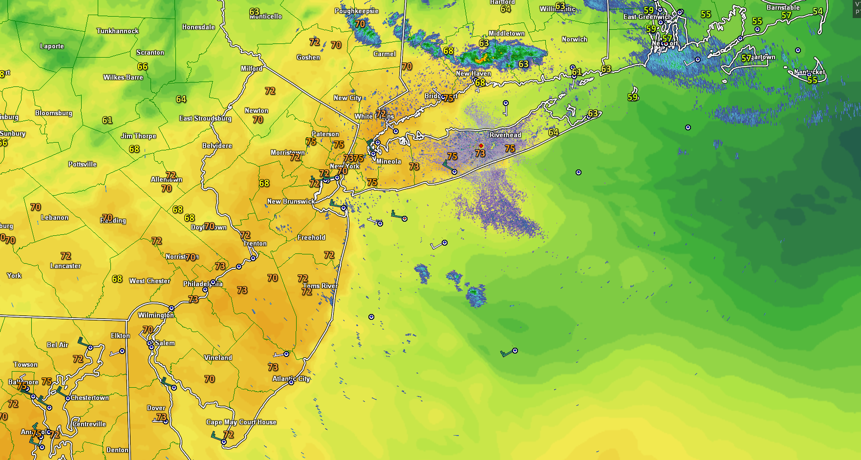
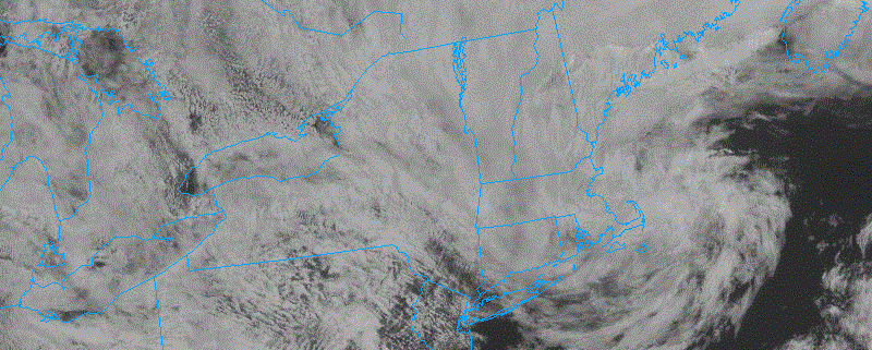
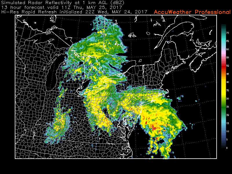
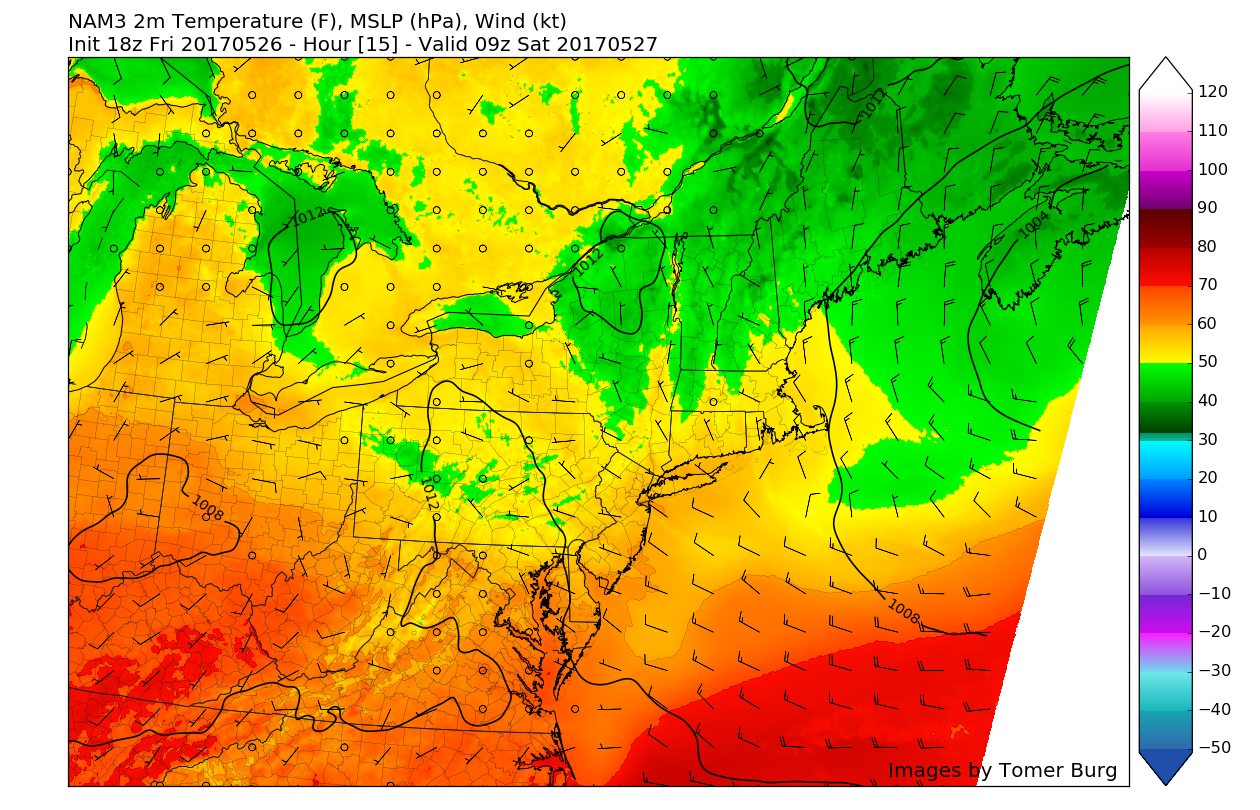
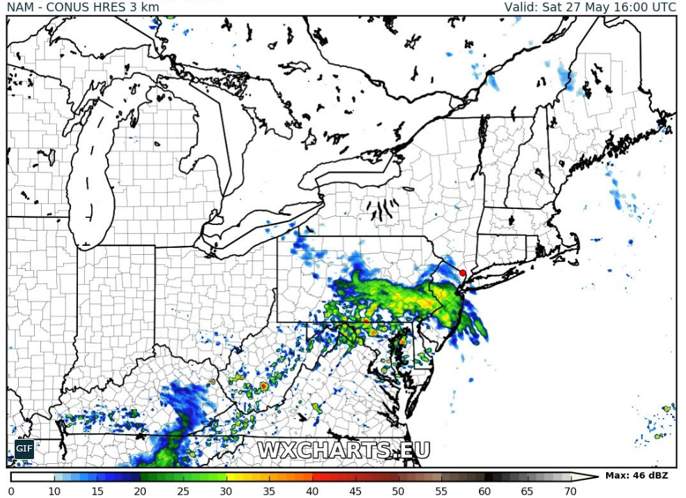
Latest regional radar mosaic, surface temperatures, offshore winds, showing a rather pleasant evening with showers located mainly to the north of the area
Saturday Into Sunday
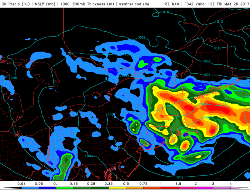
As we head into the Memorial Day Weekend tomorrow, a very weak area of high pressure associated with some increasing upper-level heights will be moving over the region during the early morning hours. This should promote a rather sunny start to the day with some wispy, high clouds likely. Then as we progress into the late morning and early afternoon hours, clouds will likely begin to increase as a weak disturbance from the remnants of a thunderstorm complex over the Ohio Valley will be working its way towards the region.
Moisture and instability will be lacking quite significantly due to the renewed dry Canadian air-mass, so only isolated-scattered showers will be possible with this system as it moves through during the late afternoon hours. Regardless, highs will likely be able to climb into the low 70’s once again, but if the disturbance coming in from the Ohio Valley happens to be stronger, it will have more clouds and showers accompanying it, which may limit tomorrows highs to the upper 60’s. Tomorrow evening will likely be another cool and clear evening as another weak area of higher heights builds over the region, allowing for more radiational cooling, which will support lows dropping back into the 50’s for locations closer to the coast and New York City, with 40’s once again possible for locations away from the coast.
Sunday looks to start off the day with a mixture of sun and clouds and the weak area of ridging that approaches our area begins to strengthen and bring in more dry air into the mid-levels of the atmosphere. With this area of ridging overhead, winds will likely be coming from the relatively cool Atlantic, which should really work in tandem with the increased cloud cover to cap off high temperatures in the mid to upper 60’s for coastal locations, which may be under the influence of thicker cloud cover and a more stiff easterly wind. Inland locations may be able to see a good deal of sun mixing with clouds, therefor highs in the lower to mid 70’s appear likely at this time. Then as we move into the evening hours, clouds should begin to increase as the entire region begins to feel the full effects of the maritime air-mass working its way westward from the coast. The increased cloud-cover will likely limit lows into the mid to upper 50’s for Sunday evening.
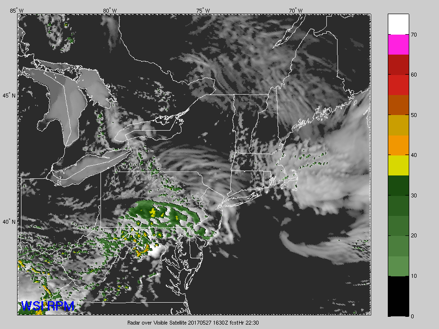
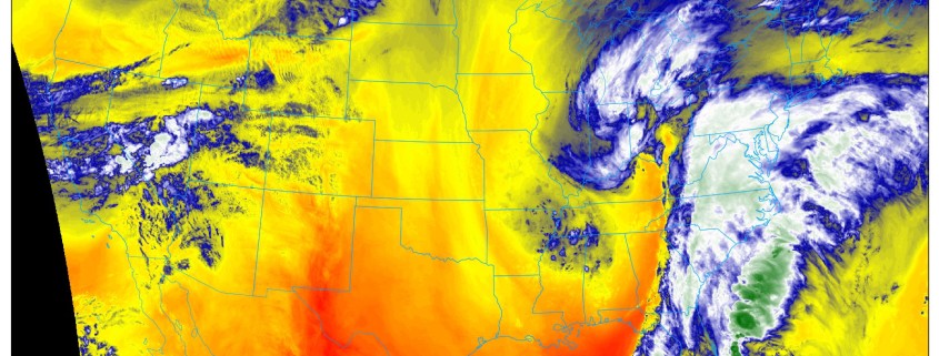
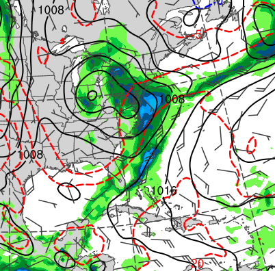
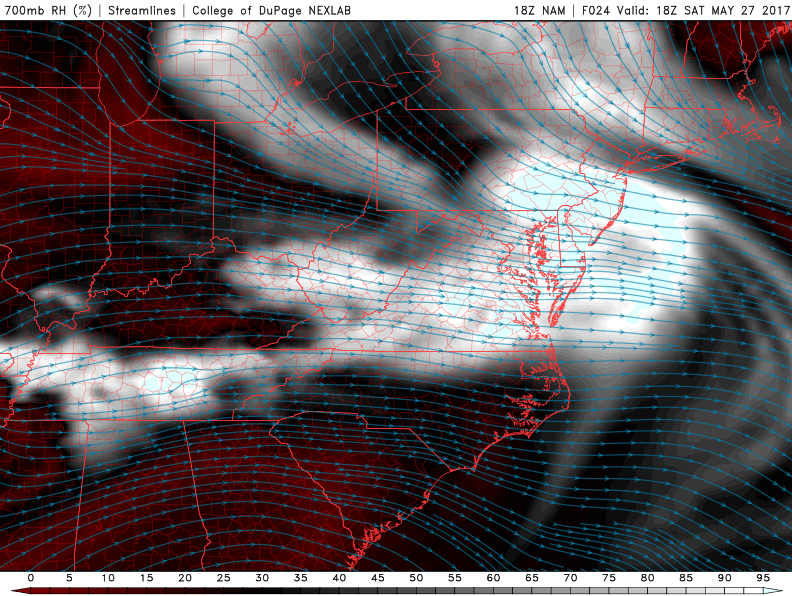
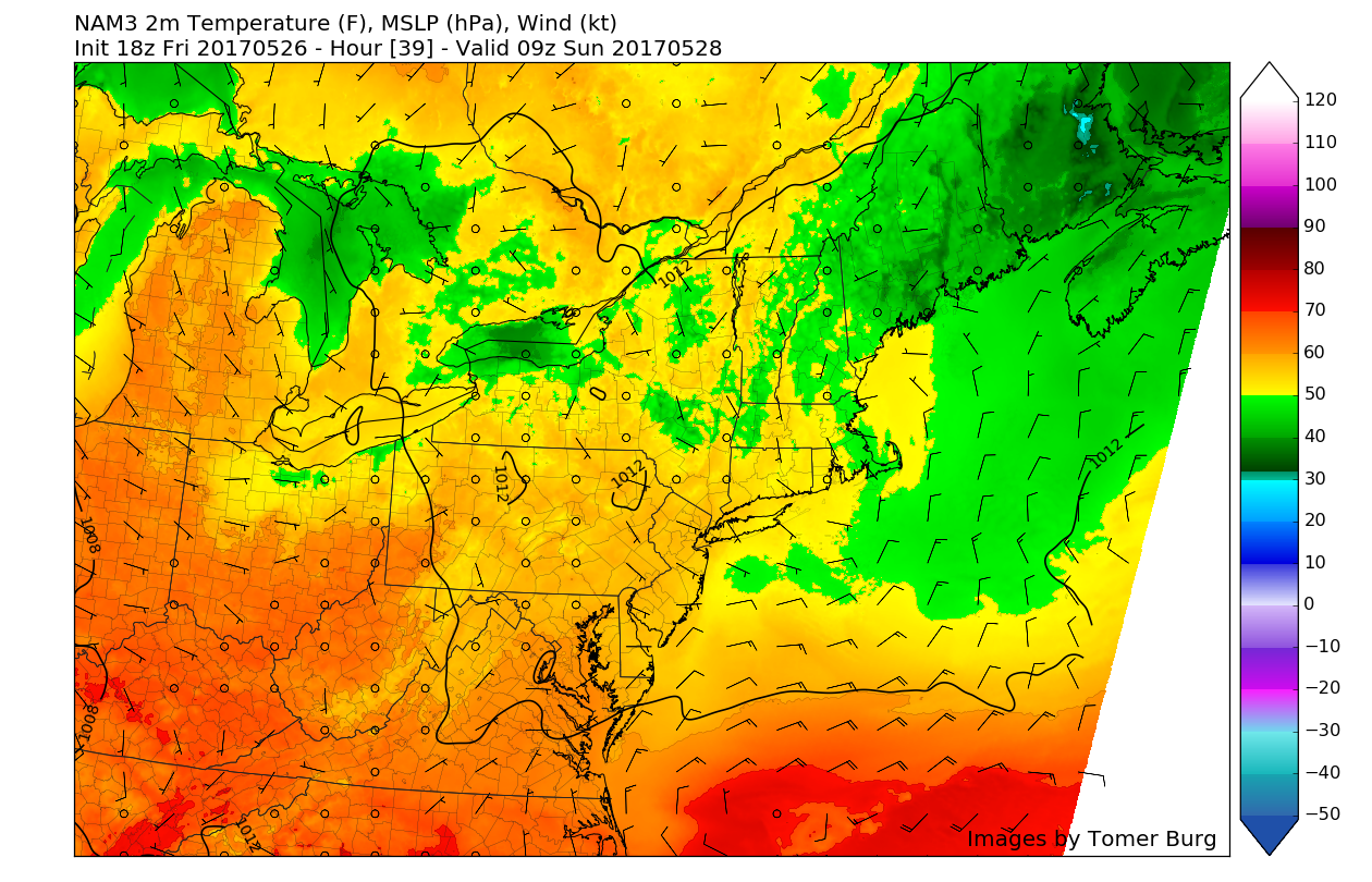
The high-resolution Rapid Precision Model showing increasing clouds and the potential for some showers during the afternoon on Saturday. The timing will be crucial in determining how warm the high temperatures area (Valid 12:30pm Saturday)
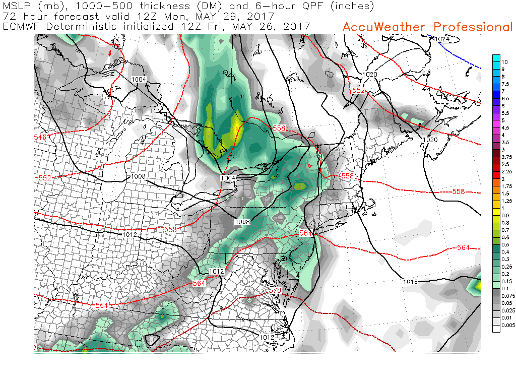
Memorial Day Monday
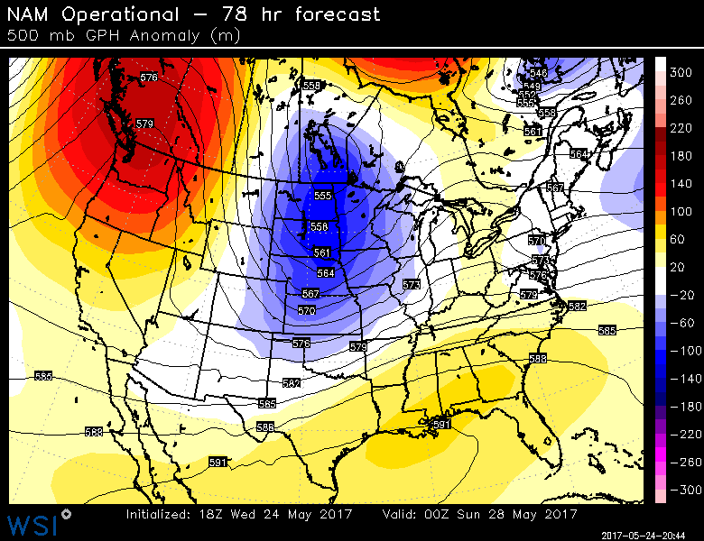
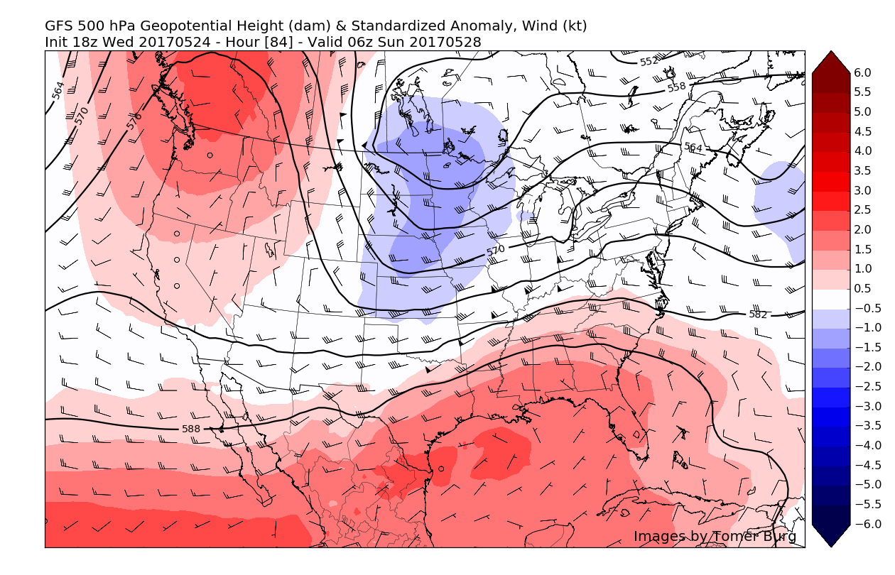
As we talked about earlier in the week, the Memorial Day Monday forecast looks to be highly dependent on an upper level trough diving south through Canada late in the day Sunday. This upper level trough will cause the ridging that provided the region with mainly dry conditions to eventually break down by the morning hours on Monday. In response, a surface low will begin to track from Missouri and into the Great Lakes region late in the evening Sunday. This afternoons latest model guidance shows that as this low pressure moves into the Great Lakes, a warm front will begin to lift into the area by the very early morning hours on Memorial Day, which should begin to increase cloudiness quite substantially and bring the threat for some showers and possibly even a thunderstorm. Moisture will also be increasing as the front begins to push northwards, so some of these showers and isolated thunderstorms may contain locally heavy downpours, but no organized severe weather is expected due to poor timing, lack of strong instability, and disjointed dynamics.
As we get deeper into the day, the forecast becomes quite a bit more uncertain with regards to how much farther north the warm front will move, if at all. As we have seen numerous times this year that these fronts can be very fickle and tough to nail down outside of twenty-four hours due to the fact that these fronts can bring very warm temperatures and sun to the south of the boundary, and cool and cloudy conditions to the north of the warm front, with the gradient sometimes being quite sharp.
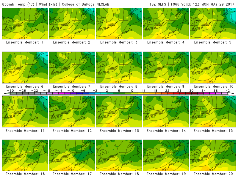
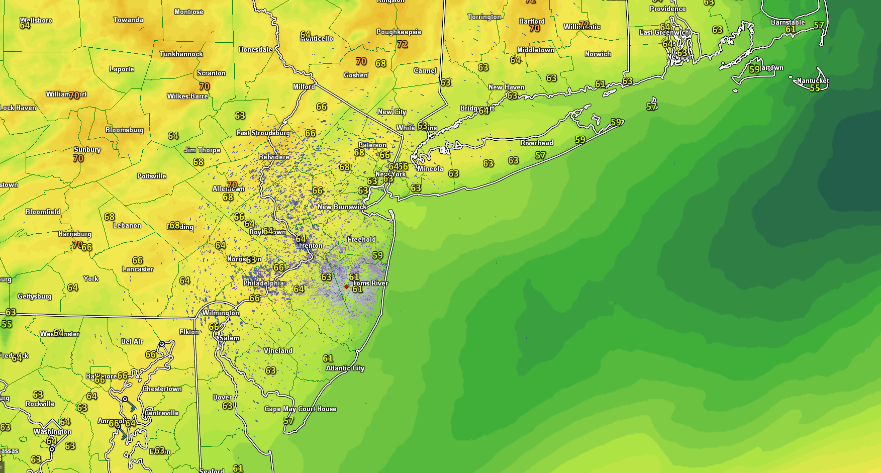
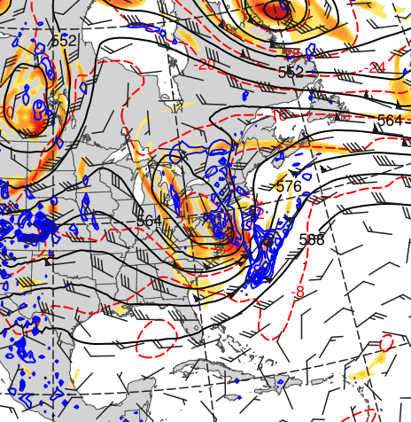
This afternoons individual GFS ensemble members showing a very wide range of possibilities regarding the positioning of key frontal boundaries
However, at this time we are leaning towards the warm front making its way over the region quicker than the models have it doing so, and the antecedent cold front from the low in the Great Lakes also moving through quicker, leaving the area with warmer temperatures in the upper 60’s to mid 70’s and some clearing of the cloud cover will also possible during the afternoon. This forecast will likely need to be tweaked as we approach Monday, especially regarding any precipitation potential, so make sure to check back for more details!
For more information and posts like this one, make sure you sign up for Zone Forecasts — where multiple detailed articles, videos, and interactives are posted each day. Also, come interact with our staff and many other weather enthusiasts at 33andrain.com!
Have a great holiday weekend!
Steve Copertino