Premium Long Range: A Look at the Western Hemispheric Pattern and Tropics in August

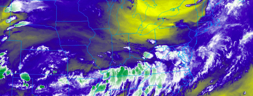
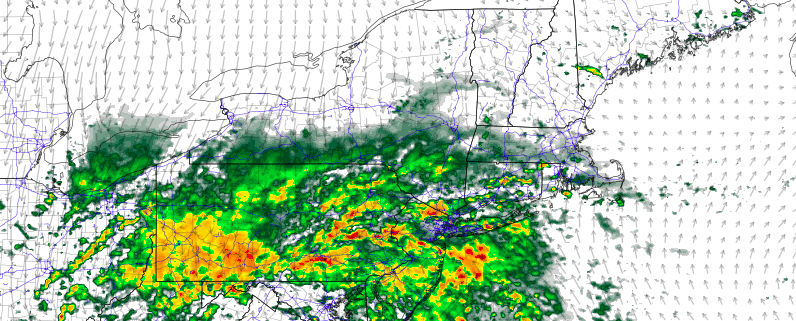
Late last week, we saw our second heat wave of the summer over many parts of the Northeast and Mid-Atlantic region. It may have appeared to some people, that may be we have turned the tide toward more hot and humid pattern for the rest of the summer. But this pattern much cooler and unsettled this week. Now there are increasing indications from several climate phenomena and long-range ensemble guidance of major pattern change now occurring over the Pacific Basin, that will support a cooler pattern, for the Northeast and Mid-Atlantic regions, at least the first couple weeks of August.

Overall Pattern

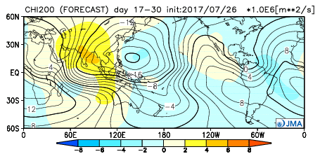
On the long-range ensemble guidance, the atmospheric pattern changes start out in the Pacific. A large trough will be over parts Southeast Asia and Western Pacific and in turn support a ridge near or just south of the Aleutian Islands and a large trough or upper-level low over more of the Gulf of Alaska and Northeast Pacific. This North Pacific pattern overall will continue to support more profound heat ridge in parts of the Western and Central US. More ridging over Greenland/Davis Strait will also result in a more negative NAO pattern. This entire pattern throughout the Western Hemisphere will on average support deeper troughiness in the Great Lakes and Ohio Valley and stronger Western Atlantic ridge to build over next couple weeks. But we do know ensembles and weeklies in general in the super long-ranges are less reliable. So what climate phenomena is potentially influence this pattern?

Read more

Eyes on weekend storm as model inconsistency continues

Active weather continued throughout much of the Northeast states Thursday, with transient clouds and showery activity for much of the day as a disturbance in the levels of the atmosphere passed through. This disturbance was relatively weak and, as mentioned, transient in nature, limiting the potential for strong to severe thunderstorm coverage that may have otherwise existed, especially given the presence of instability.

With that said, pleasant conditions gradually returned to the majority of the Northeast states on Friday morning — but it will be short lived.

Read more

Unsettled Thursday, eyes on weekend coastal storm

Good morning! A beautifully pleasant and calm weather day on Wednesday is behind us, and the weather will take a more transitional and unsettled turn in the Northeast states today. You can thank the weakening grip of a large mid level ridge for that, as its departure will open the door for multiple disturbances to move into the region. High pressure has already begun its shift off the Eastern US coast this morning.

A disturbance in the atmosphere’s mid and upper levels will begin to approach the area this afternoon and evening. The first thought going through many peoples minds will be the potential for strong and severe thunderstorms – but there are several mitigating factors that will be acting against those chances today. Instead, the potential for showers and a few isolated thunderstorms is expected to evolve.

Read more

We’re changing the way our products are structured

Hello friends! As always, we hope this post finds you well, and we’re grateful that you’ve taken the time to read it. We’re reaching out to all of our readers and existing clients today to make you aware of a change to our company which we believe everybody will be excited about.

Over the past several months, we have taken some time to mull over the way we deliver our forecasts. Our number one priority has always been getting the forecast right, and doing so by communicating to the best of our ability. A close second priority has, and will continue to be, forecasting in a way where we bridge the gap in our readers understanding of the atmosphere. In other words, our forecasts are specifically designed and tailored not just to deliver information, but to elaborate on why things are happening, how they are happening, and what our concerns and uncertainties are.

Read more