Maria and Lee Head Out To Sea, Beautiful Weekend on Tap for the Northeast

Good Afternoon! 

Today is the first in a series of more Fall-like conditions over the East with mild temperatures, low humidity, and crisp/cool nights. An area of high pressure has moved into the area behind the cold front that passed the area a few days ago, and is providing very clear and calm conditions for the entire Northeast.  Our source region for the air mass overspreading the region is fresh from Canada, so expect these pleasant and drier conditions to last throughout the day and into the evening hours. Winds should be light, but generally out of the northwest for the remainder of the afternoon. With cooler mid level temperature and relatively sunny skies, most of the area should see temperatures get up to the upper 60’s to lower 70’s, with some cooler readings likely farther into New England.

Later on in the day, a weak but compact area of low pressure associated with a mid level trough will begin to push towards the area and bring an increasing chance of clouds by sunset. The mid level system with this area of low pressure is rather impressive for this time of year and would usually be a pretty impressive clipper system for the area if it were deeper into the year, but regardless this system will begin to increase the threat of showers and possibly even a low-topped thunderstorm across the area late this evening. The change in temperature from the ground, into the mid levels of the atmosphere is also rather impressive, and this could become further enhanced as the low nears the warmer coastal regions late this evening and into very early tomorrow morning. At this time we expect any of the heavier activity to be rather isolated, but we would not be surprised to see reports of gusty winds, heavy rainfall, occasional lightning, as well as the potential for some very small hail or graupel. This activity may become more focused over the LI sound and near Connecticut where the increased temperature differential may spark some more feisty showers and thunderstorms. Regardless, we should see overnight lows drop down into the lower to middle 50’s, with some area north and west likely getting down into the 40’s before dawn.
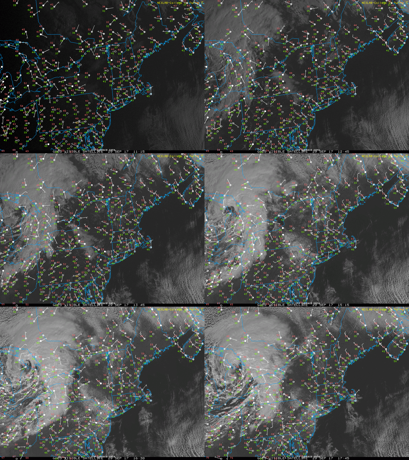
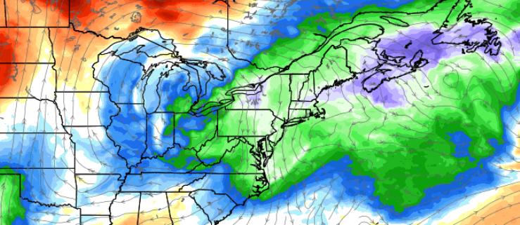
Loop of the current observations over the Northeast this afternoon showing relatively calm and cooler conditions. Also note the energetic low pressure system over the great lakes (CoD Weather)

Loop of the current observations over the Northeast this afternoon showing relatively calm and cooler conditions. Also note the energetic low pressure system over the great lakes (CoD Weather)

As we head into tomorrow and the area of low pressure degrades into a weak trough, we should see another area of high pressure begin to build into the Northeast as well as the Mid-Atlantic states for the remainder of the weekend. For both Saturday and Sunday, skies will be pretty much mostly sunny with some mid level clouds at times. Winds will also be light, but gradually shifting back to a more northerly component on Saturday afternoon, which should reinforce the overall drier weather. Highs will likely remain in the mid to upper 60’s across the entire area, with some locations near the city seeing highs reach into the lower 70’s. Overnight lows will have a much more crisp feel to them as radiational cooling takes over both nights and allows any heating gained during the afternoon hours to quickly radiate back into the atmosphere. Lows will easily drop into the lower to middle 50’s both evenings, with an enhanced potential for areas north and west to see temperatures drop into the 40’s as well. Overall, it should be an excellent weekend for any kind of outdoor activity with clear skies, light winds, and relatively dry weather.

Another area of strong ridging is expected to develop over much of the nation next week, and when looking at a mid level map one may think that we’ll return to the 80 degree highs that we had this week, but due to the juxtaposition of the ridge, we should see an area of high pressure develop to our north and east which will funnel in cooler onshore winds. This will pretty much put a cap on just how warm things can get next week, though we may have to deal with an increase in low level moisture once again and the potential for fog during the evening hours. At this time, it does not appear likely that there will be any heavy rain threats over the next seven days or so, but we will continue to monitor the latest trends and will have a full update on Monday!
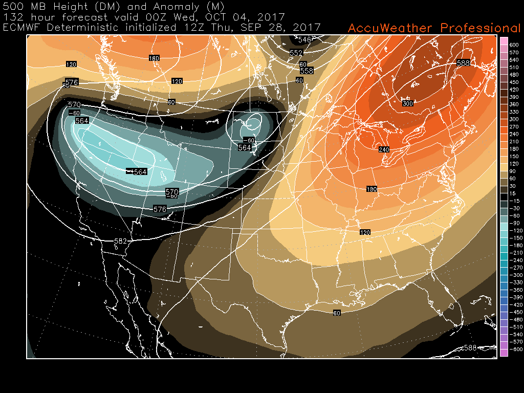
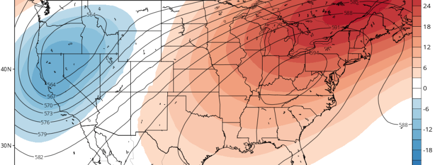
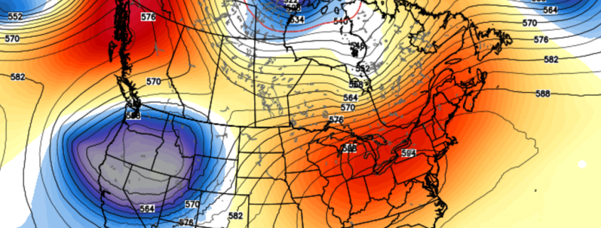
ECMWF model showing a large area of ridging forming over the eastern third of the nation next week. Temperatures will likely be back to above-normal next week, but not as warm as this week.

ECMWF model showing a large area of ridging forming over the eastern third of the nation next week. Temperatures will likely be back to above-normal next week, but not as warm as this week.

Maria and Lee Not Long for This World 

Once mighty hurricanes Maria and Lee have been reduced to tropical storms this afternoon after accelerating northeastward into a region of increasing shear and decreasing sea surface temperatures. These system will continue to head off to the east over the next few days, before being absorbed by a larger non-tropical low pressure system that may eventually impact portions of Europe with gusty winds and heavy rainfall.

Behind these two systems we have a few area to watch, but nothing imminent to develop. There is a surface trough labeled invest 99L near the southern Florida coast that is producing a large area of disorganized showers and thunderstorms, but has not been able to organize significantly due to strong wind shear that will likely persist over the system during the next few days. Farther east, we have another tropical wave producing a large area of showers and thunderstorms just east of the Leeward islands. This system is also being impacted by strong wind shear from an upper level low to its west that should inhibit any significant development in the short term. However, both system will pose a threat for heavy rainfall and potential flash flooding, so please pay attention to your local NWS office for any flood watches or warnings.Lastly, the models have become less-certain regarding the development of a large tropical gyre forecast to form over the western Caribbean in the next week or so. This system would likely be quite large in nature and would take days to organize, but would still pose a significant threat for heavy rains and flooding. We have plenty of time to monitor future trends, but we still expect that this region of the Caribbean will have at least a medium chance for tropical cyclone development over the next 7-12 days.

This afternoons GFS model showing a very large monsoon gyre developing over the Caribbean in around a week or so. Any tropical development would likely be slow to occur due to the large nature of this system (Phillipe Papin)

This afternoons GFS model showing a very large monsoon gyre developing over the Caribbean in around a week or so. Any tropical development would likely be slow to occur due to the large nature of this system (Phillipe Papin)

For more information and posts like this one, make sure you sign up for Premium Forecasts — where multiple detailed articles, videos, and interactives are posted each day. Also, come interact with our staff and many other weather enthusiasts at 33andrain.com!

Have a great weekend!

Steve Copertino

Cool & Unsettled Saturday, Warming Trend Next Week, Tropics Update

Good morning! Just a quick update on forecast through this weekend, the warm-up for next week and the tropics. First today will be beautiful with plenty of sunshine and lighter winds. After a cool or chilly start in the 40s and 50s, highs will only reach in the upper 60s to lower 70s over much of the Northeast today. These temperatures are actually closer to normal for this of year. But it will feel much cooler and more like early Autumn, compared to the past few days.

Later tonight and Saturday, as a weak area of low pressure and shortwave trough will move through parts of the Northeast.Clouds will gradually increase ahead of this system during the evening and overnight hours. A few scattered showers are possible late tonight and early tomorrow morning, as a weak cold front from this system moves through. Overnight lows will be in the lower 50s over the Interior areas to upper 50s over more urban and coastal areas.

Read more

Cooling Trend into this Weekend for the Northeast, Warming Up Again Next Week!

Good morning! Our warm and muggy pattern comes to end today. A cold front has passed through early this morning. Temperatures may hold steady or slowly falling for rest of morning, before rising again into the mid-upper 70s with lower humidity this afternoon. Plenty of sunshine and breezy conditions are expected today. Northerly winds will be sustained around 15 to 20 mph with higher gusts up to 30 mph possible this afternoon and early this evening.

Mostly clear skies will continue into tonight. As a cooler, Canadian airmass begins to settle into the Northeast, temperatures will drop into the mid-upper 50s over more urban and coastal areas and upper 40s to lower 50s over Interior areas. Winds will also gradually diminish overnight, as the pressure gradient over the Northeast weakens. But more ideal radiational cooling conditions aren’t expected. On Friday, weak high pressure over the Northeast will support plenty of sunshine for most of the day. But a cooling trend will continue, with high temperatures only into the upper 60s to lower 70s. Which is actually closer to seasonal levels for this time of year.

Read more

Cold Front to Bring Northeast Relief, Lee Becomes a Major Hurricane

Good Evening! 

Today was yet another hot and humid day across much of the Northeast with highs reaching up into the middle to upper 80’s over much of the area. Coastal sections of New Jersey, Long Island, and Connecticut were able to see lower temperatures due to easterly winds off of the cool Atlantic where highs stayed in the upper 70’s and lower 80’s throughout much of the day. Much of the day today was quite sunny and clear, which further added to the “summer-like” feel in addition to dewpoints reaching up into the upper 60’s and lower 70’s. The good news is that a cold front is working its way into sections of western Pennsylvania and into portions of New York this evening, and will bring some welcomed change to the area as soon as tomorrow!

This front will continue to march along, but have little in the way of any precipitation associated with it due to a lack of deep moisture content from the south.  There may be some small showers and brief downpours as this front continues east and interacts with subtle mesoscale features, but overall the evening should remain dry once again. As we head into the very early morning hours of Thursday, we have to watch for an increased chance of showers and some gusty winds along with Mid Atlantic and Northeast coasts. By this time, the cold front will be interacting with Hurricane Maria, which will be located to the southeast of the Delmarva peninsula. Widespread shower activity is not anticipated at this for the New York metro area as this front steadily chugs east, but the front could slow down a bit and bring in some additional moisture once it nears the Massachusetts and Rhode Island area.

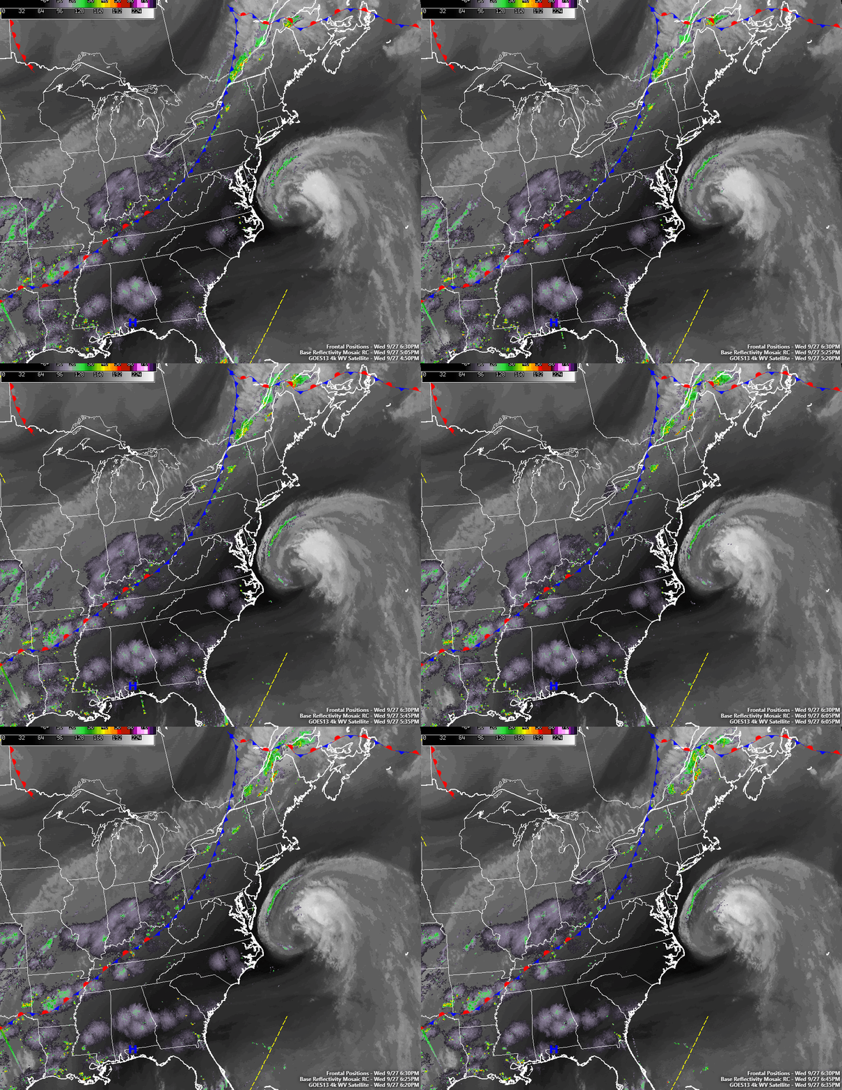
Loop of Hurricane Maria off the Mid Atlantic coast along with the cold front that will be steering it out to sea over the next few days (Simuawips.com)

Loop of Hurricane Maria off the Mid Atlantic coast along with the cold front that will be steering it out to sea over the next few days (Simuawips.com)

Thursday will be a much more comfortable day across the entire Northeast, with the mid level trough associated with the cold front moving into the region. Behind the cold front, we should see light winds out of the northwest, with mainly sunny skies. Dewpoints will also drop quite dramatically as well, so tomorrow should be quite a pleasant day compared to the past few. Highs tomorrow will range from the low to middle 70’s near the coast, with cooler temperatures in the mid 60’s to lower 70’s expected further away from the coast. Again, the area will remain rather dry due to a lack of moisture and this should last through tomorrow evening as well. Tomorrow night will be a nice change and certainly have more of a fall feel to it as radiational cooling takes hold and really allows temperatures to drop for the first time in a while. Lows tomorrow evenings should range in the upper 40’s to lower 50’s along the coast, with low to middle 40’s further north and west.

Friday and into the weekend looks to be much of the same, with much lower dewpoints, light winds, and mostly sunny skies with highs in the middle 60’s to lower 70’s through Sunday. The only real chance for showers looks to be on Friday evening and into Saturday morning as another cold front moves into the area to reinforce the cooler weather. The shortwave associated with the front will have limited energy and moisture to work with, so the threat of heavy rainfall seems quite low at this time. Overall, it should be a beautiful weekend for the area, but not quite fall weather yet!

Farther out, medium range guidance continues to suggest that a very large area of mid level ridging will develop over the eastern third of the nation by the beginning of next week. However, do to the positioning of this ridge, we may be able to escape the heat and humidity like we had this week due to the potential for an area of high pressure to bring more onshore winds. This will allow temperatures to remain in the middle to upper 70’s with some increased moisture and a few rain chances, though nothing looks too significant at this time. We may see this pattern persist into next weekend as well, with potentially warmer temperatures once again taking over, but we will have further updates on that later in the week!

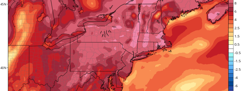
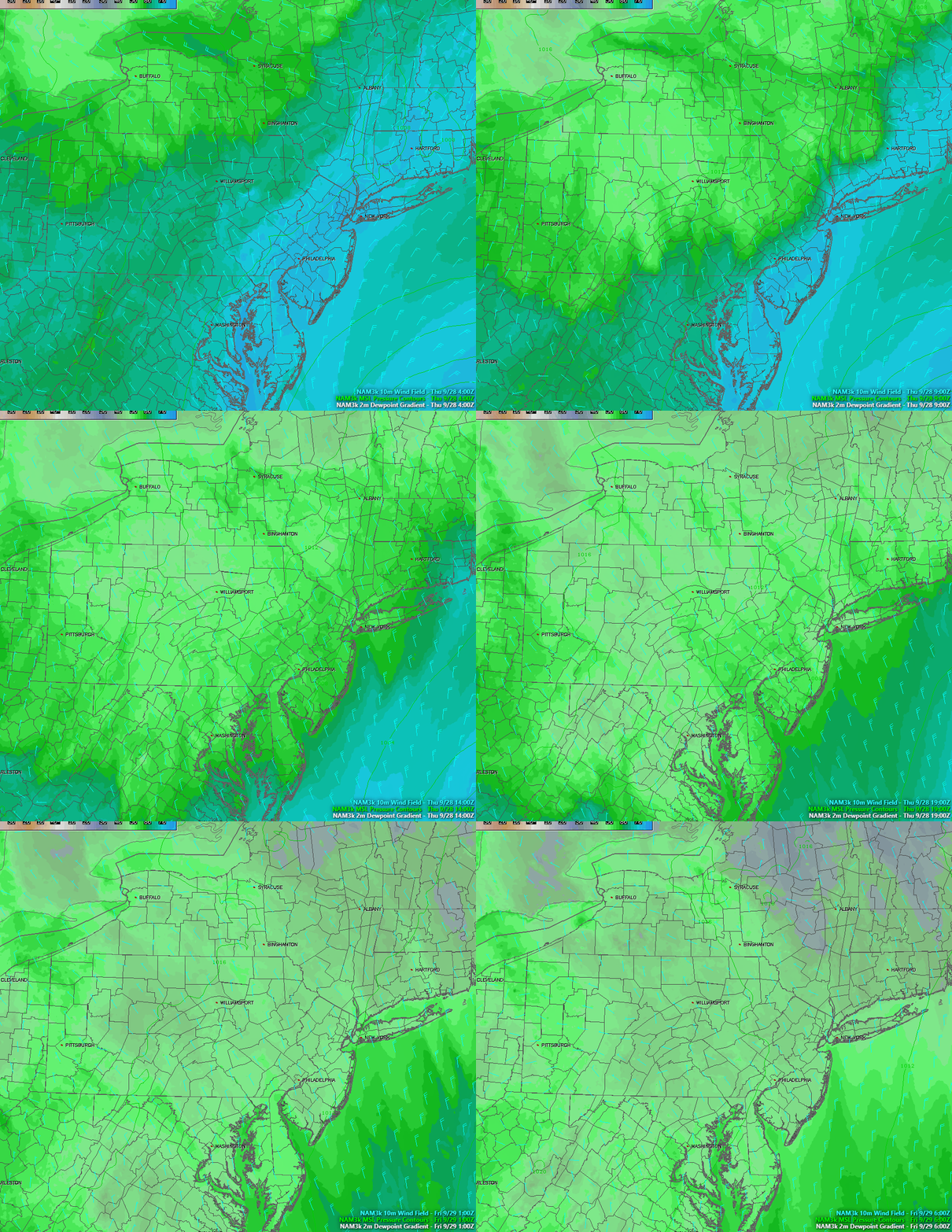
Loop of the cold front driving out the high dewpoints in the area and ushering a more seasonable airmass for the next few days

Loop of the cold front driving out the high dewpoints in the area and ushering a more seasonable airmass for the next few days

Lee Becomes the Fifth Major Hurricane of the 2017 Season-Watching the Caribbean 

Hurricane Lee made a very impressive comeback from back when it died in the central Atlantic about a week ago now. Earlier this afternoon, the storm was upgraded to a Category 3 with sustained winds up to 115 miles per hour. Lee is thousands of miles away from land and will stay that way as it continues to accelerates to the north, but it may add to the amazing superlatives that this hurricane season has racked up so far. It could push 2017 ahead of 2004 for the most active 30-day period (ACE wise) in recorded history. Later in the day tomorrow, Lee will begin to feel the effects of higher wind shear, which should start to drastically weaken the cyclone until its absorbed by a larger system in the North Atlantic. Lee has had an impressive journey over the past week or so, and will be remembered as being one of the only major hurricanes to not affect land, thankfully.

Unfortunately, our eyes will be turning to the Western Caribbean as we said they likely would be back in last weeks posts. The global models are starting to really hint on a large gyre of tropical moisture festering and eventually moving north, possibly into the Gulf of Mexico. This is all very far out, but systems like these tend to take days before becoming a named system, and sometimes they just remain disorganized masses of thunderstorms that can produce widespread flooding. Regardless, we will be closely following any developments over the next few days since the Caribbean is the climatological breeding ground for strong cyclones in October, and we currently have very favorable conditions for a system to take advantage of if one does wind up forming. As of right now, I would say that there is a medium chance of tropical cyclone formation in the NW Caribbean and Gulf of Mexico in the 7-10 day period.

Animation of the ECMWF model showing a large, cyclonic gyre taking shape in the Caribbean/Gulf of Mexico in 6-10 days (Courtesy Phil Pappin

Animation of the ECMWF model showing a large, cyclonic gyre taking shape in the Caribbean/Gulf of Mexico in 6-10 days (Courtesy Phil Pappin)

For more information and posts like this one, make sure you sign up for Premium Forecasts — where multiple detailed articles, videos, and interactives are posted each day. Also, come interact with our staff and many other weather enthusiasts at 33andrain.com!

Have a great evening!

Steve Copertino