-2")
Cold front arrives Saturday, watching two light snow events around Christmas
Improving conditions Saturday, watching a system to our west on Sunday night
After the passage of a cold front this morning, temperatures are falling and wind gusts are picking up. Clouds will also be diminishing throughout the day as well, allowing for mostly clear skies to overtake the region by the mid/late afternoon hours. The combination of these factors will mean that today will be much cooler than the previous couple of days, but not quite “cold”. After the passage of the cold front, most of the area should see temperatures drop into the middle to upper 30’s, with some 40 degree readings possible along the coast. Conditions will remain calm and clear for the remainder of the day, with any residual gusty winds dying down tomorrow evening. This should allow for temperatures to drop back into the upper 20’s and lower 30’s tomorrow night, which is right around normal for this time of year.
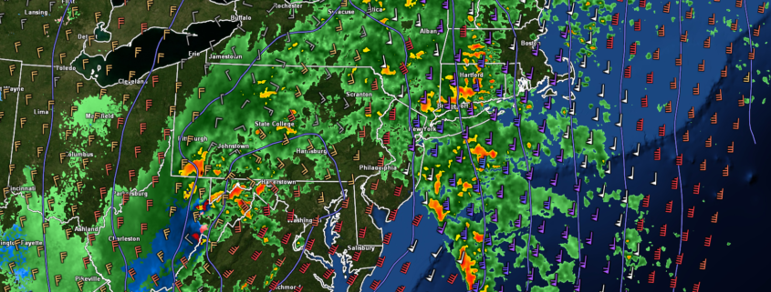
Sunday should start off as an excellent day, with sunny skies and temperatures in the lower to middle 40’s across the entire forecast area. However, we will have to watch a shortwave trough off to our west that will be moving through the Ohio Valley by Sunday evening. Model guidance diverges significantly on the exact evolution of this system, but there is a low chance that this system is able to cause an area of light rain/snow to develop over portions of the Mid-Atlantic and Northeast late Sunday and into the very early morning hours on Monday. This system will be moving very quickly from west to east, will not have a lot of moisture associated with it, and the airmass it will be moving into will be quite marginal for snow. It appears that any potential for anything outside of a brief coating of snow is quite low, and this system should not cause significant travel issues overnight Sunday and into the very early morning hours of Monday before moving off the coast by daybreak Monday.
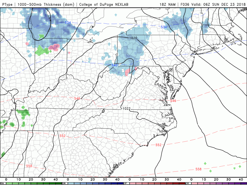
This afternoons NAM model showing an outside chance for a potential light rain/snow event Sunday night/Monday morning
Another weak system passes through Wednesday, conditions go downhill once again late next week
Conditions should be quite pleasant for much of the area on Tuesday (Christmas Day), with mostly sunny conditions and highs in the upper 30’s to lower 40’s expected. Calm and cool conditions should last throughout the entire day, with lows eventually dropping down into the middle to upper 20’s-with coastal locations likely in the lower 30’s. By the time we head into the overnight hours, our attention turns to the Ohio Valley once again. Yet another moisture-starved northern stream shortwave trough will be quickly moving from west to east, possibly causing an area of very light rain and snow showers to develop from west to east Christmas night and into the very early morning hours of Wednesday. Once again, due to the quick-moving nature of this system and the marginal airmass in place, any accumulation potential will be very low for the New York metro area.
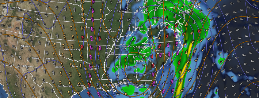
A large area of high pressure will begin to build over much of the east on Wednesday as the next major storm system begins to build over the Plains states. This system looks to take a track predominately up over the middle of the country, which should once again drag a warm/moist airmass from the south and up into the Northeast. Though this system is still a week out, there appears to be a heightened threat of yet another dreary and wet end to the week next week across much of the eastern half of the country.
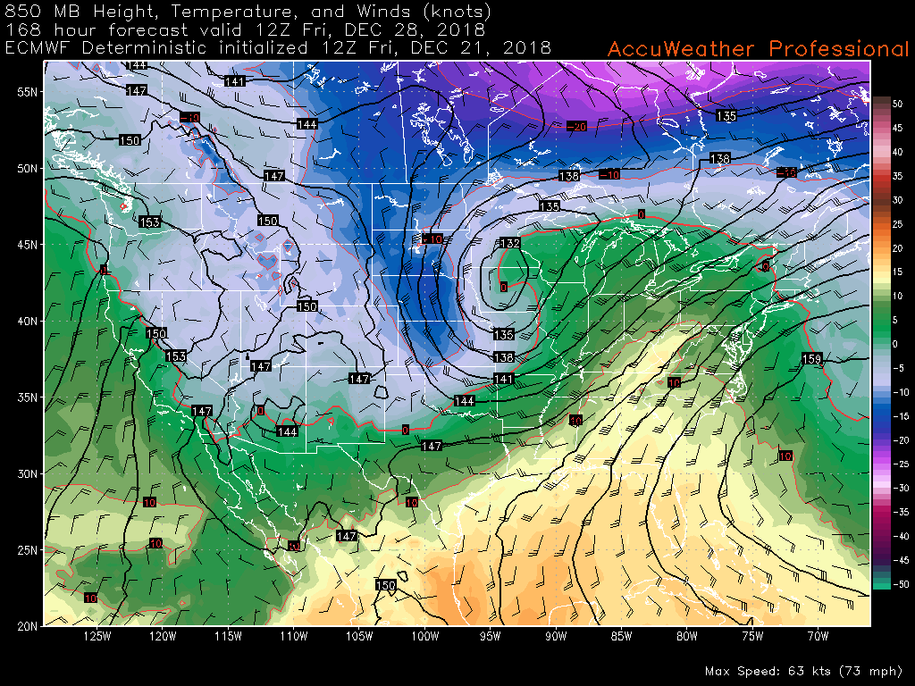
This afternoons ECMWF model showing another exspansive storm system moving off to our west, bringing unsettled and above-average conditions to much of the East
We’ll have an update on the potential light snow events and any other threats that may arise by the later half of this weekend!
Have a great Holiday Weekend!
Steve Copertino