NYC Area Forecast: Additional strong storms possible later today

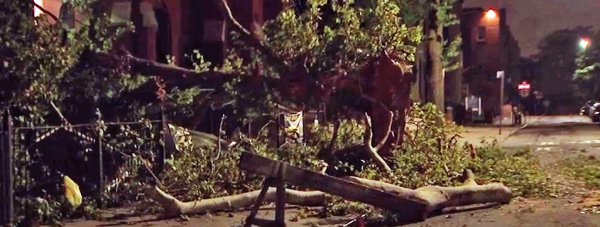
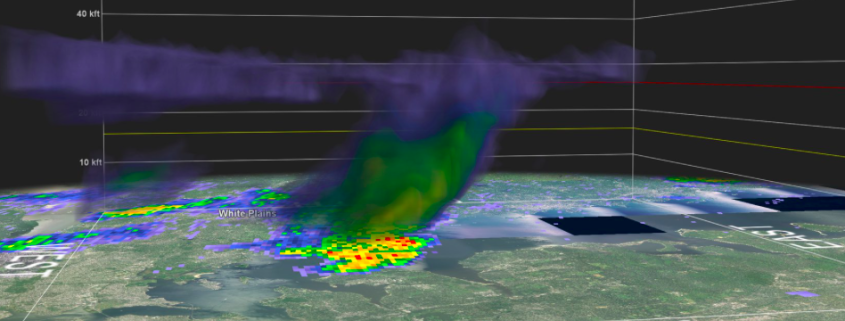
Strong and severe thunderstorms moved through parts of the Northeast states on Tuesday evening, producing frequent and dangerous lightning as well as strong, gusty winds and torrential rain. There was even a wall cloud spotted in Queens and Nassau counties, as an area of distinct rotation appeared on terminal doppler radar out of Kennedy Airport. This was the third instance of rotating thunderstorms in the NYC area in just over a week.

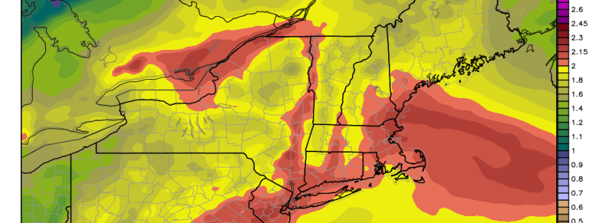
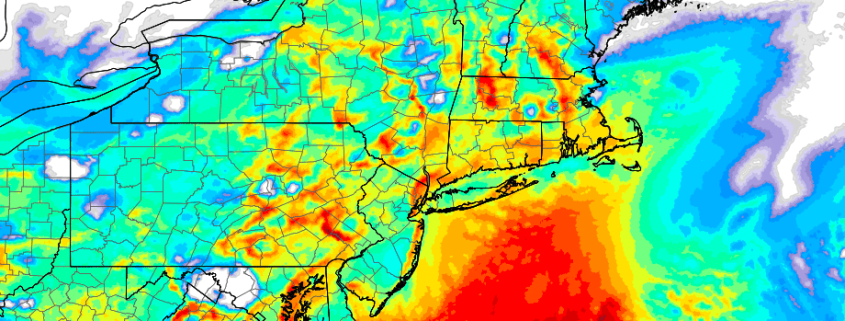
The threat for strong thunderstorms will continue today as a frontal boundary slowly sinks towards the region. Instability is expected to build once again by this afternoon across the Northern Mid-Atlantic States with ample heating and a continued source of moisture (you may have noticed that it is very humid outside). As better forcing for storm development approaches later today, thunderstorms are expected to increase in coverage once again.

Read more

NWS confirms tornado in Queens

The National Weather Service has confirmed an EF0 tornado in Queens on Thursday evening, with winds of 85mph and a path of 0.7 miles.

A Tornado Warning was issued last night at 10:18pm by the National Weather Service, a few moments after strong rotation appeared on the Terminal Doppler Radar out of Kennedy Airport in Southern Queens.

Read more

NWS to investigate possible tornado in Queens last night

A Tornado Warning was issued for Queens on Thursday evening shortly after 10:00pm, and the National Weather Service will head there this afternoon to investigate the possibility of tornado damage. Local terminal doppler radar showed the presence of a notable couplet, or signal for rotation, moving through College Point around 10:15pm.

Read more

Northeast US Weekly Planner: Humidity & Storms Return This Week

Good morning! Have you noticed the cooler and drier air in place? Great! Are you enjoying it? Even better! Because it won’t be around for long.

The first several days of August, in particular, look to bring a sharp return to mid-summer conditions in the Northeast, with increasingly prevalent moisture and humidity. Temperatures will warm gradually as well, with a tropical-like feel to the airmass that looks likely to continue into the middle of August at minimum.

High pressure is weakening and sliding offshore from the Northeast states today. Sunshine and lower humidity is expected to persist through the afternoon, as drier air remains stout. Gradually, however, a southerly flow is expected to return. This will aid in an increase in humidity and clouds as the afternoon goes on, with high temperatures in the Northeast averaging in the lower to middle 80’s.

Read more