PM AG Update: After Moderation, Cool Risk Returns

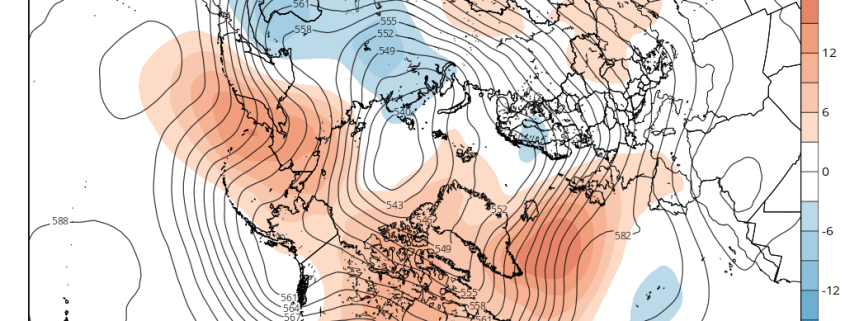
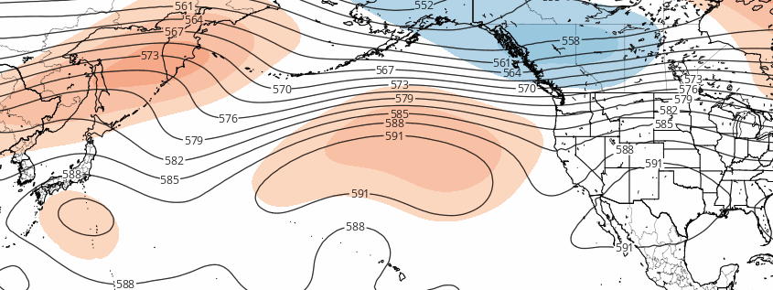
The retrogression in the Pacific has long been advertised, and it will certainly help a good chunk of the US modify in week 2, and into a decent chunk of the week 3 period as well, as a large ridge builds across much of the US. Now that we have this idea figured out with a decent amount of confidence, it becomes a bit easier to roll forward with expectations in the extended period.

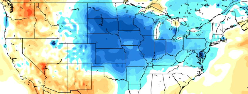
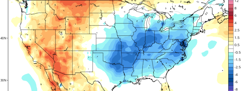
While there will be a lot of modification taking place, the orientation of the retrogression will allow a large piece of a trough to break off in Canada and slide eastward towards the Great Lakes and the Northeast. Thus, despite the overall progression towards modification, there will be a decent shot of cool air for much of the Eastern third of the US to begin week 2, and a potential for a lot of rain to be focused in the Northern Plains, the Great Lakes, and parts of the Northeast in the midst of this trough’s arrival.

Read more

Midday AG Update: Retrogression Theme Remains

Happy Tuesday! We’re going to dive straight into the latest model guidance today and detail some of the latest available information. Fortunately, there has not been much of a change in last night’s and this morning’s guidance — a good signal that the retrogression ideas discussed in yesterday’s AG update are in fact holding true. You always want to see the signal persist and move up in time on model guidance when trying to verify sensible weather changes taking place, and that is indeed what we are seeing.

For a frame of reference, we are going to use this morning’s GEFS model. The conditions right now reveal an amplified pattern in the United States with some deep troughs present (blues) and a large blocking pattern in Canada (reds). This has helped to keep a good chunk of the Eastern two thirds of the US below average in temperatures, as well as active in terms of precipitation. Read more

AM AG Update: Impacts of a retrograding Pacific pattern

Happy Monday, folks! We hope our morning update finds you well. We’re going to jump straight in to some developments which we communicated over the weekend, and take a bit of a deeper look at their evolution and impacts. About 5 days ago, we discussed at length the pattern which currently existed across the Northern Hemisphere — including why it had become so stagnant. We also discussed the pieces behind the potential for a change during the latter half of the month of August, namely the pattern in the Pacific Ocean. As we move towards the middle of the month,  medium range forecast ensembles are starting to pick up on these gradual changes as well.

Read more

PM Update: Cooler risks linger, is there any change in sight?

A well documented period of cooler than normal temperatures has taken over the Central and Eastern United states over the past week or two, especially from an anomaly standpoint. Many regions east of the Central and Southern Plains have observed temperatures 2 to 3 degrees below average over multiple days, which obviously leads to impacts both in terms of energy and crop. While precipitation patterns have been a bit more sporadic, the temperature forecast of near or below normal has been fairly consistent.

Read more