3/12 PM All Zones Update: High-Impact Blizzard Likely Tuesday Into Wednesday

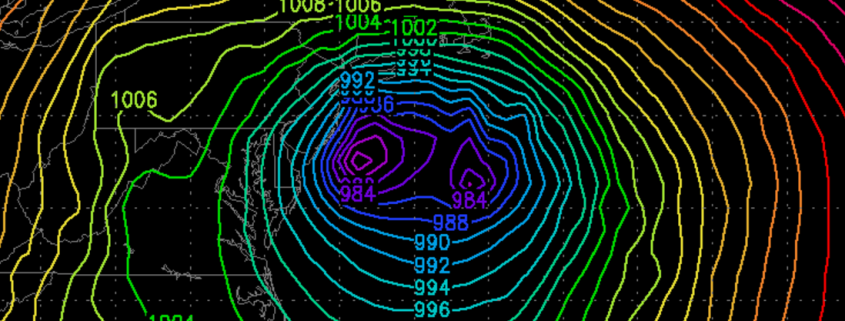
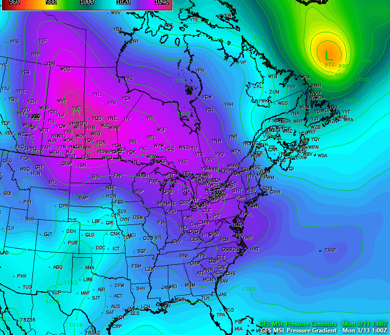
Today has been what some may call the “calm before the storm”, as the day has been characterized by mostly sunny conditions across the entire area with temperatures only in the upper 20’s to low 30’s, which is below normal for this time of year. We have also seen some gusty winds across the area thanks to isobaric packing between an Arctic high pressure system centered over the central Canadian prairies and a deep low pressure system off of the eastern Canadian maritime region. As this low pressure continues to the east, winds should gradually diminish this evening as the high pressure from Canada takes control. Tonight should be an excellent night for steep radiational cooling. Under mostly clear skies and light winds, temperatures will be able to fall into the upper single digits for inland locations and teens for the rest of the region, so another very cold night is expected.

Read more

Mid March may offer more wintry potential in Northeast

A happy Saturday afternoon to you all! We enjoy the weekends particularly because we often can take some time to dive into the details of more complicated discussion. In this case, we don’t have to look much further than the medium range weather pattern to find a complicated, convoluted evolution in the atmosphere. Over the next few weeks, the pattern will be changing quite dramatically in the higher latitudes — or the latitudes near the arctic and polar regions.

Blocking ridges of high pressure, more affectionately known as “blocks”, are forecast by multiple models and ensembles to develop — both on the Pacific and the Atlantic sides. The Atlantic blocking, from Greenland into Northern Canada, is the most significant for residents of the Northeast United States. Exactly how this blocking develops will determine when and where opportunities for cold and snow will arise.

Read more

Why the MJO and stratosphere are so critical for wintry weather in February

As we move into February we are likely to see another change in the hemispheric weather pattern. Once again, changes with MJO/tropical forcing and in the stratosphere will play a major role in this shift. In our long-range outlook update on Saturday, we discussed these features and how they may potentially influence the atmospheric pattern. Here we will discuss what influence these climate phenomenon will have on pattern during the February and into first half March.

Read more

Significant storm next week will bring rain, strong winds

A powerful upper level trough is forecast to develop in the Eastern United States next week, within an amplified upper level height pattern. A strong disturbance is forecast to eject eastwards from the Western United States, and eventually amplify into the Southeast United States during this upcoming weekend. Thereafter, the disturbance will move up the East Coast while slowing down — and allowing a surface low pressure to amplify.

Forecast models have jumped around a bit with the positioning of this surface low pressure, but recently have come into better agreement on the track, taking the surface low inland over the Mid Atlantic states and then off the coast. A considerable amount of modified, warm air exists ahead of the storm system — so the threat with the system is not winter weather. Instead, an anomalously moist atmosphere and very strong jet dynamics are expected to create the potential for torrential rain and very strong winds near the coast.

Read more