-2")
Multiple Wave-Breaking Events Support an early January Snowstorm
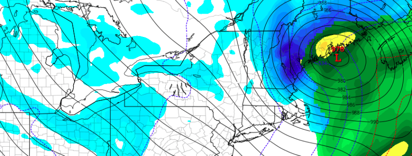
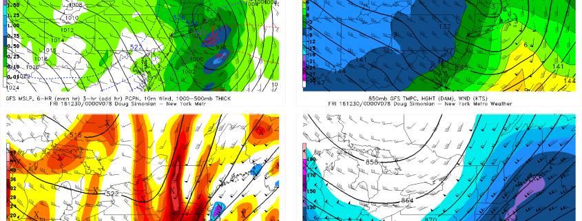
While the coast is experiencing yet another rain event to end 2016, there are many changes currently ongoing to the pattern that could open the door for a widespread snow event in the beginning of 2017. How long the pattern change lasts for is a different discussion and will be talked about in our long range update tomorrow, but for now we will be focusing on the changes over the next week.
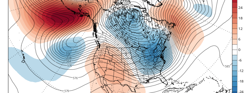
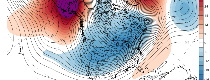
We first place our eyes on the Pacific. A couple of days ago, there was a strong Pacific Jet and the flow was somewhat zonal in the Pacific, and to some extent that is still currently true. But looking closely, there was an active wave train of ridges and troughs, despite the relatively flat flow. It wasn’t just one straight buzz-saw — there were ripples to this pattern that could easily lead to more amplification in a short period of time. While this isn’t the sole cause of the eventual wave-break, we have a cut-off low in the Southwest that retrogrades, and that began to slow the pattern down upstream in the Pacific. And when there are already ridges and troughs in-place, sometimes it just takes one slow-down to truly shake things up.