Hurricane Maria’s Track May Depend on Jose

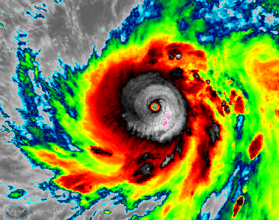
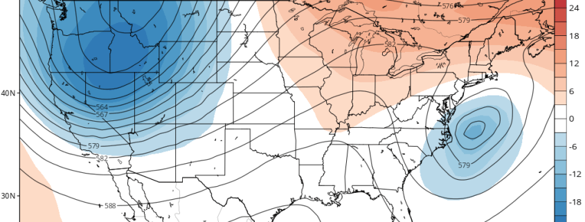
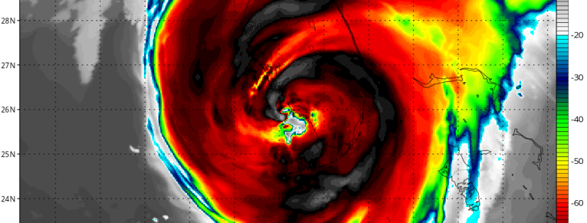
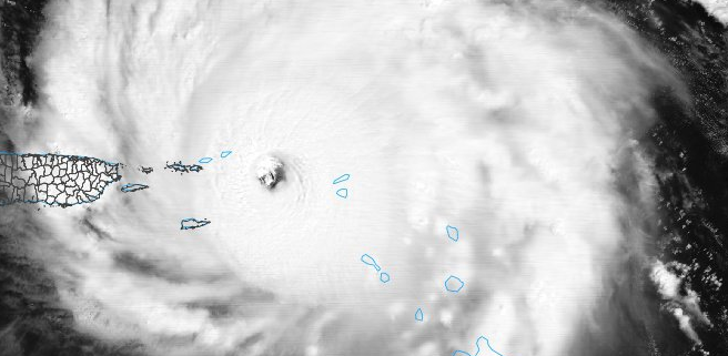
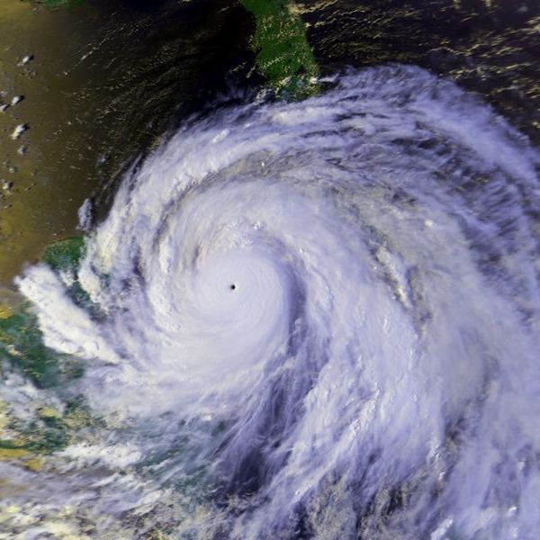
In what seems to be about day seven hundred in an endless cycle of Tropical news, we have plenty more to talk about. Hurricane Maria underwent rapid intensification last night, strengthening from a Category 1 to a Category 3 storm. It developed a very tight core with a rapid increase of lightning around the center — a classic foreboding of rapid intensification. This intensification has continued throughout the day, as it has now become a Category 4 hurricane with 130mph winds. This was evident because a classic pinhole eye opened up, reminiscent of some of the strongest hurricanes, such as Hurricane Gilbert. It is looking like Puerto Rico will take a direct hit from Maria, as perhaps a Category 4 or even 5 hurricane. Afterward, there is a lot of spread in potential outcomes, though the general pattern at large does signal a landfall somewhere along the East Coast. But a big variable will be how the remnants of Jose behave, something that will be very hard to forecast.

Read more

Unsettled Weather Today, More Pleasant This Weekend, Watching Jose for Next Week

Good morning! More unsettled weather is likely today. First, some areas of patchy fog will clear out later this morning. Then a large mid-upper trough over OH/TN Valley will be moving eastward  with more cloud cover and scattered showers and thunderstorms today over the Northeast and Mid-Atlantic regions today. Shortwave energy and wind fields with the trough will gradually be weakening, as it approaches the coastline. So we don’t anticipated any more organized convection or severe weather. For most part today is just looking more dreary, more warm and muggy conditions.

Read more

Hurricane Irma Strengthens Again, Severe Impacts Likely in Florida

Good morning! While our weather remains calmer, we have been monitoring Hurricane Irma very closely this weekend. Irma had been moving west-northwest along the north-coast of Cuba on Saturday. This was due to a stronger sub-tropical Atlantic ridge to the north of Irma, stronger than much of the model guidance had previously indicated. Irma had also weakened from a Category 5 hurricane to a Category 3 hurricane, from more land interaction with Cuba. But Irma has now restrengthened to a Category 4 hurricane with 130mph maximum sustained winds this morning over the Florida Straits and is moving slowly northwest towards the Lower Florida Keys.

Irma is now beginning to interact with a mid-level trough over Northern Gulf of Mexico. Irma will turn even more north-northwestward today, as shortwave energy with this trough begins to phase with Irma. After moving over the Lower Florida Keys this morning, Irma’s eye will likely make landfall somewhere along the Southwest Florida coast late today or tonight. Irma’s inner core remained largely intact after leaving Cuba — and Irma just completed an eyewall replacement cycle, with the inner eyewall collapsing and the outer eyewall contracting. This has lead Irma to restrengthen again.

Read more

Hurricane Irma a Major Threat to the Southeast US, Cool Weather for the Northeast

Happy Wednesday! Some unsettled weather continues for the Northeast today. Then improving weather is likely for the rest of the week. But it will feel more likely early Autumn. Hurricane Irma will become a major threat to the Southeast US this weekend and early next week. More detailed analysis on Irma’s potential future is below.

First for today, a few weak waves of low pressure running will be running along a slow-moving cold front. This will result in multiple rounds of showers and/or t-storms will continue moving through parts of the Northeast, especially near I-95 corridor and coastal plain through much of tonight. Instability is marginal at best. So no severe weather hazards are anticipated. However, some locally heavy rainfall and flash flooding is possible with high precipitable water values over 1.50″.

Read more