ENSO Update: Weak La Nina Likely for the Winter

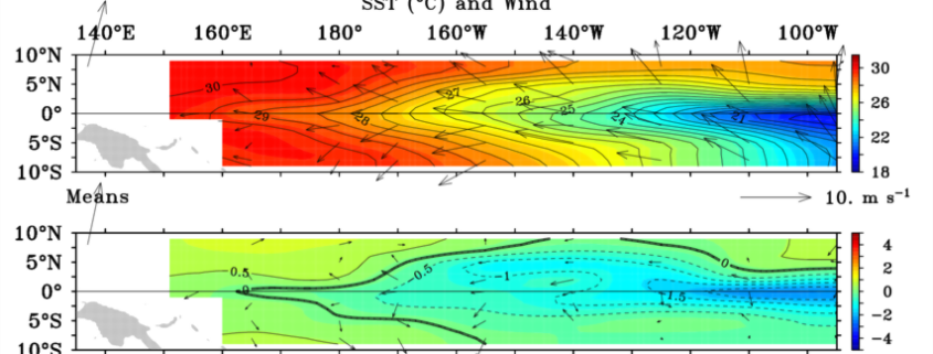
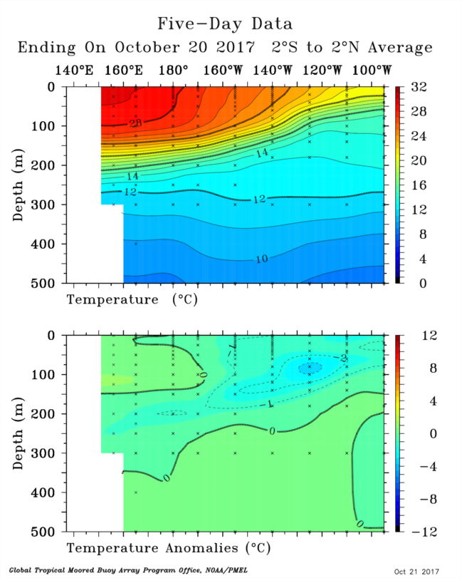
Good afternoon! We continue to monitor developments with La Nina this weekend, as it will one important features will be considering in our monthly and winter forecasts. Sea-surface temperatures this past week, have cooled over more of ENSO regions in the Central and Eastern Pacific, as anticipated in our last major update. The thermocline (sea-surface temperature gradient) has been rising this week, with an easterly trade wind bust causing more upwelling cooler sub-surface waters into the Central Tropical Pacific. The latest 30-day moving SOI is now at +13.03. So La Nina conditions have been strengthening this week.

Read more

MJO and Recurving Typhoon Leads to Volatile Pattern

Good evening, friends! Over the past few days we have discussed, at length, an upcoming wholesale pattern change across North America. As changes in the Pacific Ocean fold down into the United States, a large and stagnant ridge over the Eastern United States will gradually become replaced with a trough, arcing from the Central States to the East through days 5-10. This will result in colder than normal temperatures expanding eastward from the Central United States. The duration and exact intensity of this cooler air remains in question, but what exactly is causing it to occur in the first place?

As we have discussed before, the pattern change comes initially from the retrogression of synoptic features over the Western Hemisphere and North Pacific.  The polar vortex retrogrades out of Northern Canada and into the Bering Sea by early next week. That very same vortex phases with more energy over the North Pacific and results in a larger, deep trough positioned over the Aleutians. This pattern forces a ridge to build over the West Coast of the United States and Canada, and large mid-latitude trough to start digging into the Central and Eastern US during the middle of next week.

Read more

Cooler risks increasing, volatile pattern on horizon

Happy Tuesday! For the past several days, discussions have turned from the presence of abnormal and anomalous warmth towards winds of change, which are signaling the return of cooler air and a volatile weather pattern. Overnight forecast models continue to supplement these ideas, with further confirmation that the pattern is set to undergo wholesale changes across the large majority of North America.

As we have discussed, most of these changes are being driven by the Tropical Pacific and the MJO, where global circulations are being affected heavily by its progression over the next few days. While La Niña’s base state has become entrenched in the atmosphere (30-day moving SOI now up to +11.3), the progression of the MJO will allow for a wave-pattern realignments by Days 5-7.

Read more

Cool & Unsettled Saturday, Warming Trend Next Week, Tropics Update

Good morning! Just a quick update on forecast through this weekend, the warm-up for next week and the tropics. First today will be beautiful with plenty of sunshine and lighter winds. After a cool or chilly start in the 40s and 50s, highs will only reach in the upper 60s to lower 70s over much of the Northeast today. These temperatures are actually closer to normal for this of year. But it will feel much cooler and more like early Autumn, compared to the past few days.

Later tonight and Saturday, as a weak area of low pressure and shortwave trough will move through parts of the Northeast.Clouds will gradually increase ahead of this system during the evening and overnight hours. A few scattered showers are possible late tonight and early tomorrow morning, as a weak cold front from this system moves through. Overnight lows will be in the lower 50s over the Interior areas to upper 50s over more urban and coastal areas.

Read more