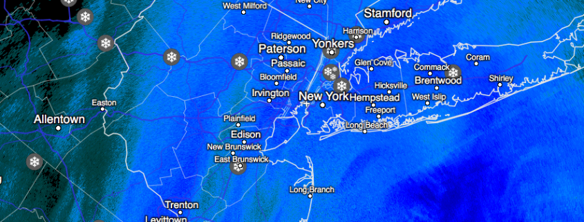
Yet another northern stream system will be dropping down from Canada this evening and progressing very quickly off to the east on Tuesday. This quick-moving disturbance will have a high likelihood of bringing a measurable snow threat for the northern areas of the NY metro by early-mid afternoon tomorrow. Steady snow should begin just after the bulk of the morning commute on Tuesday. With the upper-level jet streak in a favorable position overhead, as well as sufficient low-level moisture advection (the movement of moisture in the lower levels of the atmosphere) taking place, a band of light to moderate snow should become fairly widespread over the northern half of New Jersey, Long Island, Southeast New York, and most of Connecticut. While the upper-level system associated with this snow is rather impressive, this system is much like the others that have come before and will remain solely connected to the northern stream and a deep continental polar air mass. While providing sufficient cold for snow, this will limit the overall potential moisture from this system.

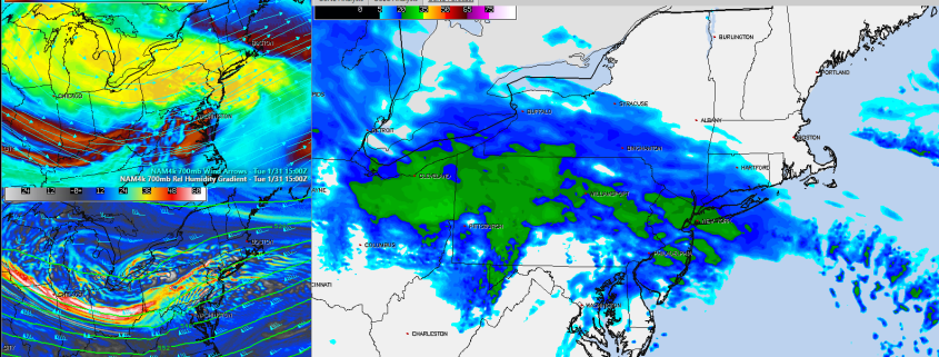
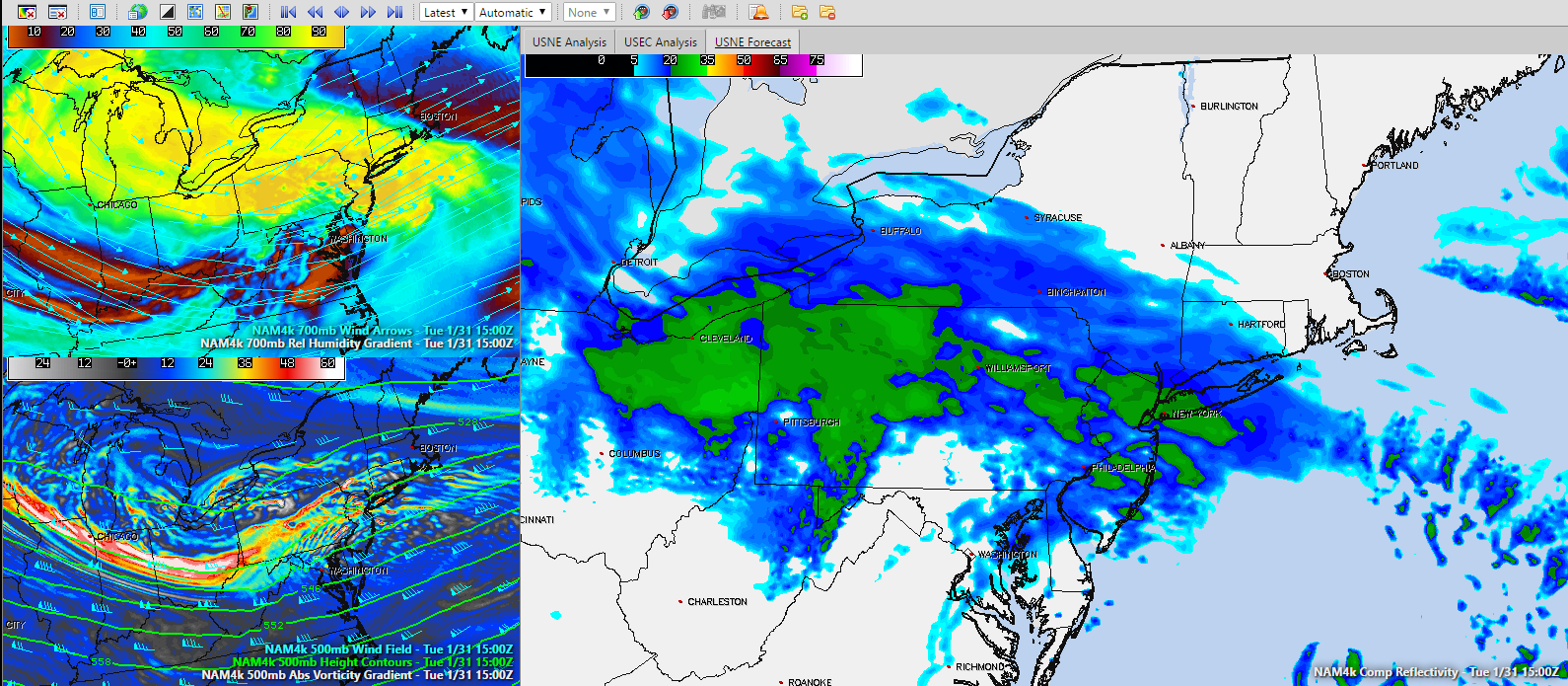
4km NAM showing Composite Reflectivity, 700 mb Relative Humidity & Vectors, and 500mb Heights and Vorticity valid 15z Tuesday (Courtesy of Simuawips.com)
Today’s model guidance has been consistent in showing that the low pressure system will then reform off of the New Jersey coast and just to the south of Long Island sometime during the mid-late afternoon hours, which should create enough subsidence (sinking air) in the atmosphere to end the snow across portions of Central, NJ. Eventually, snow will taper off over Northern New Jersey, Long Island and eventually Connecticut towards the evening, with some areas of Connecticut hanging onto the light to moderate snow rates for a little longer. In general. accumulations should range on the lighter side with 1-3″ being commonplace, with locally higher amounts possible in Southern, NY and portions of Connecticut. Regardless, Tuesday should be a wintry day with slick conditions possible for the evening commute, so stay aware of road conditions when driving!
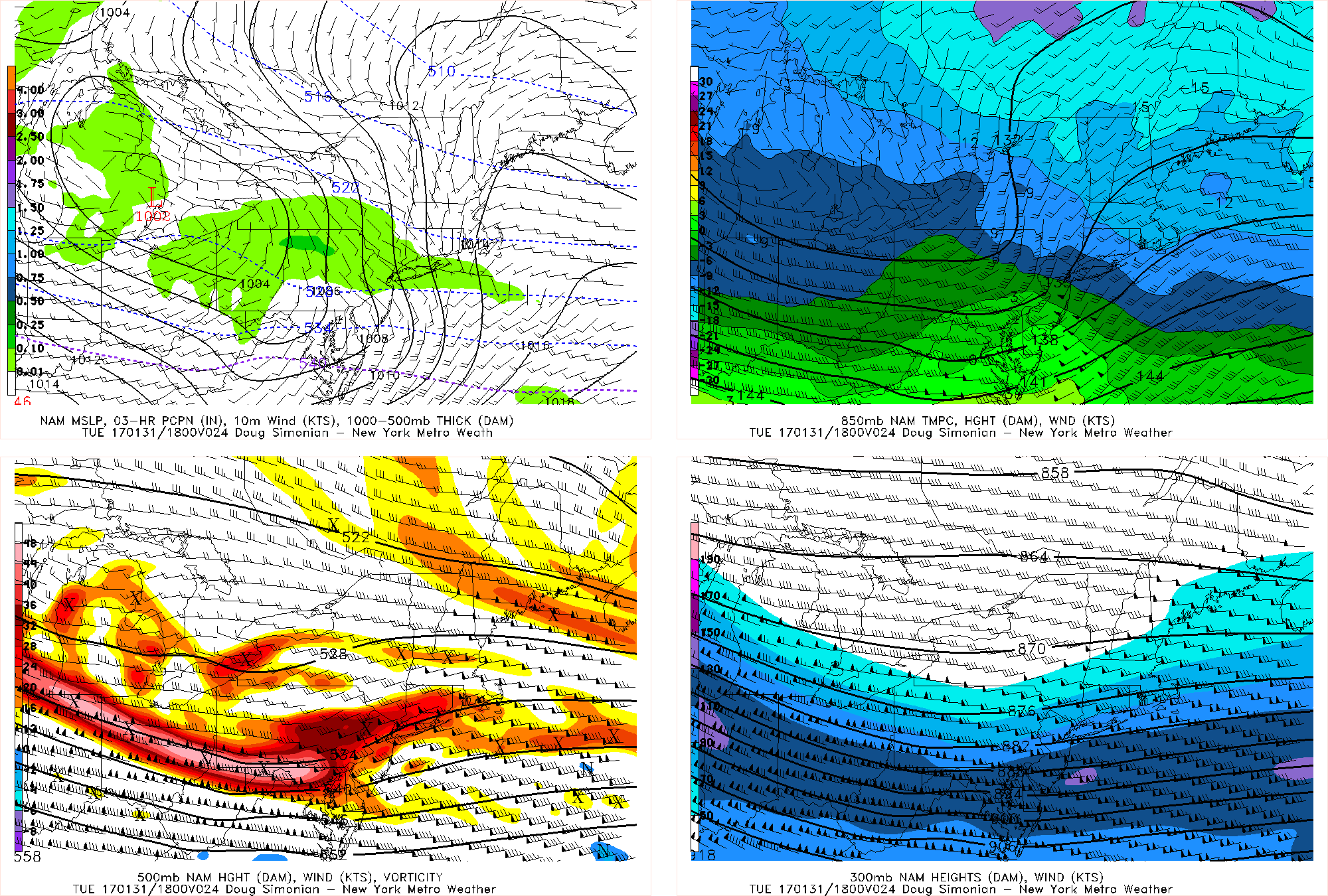
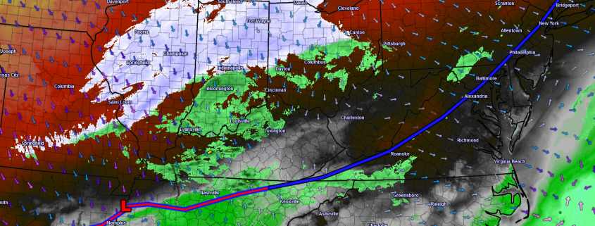
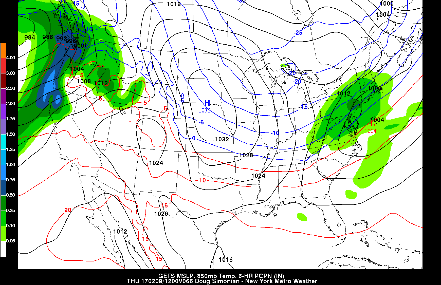
12km NAM showing Precip and MSLP/ 850mb Heights and winds/500mb heights and vorticity/300mb Heights and Winds
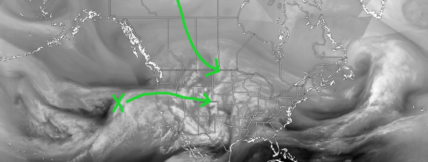
Later in the period, our attention turns towards this weekend as a potent shortwave from deep in the Pacific comes ashore along the Oregon/California coast late this week. Like past systems that have affected the Northeast, this shortwave is currently progged to head east while embedded within a relatively fast atmospheric flow, however this wave (if the pattern is favorable enough) may possibly interact with the northern stream that has been quite active as of late. This combination could produce a quick-moving low; and over the past two days most of our reliable guidance has shown us a variety of solutions as well as possible impacts from this system if it reaches our area ranging from snow on Super Bowl Sunday, to a more suppressed system that could miss our area to the south.
The latest trend in the models today has been for more of a flat and progressive flow along with a weaker Pacific shortwave. This would ultimately limit the impacts for our region, but this could very easily change as there are many moving parts with this possible system and none of these pieces will be sampled for days. One of the key pieces to this puzzle will be how much ridging we will have available in the western states, as this will help dictate how much northern stream energy can phase into this system as it heads east. Another key is how strong this system is when it comes ashore later this week, as a stronger storm would likely be more susceptible to a cleaner phase along with more direct and significant impacts for our area. We will continue to monitor the latest guidance over the next few days and provide updates as they become available on this potential threat.

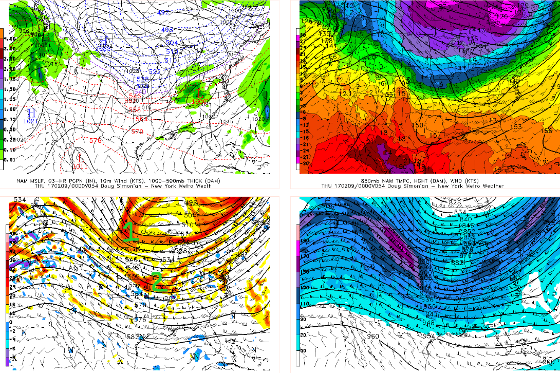
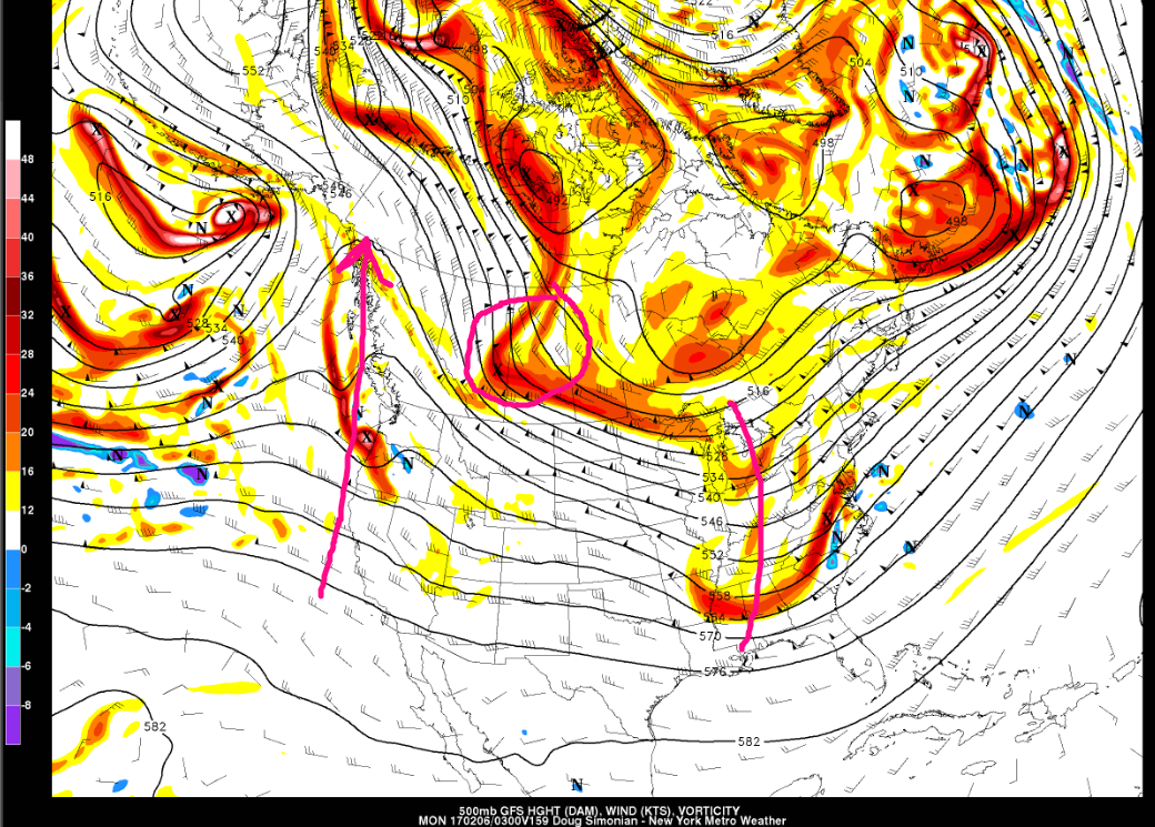
12z GFS (from left to right) showing the PNA ridging in the west, key northern stream energy in Canada, and the position of the shortwave over the Ohio Valley (valid: February, 6th)
Be sure to stay tuned throughout the next 24 hours to get the latest on the low pressure system that will be producing area-wide light snow for our area. Posts like this one are available multiple times each day to Personal and Commercial clients, including Zone Forecast subscribers. Contact us today for more info!
Have a great evening!
-2")