-2")
Snowstorm Exits, Warmer Conditions Ahead Next Week
Good Evening!
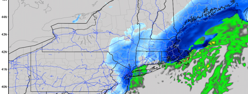
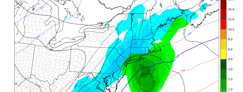
The snowstorm that we have been discussing for the past week has finally exited the region after dropping light to moderate snow for most locations. Due to onshore flow, precipitation mainly started out as rain over portions of New Jersey and southern New York, but colder air associated with the frontal system over Pennsylvania gradually made its way south. This caused the rain to flip to snow over much of the area, with coastal sections of New Jersey and Connecticut seeing plain rain. Rain was also quite common over the majority of Long Island this afternoon, as winds from the east kept temperatures in the middle to upper 30’s. Snow totals around the New York city metro area were generally light with a trace to three inches common for most locations. Totals over the southern half of New York state were a bit higher, with 6-10″ being reported due to snow from the frontal system as well as the weak coastal low. All major NYC airports reported less than one inch of snow as of 4pm, so travel likely will not be impacted all that much tonight.
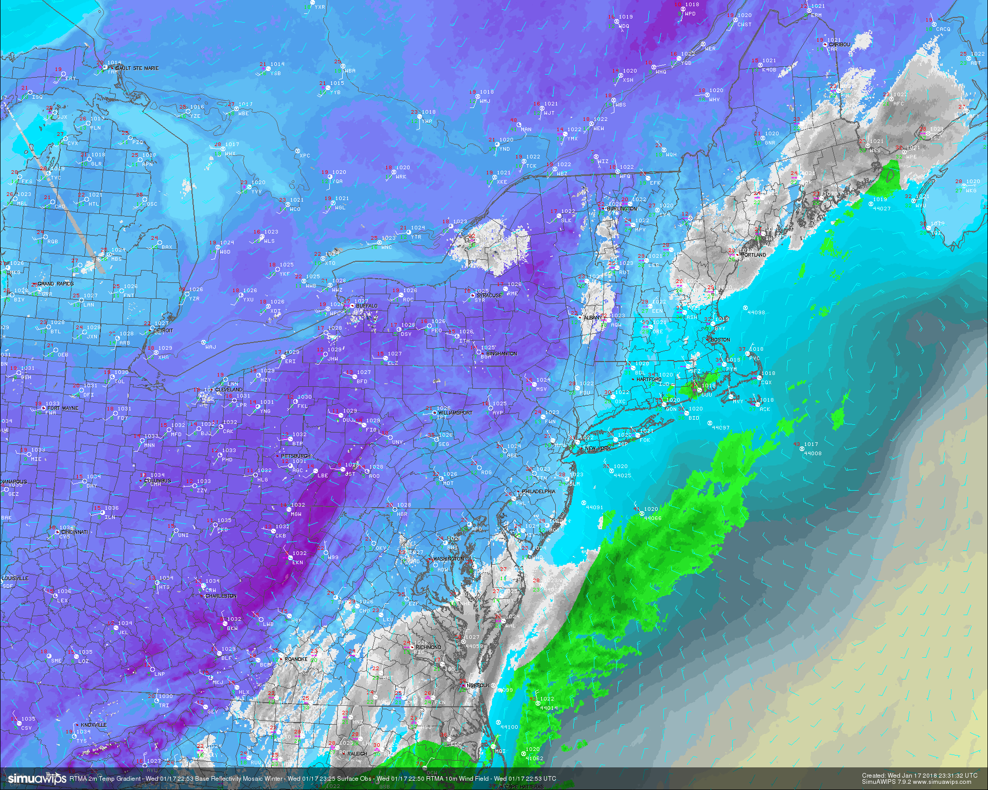
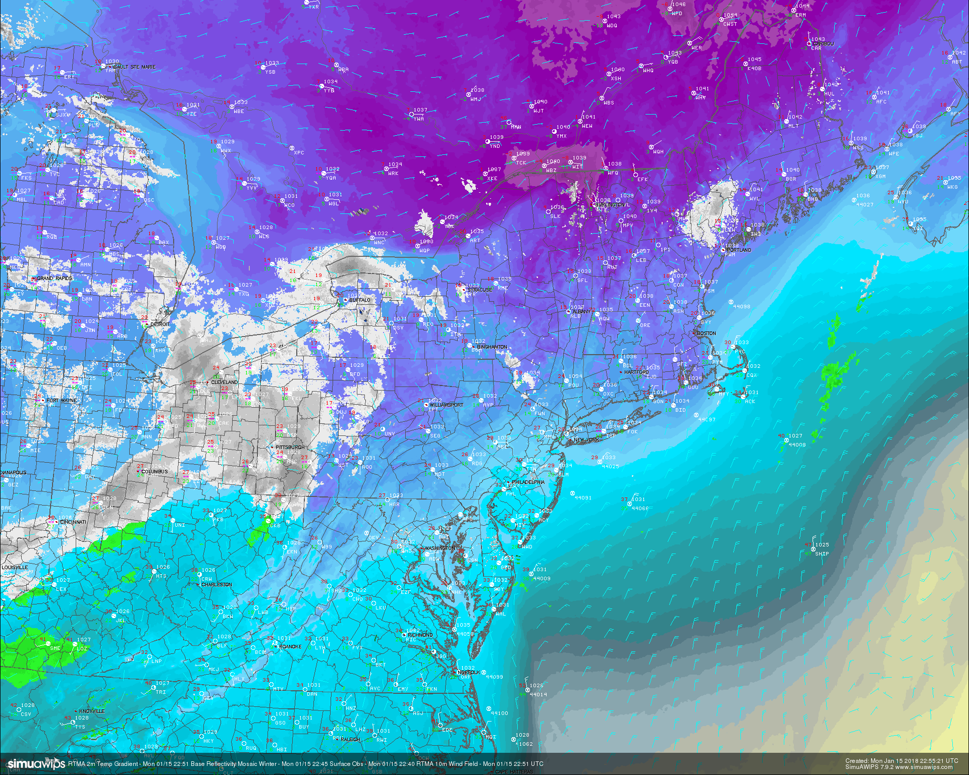
This evenings latest RTMA 2m temperature analysis, surface observations, and regional radar mosaic showing the snowstorm exiting off the coast
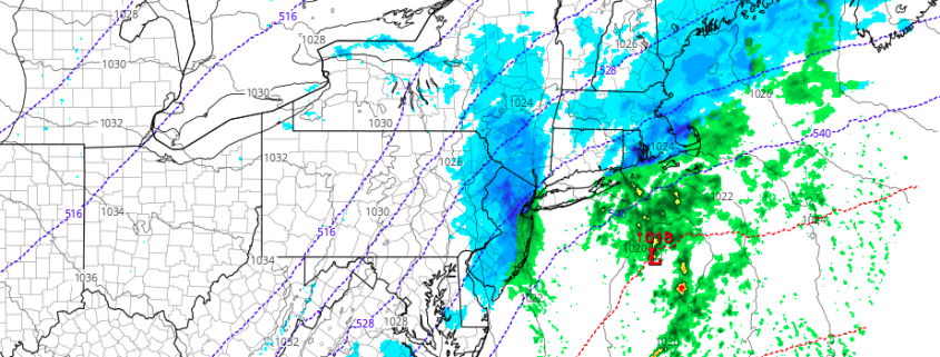
Conditions this evening and into the overnight hours will be generally calm as drier air begins to work in at all levels of the atmosphere. This should pretty much kill any chance of residual snow showers, but there could be a brief flurry or two mainly to the north of NYC. Winds will begin to increase from the north and northwest as another coastal low begins to strengthen well to our south. This system will have absolutely no impact on our weather this evening outside of some occasionally gusty winds. The northwesterly flow in the mid levels of the atmosphere combined with the fresh snow pack over much of the Northeast will lead to some pretty cold temperatures overnight, with lows getting down into the upper teens and low 20’s across the immediate NYC area, with locations to the north and west likely seeing lows well into the teens and single digits. This will cause a chance for some of the snow that melted this afternoon to quickly refreeze on untreated roads, so please use caution when traveling.
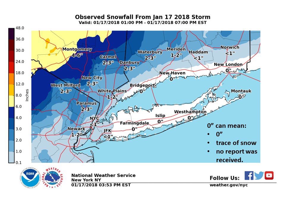
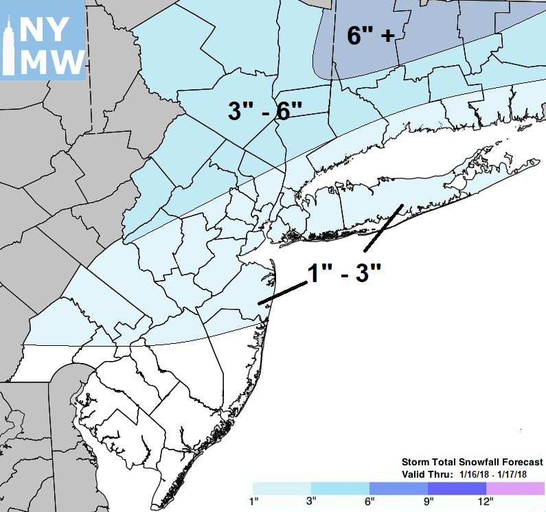
Snow totals from around the immediate NYC area courtesy of the NWS in Upton, NY
Warmer and Calm Conditions Through the Weekend
Thursday will be the last cold day across the Northeast for a bit of time as mid level ridging begins to build quite a bit over the central part of the United States tomorrow. Highs will likely remain below freezing during the day, with readings staying in the middle to upper 20’s for northern locations, with lower to middle 30’s possible south of New York City. A weak shortwave trough looks to pass through portions of southern Canada by
Friday afternoon, and this could spark some light snow over portions of northern New England, mainly over ski country. Otherwise, mid level flow from the west should cause temperatures to rise quite a bit, with locations south of New England seeing highs into the 40’s. Conditions will likely remain pretty quiet for the end of the work week south of New England as well as zonal flow begins to setup in the mid levels of the atmosphere.
Mid level heights will rise substantially on Saturday morning, leading to a mainly calm and warmer day. Temperatures should be able to reach into the lower to middle 40’s during the day, with some locations south of the city likely getting into the 50’s! These temperatures will be quite a bit above-normal for the middle of winter, so enjoy them while they last!
More dry and warm conditions are expected to hold on for Sunday as a large storm begins to gather over the Rocky Mountains that will likely impact us early next week. Regardless, temperatures should be in the middle to upper 40’s once again, with mainly clear conditions expected, making it another great day to get some things done outside like getting rid of the last of the holiday decorations!
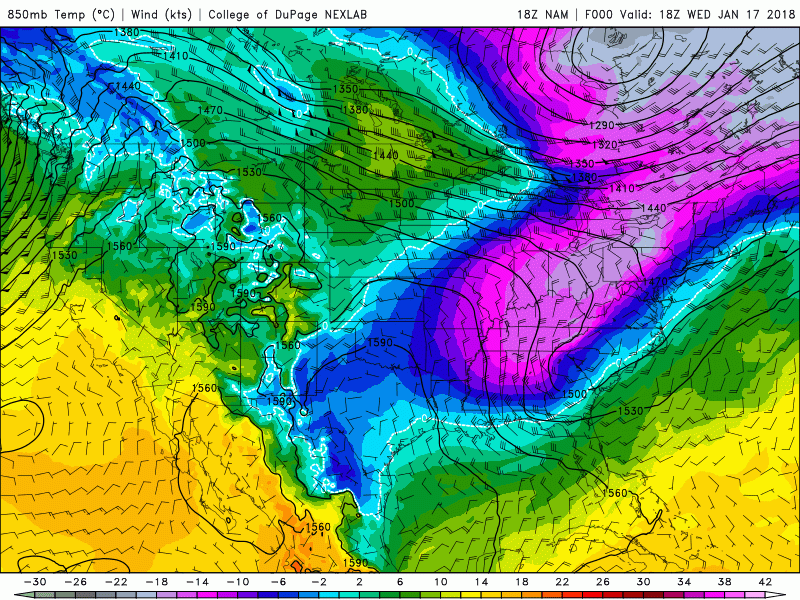
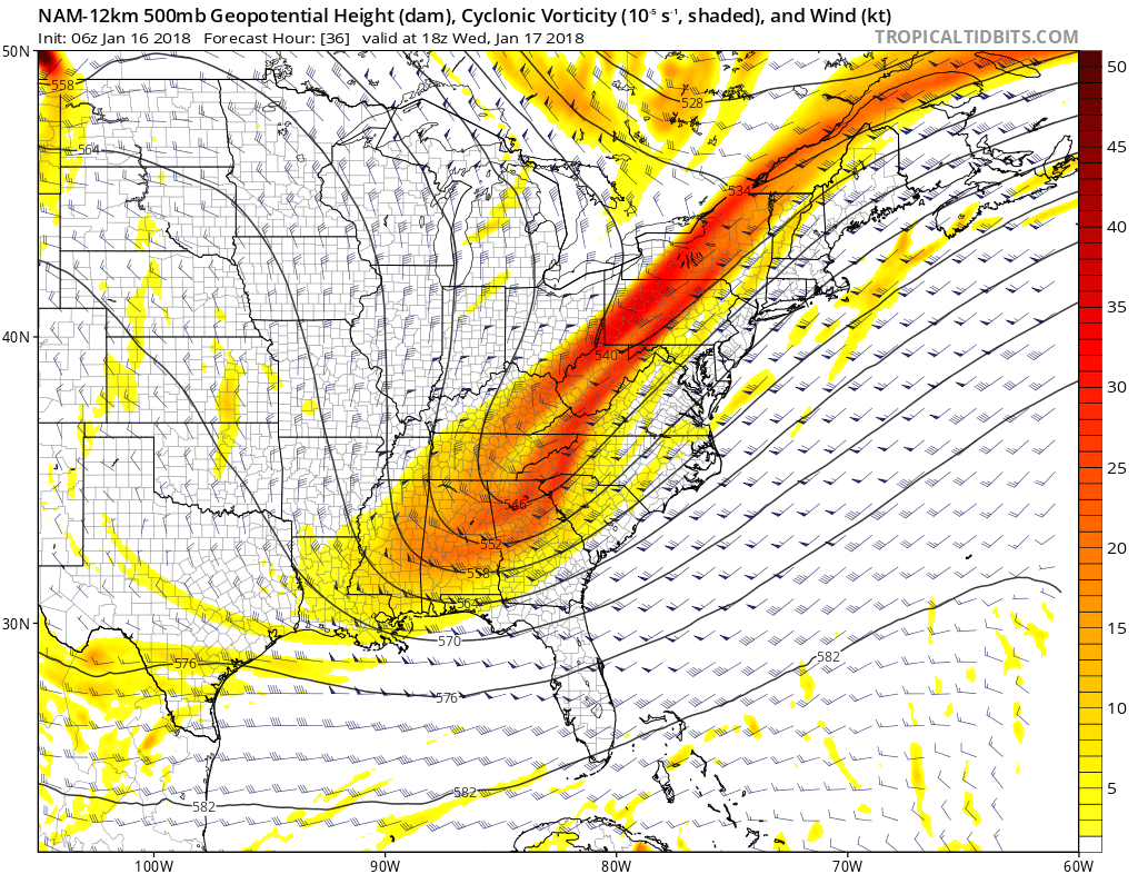
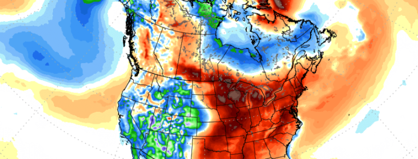
This afternoons NAM model showing a drastic change in mid level temperatures over the East during the next three days
Large Plains Snowstorm and What It Means For Us
A large trough will be digging deep into the Rockies and southern Plains by Sunday night, which will trigger a surface low to develop over portions of Kansas and Nebraska. This system will have rich tropical moisture feeding into it from the Gulf of Mexico and as a result, a very expansive area of precipitation will fan out with the help of an impressive upper level jet. Heavy snow will likely fall over the northern Plains, with heavy rain and some thunderstorms likely across the Ozarks and Gulf Coast. This system will likely then begin to weaken a bit, but the strong moisture feed will continue to pump northward as the low moves east towards the Great Lakes. By this time the entire East coast should be in the warm sector of this system, with temperatures likely reaching into the well-above normal category once again. By Tuesday evening, we could be looking at a large cold front moving through the Northeast with associated heavy rainfall and potentially some embedded thunderstorms. There is strong model support for this system almost a week out, but we will certainly be monitoring it over the next few days, so be sure to check back for more updates!
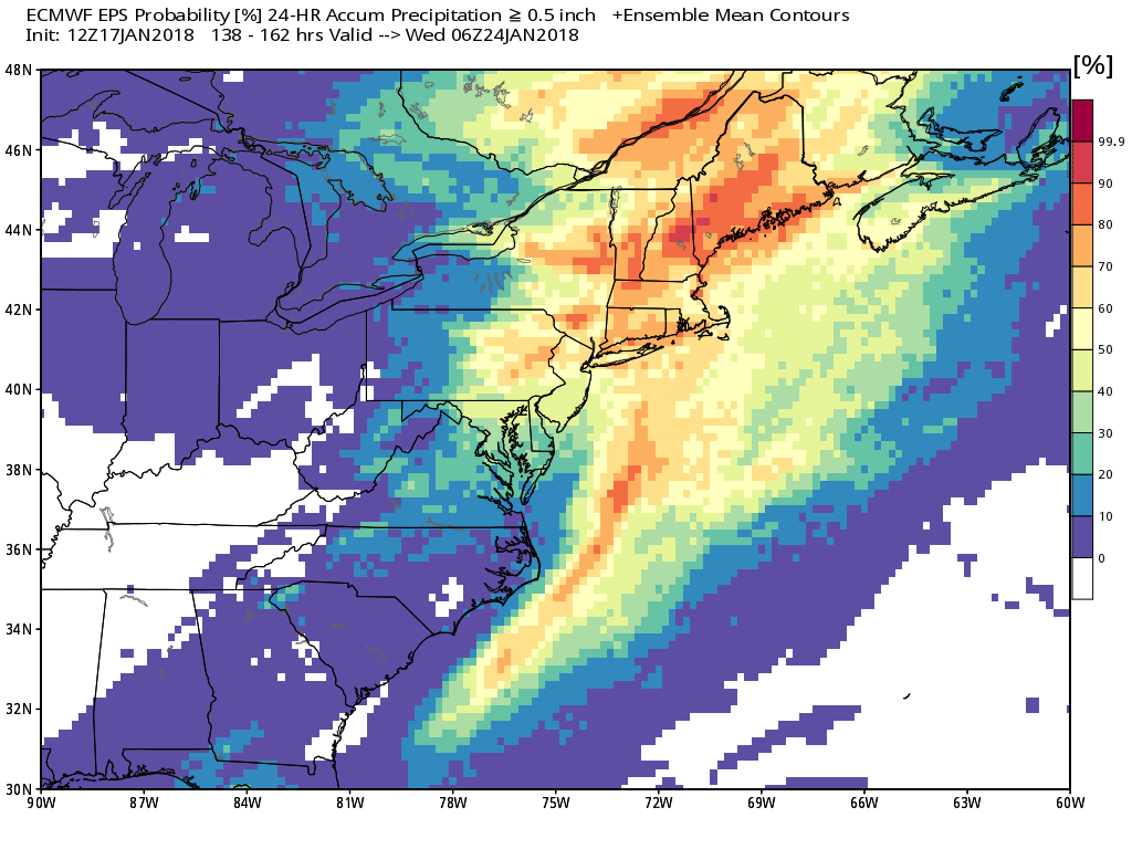
This afternoon European ensembles showing a pretty impressive signal for heavy rain next week across much of the Northeast
Have a great night!
Steve Copertino