-2")
Active Pattern Kicks In With Multiple Heavy Rain Threats
Good Evening!
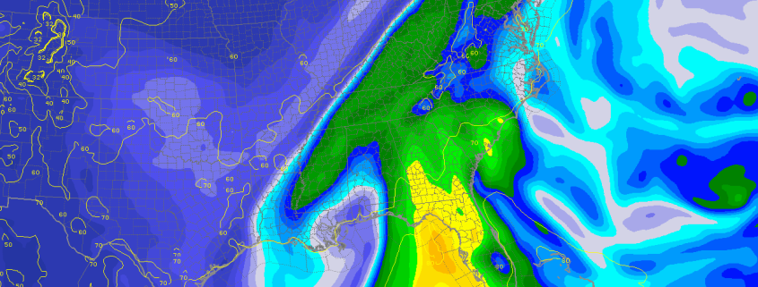
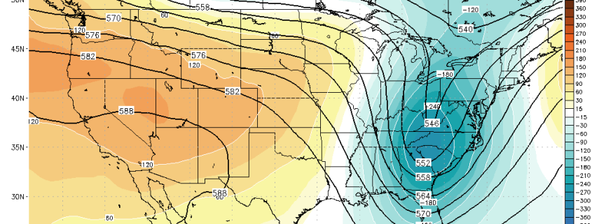
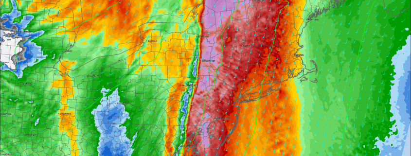
Today was likely the last in the series of nice warm fall days that we have managed to string together over the past five days or so. Mots of the day was rather calm and clear with winds out of the south/southeast, bringing in more moist dewpoints into the area. With mid level temperatures rising ahead of a strong mid level trough located in the central part of the country, we were able to get temperatures to rise into the lower to middle 70’s this afternoon-which is slightly above normal for this time of year. As we progressed into the late afternoon and early evening, mid level clouds began to increase substantially as the vigorous mid level system that we have been talking about since last week began to intensify and pivot towards the east. As of this evening, heavy showers were located in portions of the Mid Atlantic states, and reaching into western Pennsylvania. This heavy shower activity is being fueled by a strong upper level jet in conjunction with an impressive low level jet, working to transport deep tropical moisture northward into the East. As we continue into the night tonight, this activity will likely continue to gradually move northeast, and eventually make its way into eastern Pennsylvania around 5am or so. By this time, moisture transport from the source region of the Caribbean will be maximized, and the upper level jet over-top this anomalous moisture will be to expand and promote surface convergence, which will promote heavy/intense rainfall to develop. High resolution model guidance disagrees on the exact evolution of these features, but signs point to possible low-topped convection forming over eastern Pennsylvania and quickly heading northeast into the NY metro.
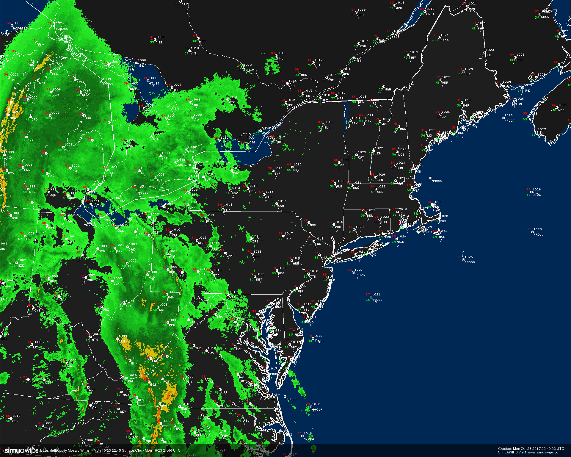
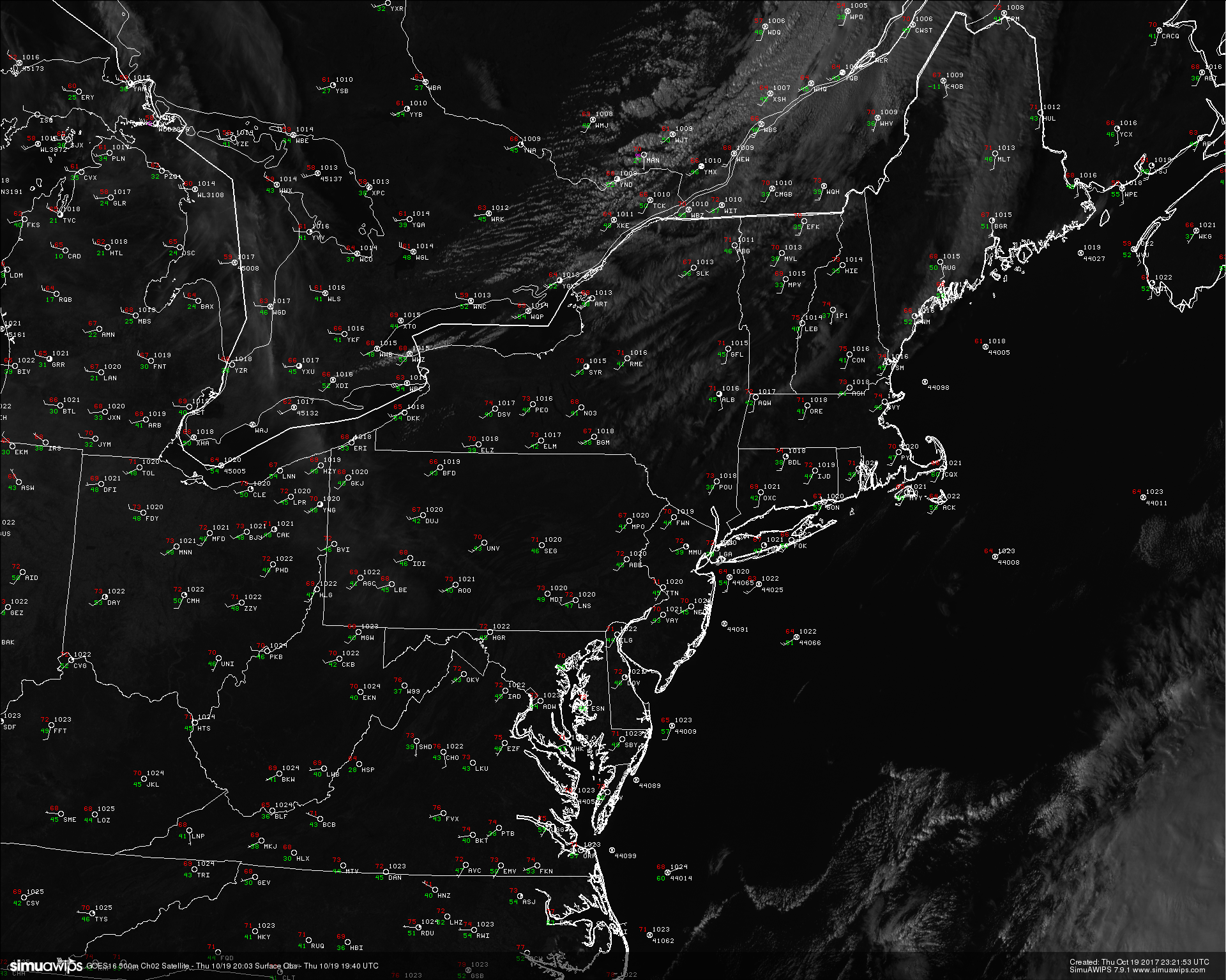
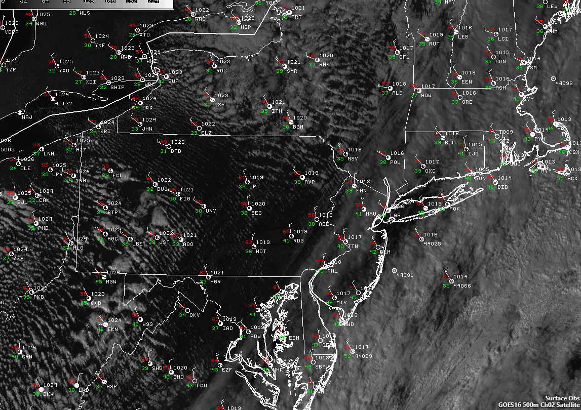
Radar and surface observations from around the Northeast and Mid Atlantic states showing the vigorous Pacific system finally getting ready to impact the region with heavy rain and strong winds.
This area of heavy showers with embedded convection will have the potential to produce very heavy rain, gusty winds, and localized road flooding due to leaves clogging areas of poor drainage as it heads northeast. As this activity moves onward, the stout mid level jet will be strengthening through the morning hours, and this will help to promote strong, gusty winds in the 30-50mph range even outside of the strongest area of activity. These winds could easily take down small tree limbs that still have leaves on them and could possibly cause localized power outages. For this reason, the NWS has issued numerous Wind Advisorys for the Northeast. The bulk of the activity should be located just west of New Jersey by 8-9am, and we may see renewed activity begin to form from the south over the Atlantic and possibly move inland over New Jesery and Long Island. Eventually, this activity looks to become focused along a frontal system that will likely be set up just to the east of New York City by later in the day on Tuesday. This activity will have the same very moist precipitable water feed that the morning activity had, as well the strong mid-upper level winds, so very heavy rain and strong, gusty winds will also be possible along with some rumbles of thunder mixed in as well. This frontal system will likely be slow to move later in the day tomorrow, and we could see training of showers and thunderstorms over the same regions, which would put areas that see multiple rounds of rain under a heightened threat for flooding.
Isolated locations on Long Island could see upwards of 2-4″ of rain, with a very sharp gradient on the east and west side due to the northward movement of the showers and thunderstorms. It is also important to note that we will have to watch any organized thunderstorms moving off the ocean for possible tornado/waterspout activity, as there may be just enough low level turning to support a brief/weak spin-up along the NJ/LI coasts.
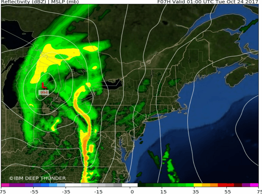
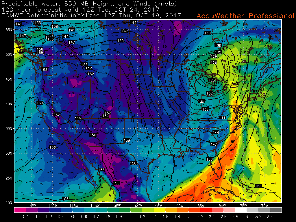
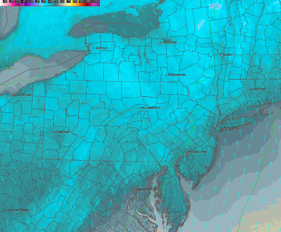
This afternoons RPM model showing the evolution of the heavy rain and wind threat tomorrow afternoon/evening
Wednesday and Beyond
After this first system, high pressure looks to build in behind the exiting upper level trough, which should help to bring in much cooler temperatures and low humidity courtesy of a fresh Canadian airmass. This should allow temperatures to become quite seasonable across the region, with highs likely staying the upper 50’s to middle 60’s for the remainder of the week. Conditions should also become quite calm as well, with mainly sunny conditions expected. Each night should feature fair to excellent conditions for radiational cooling to take place, so expect overnight low temperatures to drop down into the middle 30’s to low 40’s, with some areas likely seeing another round of patchy frost-with the best chance being on Thursday.
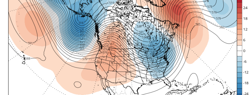
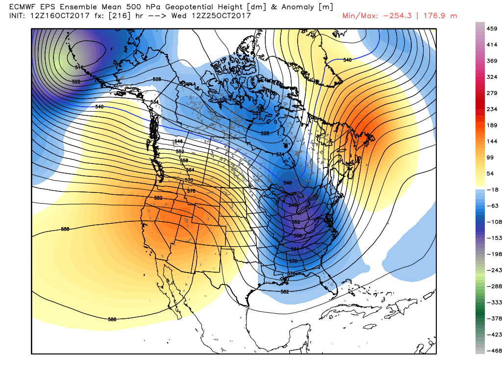
After this bout of calmer weather, we then turn our attention back to the Pacific northwest as another vigorous mid level system crashes into the West coast. This system will gradually move into the central part of the country by the end of the work week, and should likely phase with another piece of mid level energy located over the southern Plains. As the energy consolidates and begins to strengthen, it will begin to deepen a trough over the eastern third of the country, which will once again draw up a very impressive amount of tropical moisture from the Gulf of Mexico and Caribbean. This mid level system will likely be much more impressive than this current one, as it should have enough cold air on the back side of the trough to potentially drop a good amount of snow on the northern tier of the country. This storm system will likely track into the Great Lakes region by Saturday afternoon, but the models show a potential wild card to this forecast. Due to the enhanced convection over the Caribbean and Gulf from the strong Madden-Jullien Oscillation pulse over the area, we could potentially see some kind of tropical system become tangled up with the cold front draped over the southeast US. As the front heads east towards our area, we could see copious amounts of rain from the tropical system riding the front up the east coast, but this will likely change and will be highly dependent on just where the front sets up. Regardless, there is a heightened potential for a cool and stormy weekend ahead, and we will have further updates on this system during the week!
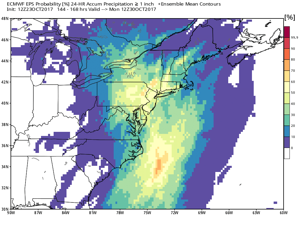
This afternoons European Ensembles already showing a high probability of 1″ or greater of rain for this weekend
For more information and posts like this one, make sure you sign up for Premium Forecasts — where multiple detailed articles, videos, and interactives are posted each day. Also, come interact with our staff and many other weather enthusiasts at 33andrain.com!
Have a great night!
Steve Copertino