-2")
Public Analysis: Another Week of Extremes on Tap
If you enjoyed the record warm temperatures, severe weather, and sudden return to more winter-like conditions that we experienced over the past week, then you’re in luck! This week is shaping up to be very similar to last, with record or near-record temperatures possible in the middle of the week, followed by a strong cold front passage that will leave the entire area right around seasonable or just slightly below average for this time of year with a possible clipper system passing near the area by the end of the work week.
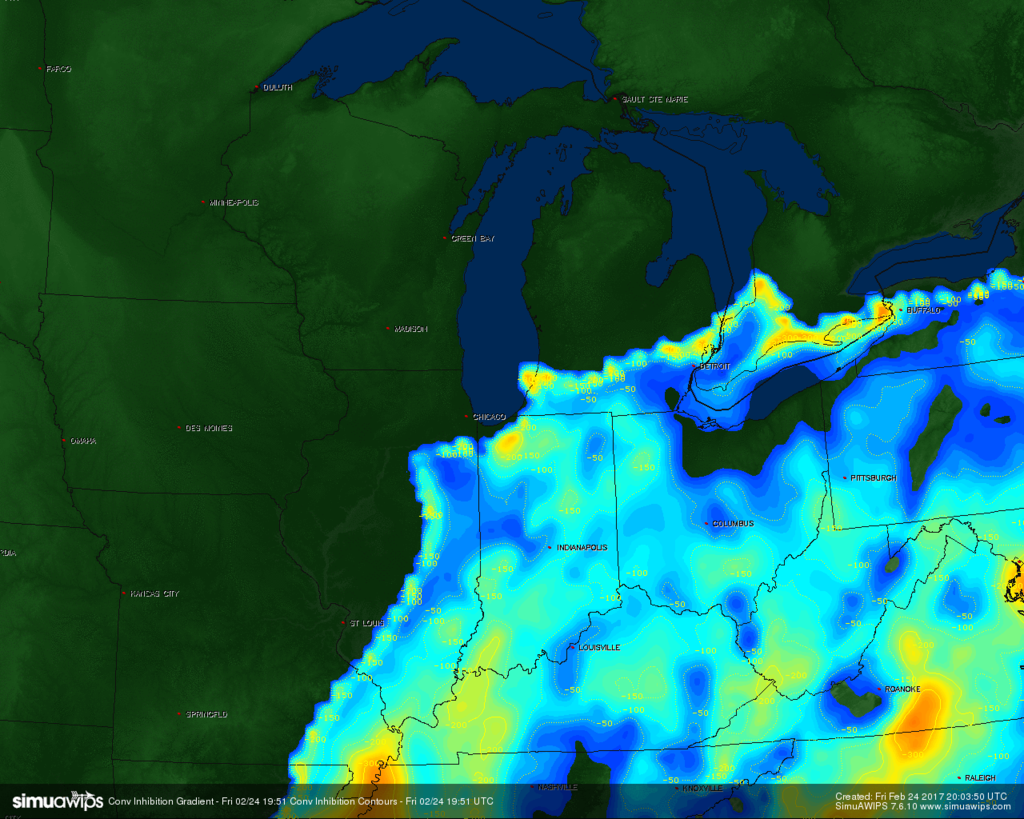
This afternoon was rather pleasant with some mid to high level clouds noted on visible satellite imagery as a high pressure system located off of the mid-Atlantic coast remains in control of our weather for the rest of the day and into tomorrow. As we progress into late afternoon hours and evening, cloud cover will begin to increase over the entire area as southerly winds usher in a moist airmass in the low levels of the atmosphere. Since the cloud cover will be relatively heavy, temperatures will have a hard time dropping much this evening, so expect temperatures to only be in the mid to high 30’s inland and in the lower 40’s for the coastal regions as well as southern locations. Some patchy drizzle may be possible as the low level moisture mentioned earlier begins to increase as we head into the evening hours.
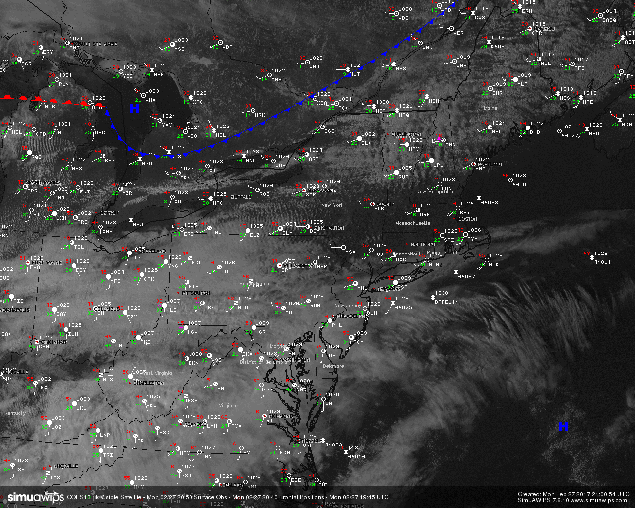
Current visible satellite and surface observations showing a rather thick cloud deck overspreading the Northeast (Simuawips.com)
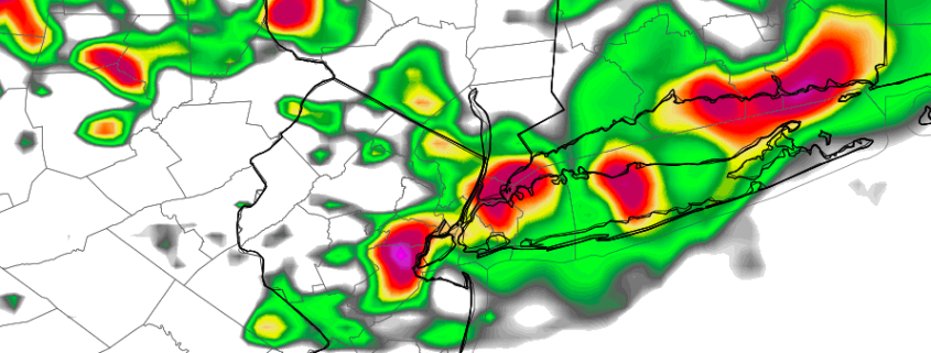
As we move into Tuesday, a warm front should gradually begin to overspread the region in the morning and bring a cloudy start to the day. As we progress into the afternoon hours, temperatures should rise into the upper 50’s to mid 60’s areawide, with cooler temperatures around the mid 50’s likely along coastal locations. High level clouds may allow some sunshine to break through tomorrow afternoon, but as another warm front moves through in conjunction with some upper level energy from a disturbance passing near our area, low clouds and even some rain are quite possible by the afternoon. Low level clouds should continue to increase into the evening hours, with some steadier rain showers possible by late evening. Though winds look to be a little too strong for fog in the evening, warm winds coming off of the ocean and low level moisture in place may allow for at least the coastal communities to see some periods of fog, though this will have to be looked at in greater detail as we get closer to tomorrow evening.
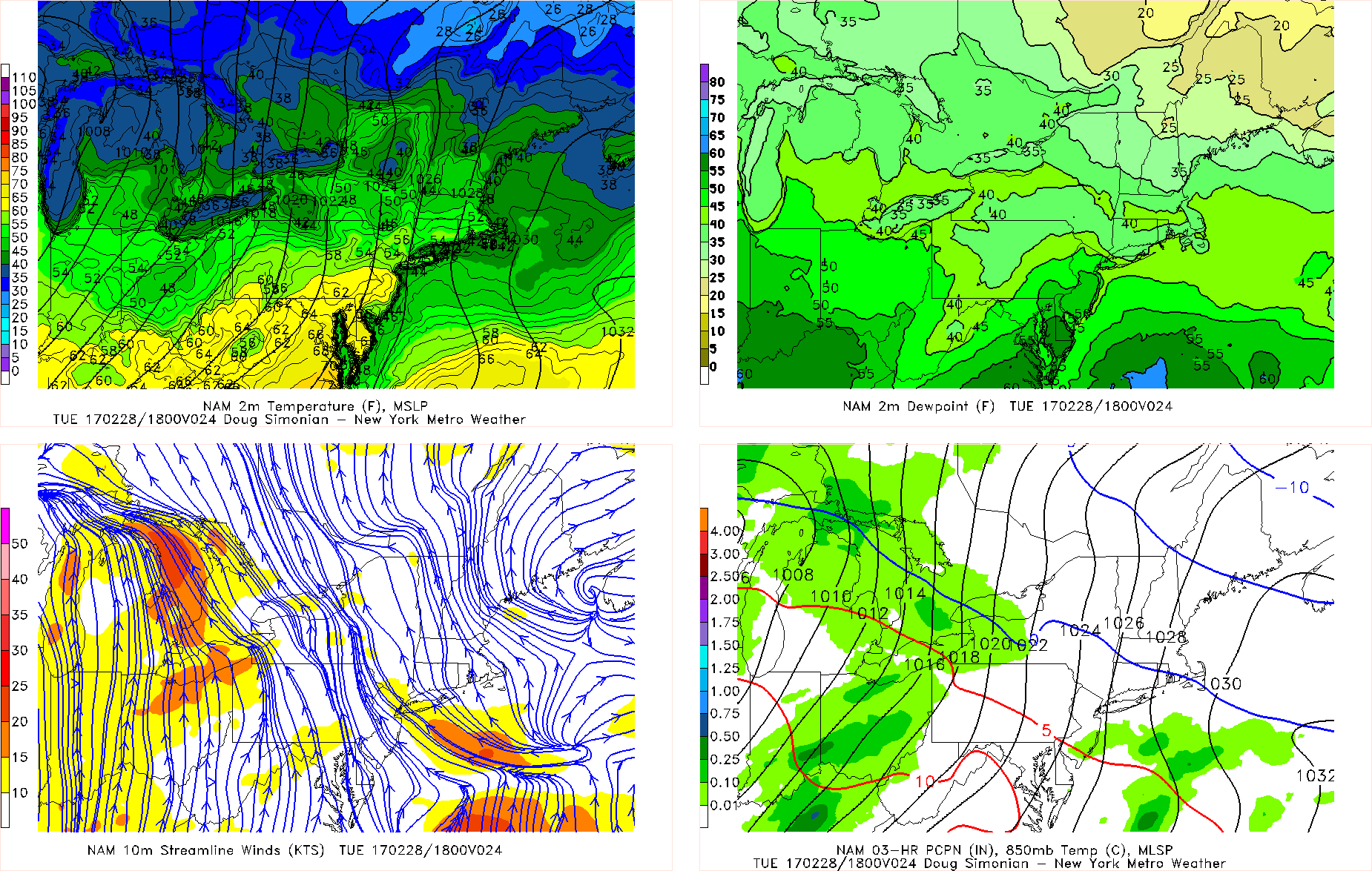
NAM model showing winds coming off of the Atlantic on Tuesday afternoon, providing cloudy conditions as well as a threat for showers later in the day into the evening hours
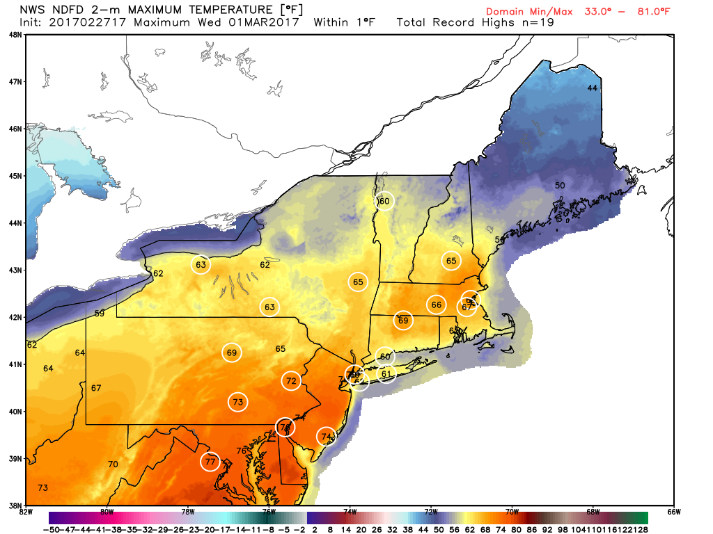
Wednesday should be the most eventful day of the week in terms of sensible weather as the warm front that initially approaches the region tomorrow begins to advance north. The initial fog and rain showers should diminish by late morning, giving way to at least some sun breaking through the clouds. Temperatures should quickly rise deep into the 60’s and even low to mid 70’s by the afternoon hours, which could break numerous records once again across our area. Since we still do hold on to southerly winds, coastal sections as well as Long Isalnd may be limited as to just how warm they get.
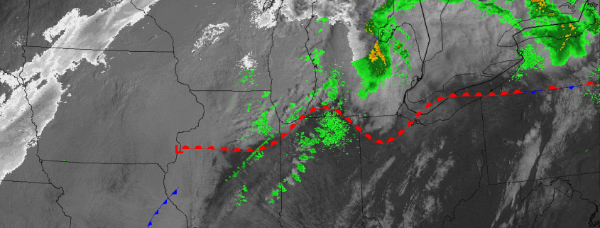
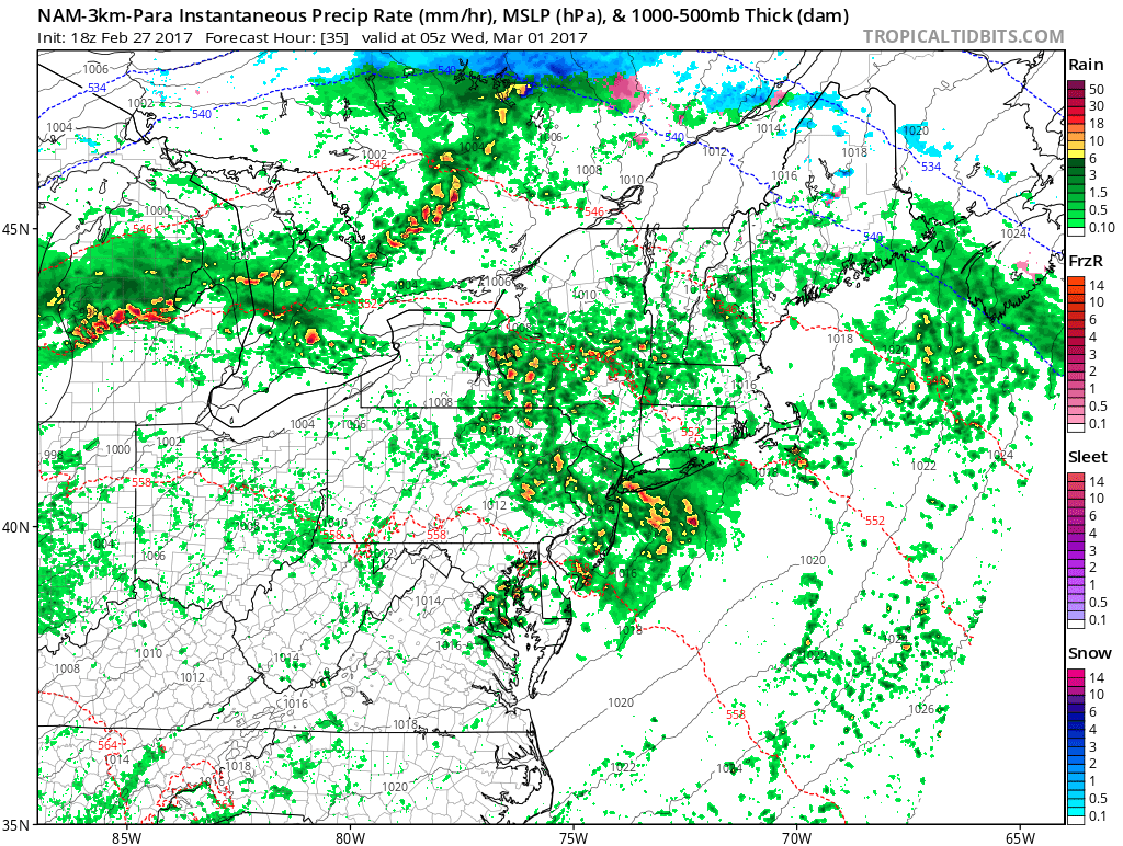
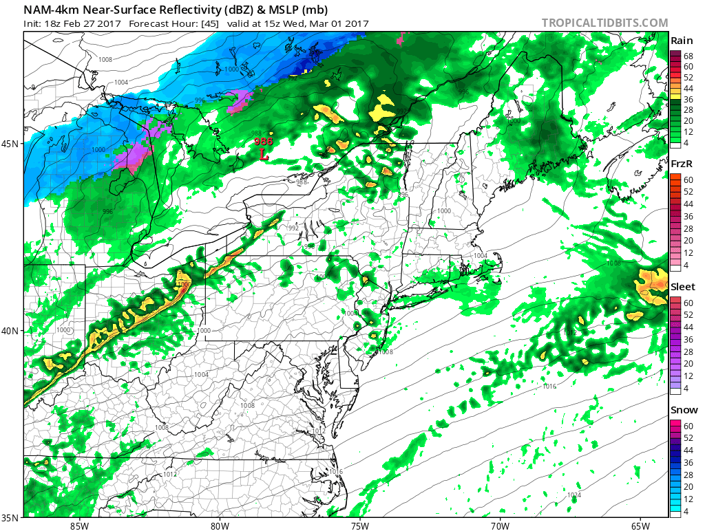
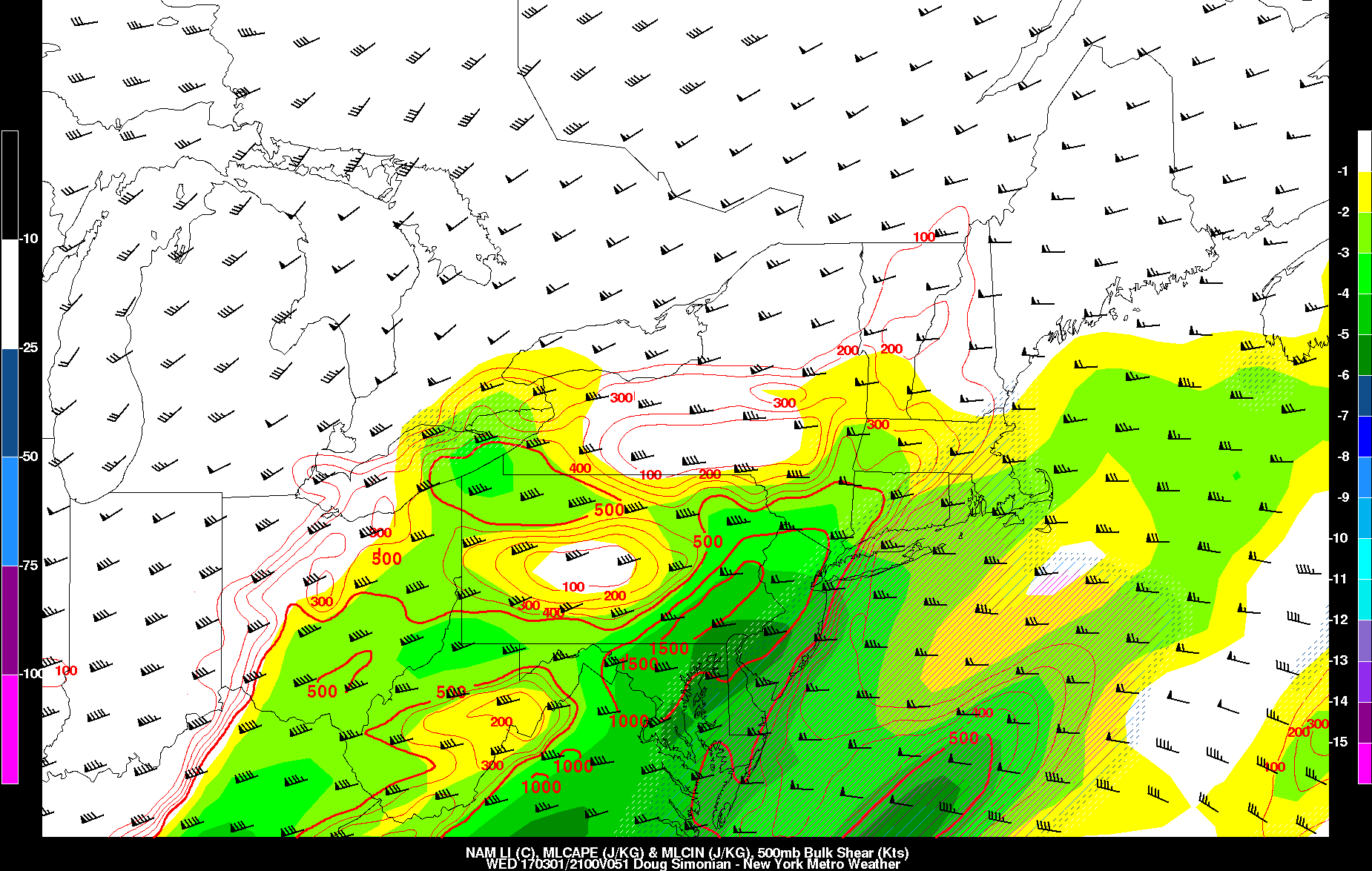
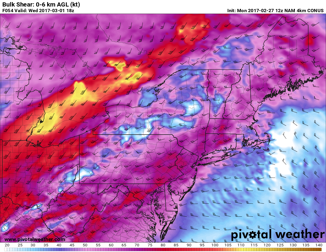
As a strong cold front associated with a low pressure system moves through the Great Lakes Wednesday afternoon, winds from the south will usher in a very moist airmass for this time of year which will allow the atmosphere to become quite unstable. Even before the cold front and its associated “lift” which helps to build thunderstorms arrives, some showers and thunderstorms will be possible by the early afternoon hours. These shower and possible thunderstorms will mainly be limited to heavy rain and perhaps some gusty winds, but after these initial storms pass through is when the main event of the day looks to unfold. As we begin to destabilize the atmosphere again later in the afternoon, very strong upper level wind shear as well as significant lift will be present over the metro area, which will be quite favorable for organized severe thunderstorm development capable of potentially damaging winds. Though model guidance is beginning to key in on the potential for severe thunderstorms to pass near or over the area later in the day and into the evening, there are still some very important details that will have to be worked out during the day on Wednesday. One of the key factors to this potential severe weather threat will be just how widespread the initial showers and thunderstorm development is Wednesday morning, which will ultimately determine where the best instability is located, as well as where the leftover low level boundaries are located (which could locally enhance storm development). As of this morning, the Storm Prediction Center in Norman Oklahoma has placed our area in a Slight Risk for severe thunderstorms on Wednesday with damaging wind gusts being the most likely risk at this time. Make sure to stay tuned as we will have continuing coverage of this potential severe threat over the next 48 hours.

Afternoon NAM model showing strong thunderstorms approaching the tr-state area by late afternoon
Behind the front will come a dramatically changed weather pattern. Thousands of miles to our north, a blocking ridge near Greenland will begin to have its effects on the weather throughout the hemisphere. Northern jet stream disturbances will slide southward through the Great Lakes and into New England, with colder air lingering across the Northeast parts of the United States. The first of these disturbances comes late this week in the form of a transient clipper system. Forecast models have wavered with the storms exact track, but a weak low pressure area tracking quickly through the Northeast US on Friday holds the potential to deliver some light snow — especially in New England. The exact track of the low pressure area will determine where the swath of light wintry precipitation falls. Make sure to stay updated with the active weather week ahead! For more information and posts like this one, make sure you sign up for Zone Forecasts — where multiple detailed articles, videos, and interactives are posted each day.
Have a great evening!
