-2")
Nor’Easter set to impact the area today, worst east of NYC
[soundcloud url=”https://api.soundcloud.com/tracks/412811202″ params=”color=#d0e3ef&auto_play=false&hide_related=false&show_comments=true&show_user=true&show_reposts=false&show_teaser=true” width=”100%” height=”166″ iframe=”true” /]
Quick Links: Northeast US Impact Map | Snowfall Forecast Map
Another significant Nor’Easter is set to impact the Northeast states on Tuesday – this time with the worst of the storm passing well east of NYC and impacting Eastern New England.
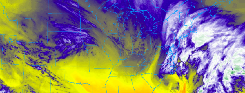
The third Nor’Easter in as many weeks (well, technically just over two weeks) is set to impact the Northeast states on Tuesday, bringing widespread impacts from just east of New York City into Long Island and all of New England. This storm’s formation was well underway this morning and it is expected to continue to strengthen through Tuesday morning and afternoon across the Northeast States.
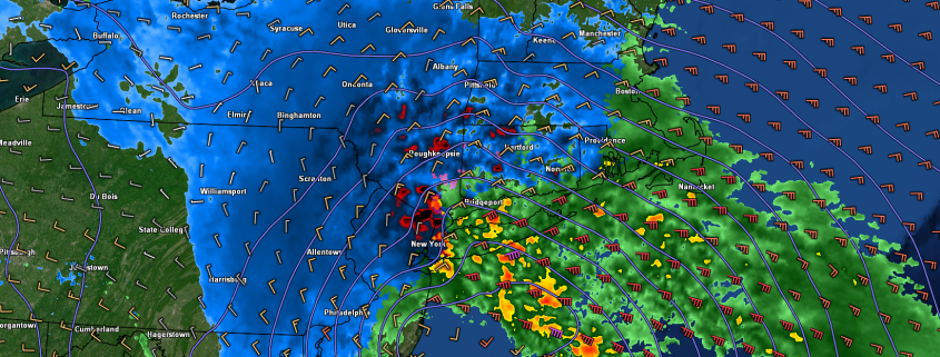
9:00am Tuesday Update: Heaviest banding has shifted east into parts of Long Island and Connecticut, where 700mb frontogenesis has increased over past few hours, with the storm tracking well offshore, as was previously anticipated. Current radar shows actually shows two frontogenetic bands of snow with some subsidence in between over Central Suffolk county and central parts of Connecticut. But these bands will likely merge before finally shifting east by early this afternoon.
Heavy snowfall rates of 1″ to 2″ per hour and perhaps even higher with reduced visibilities may for hazardous driving over next few hours. Snowfall totals over parts of Long Island and CT have been 2″ to 5″. These totals will likely double later this morning, especially over Suffolk County and New London County in CT. Although roads may not receive as much accumulation with surface temperatures between 32 to 34 F.
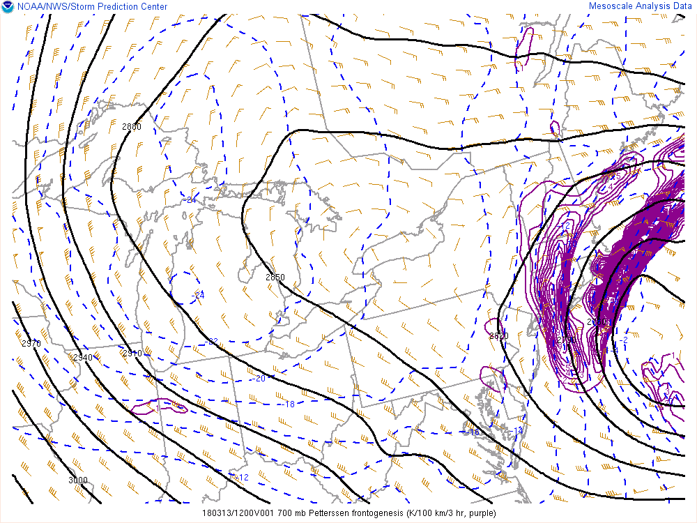
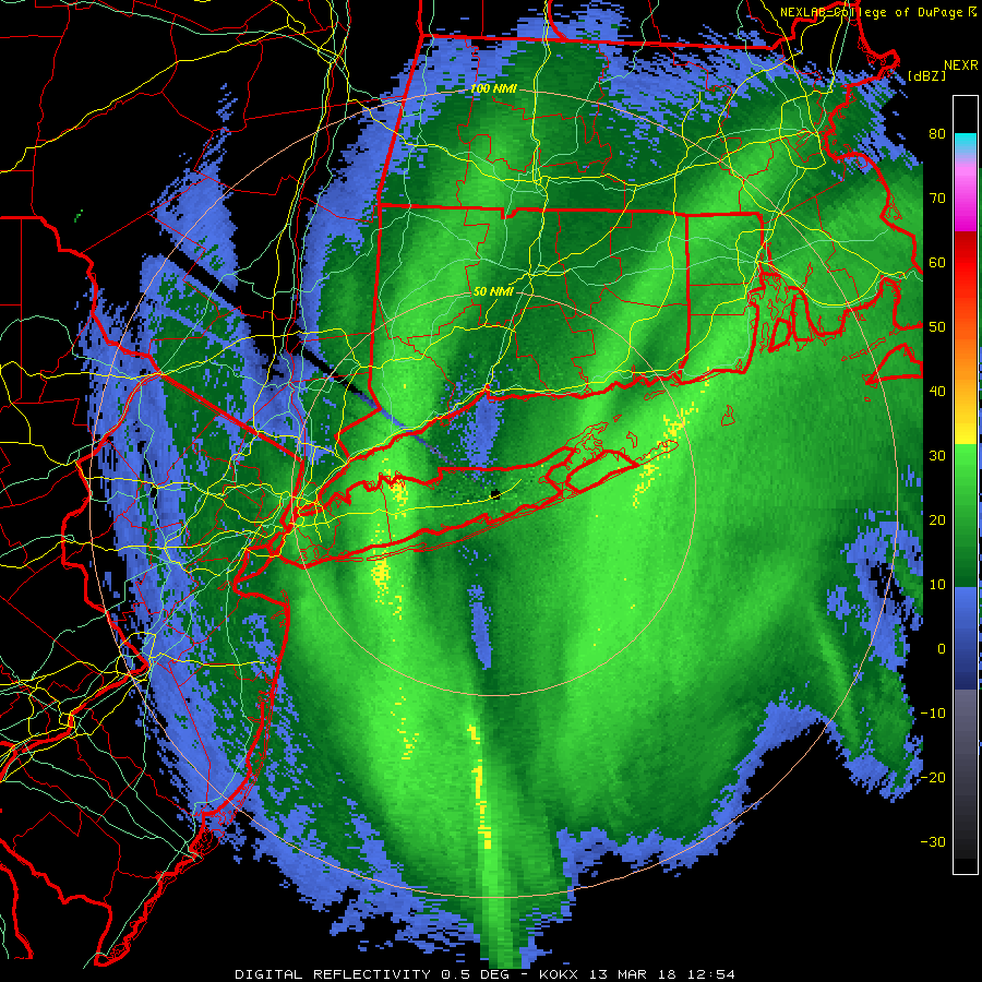
Current SPC mesoscale analysis , showing strong 700mb frontogenesis over Long Island and Connecticut.
Elsewhere, over most of New Jersey and the Lower Hudson Valley and Eastern PA snow appears to be winding down. A small moderate band has build back over NYC and extending into the ocean. This should shift east during the next hour. Snow will taper off to snow showers everywhere by around noon. Snowfall totals will likely wind up between 2″ to 5″. Although many paved surfaces, including roads, especially in NYC will likely receive less accumulation, with temperatures now in the mid 30s.
-Miguel Pierre
7:00am Tuesday Update: Snow is spreading throughout New Jersey and New York this morning, with light accumulations in many suburbs. Snow is much less likely to stick in New York City proper with warmer ground and pavement temperatures. This light snow will continue for the next few hours before beginning to pull back toward the east, with heavier bands developing towards Long Island and Connecticut.
The difference between this storm system and the past few will largely be the area it will impact. It otherwise parallels the other two storms very closely; it is powerful, rapidly intensifying, extremely dynamic, and will bring a myriad of impacts to the area it affects. The area most strongly affected with this one, however, will be Eastern New England and Long Island, where heavy snowfall and strong winds are likely.