-2")
Not-so-polar vortex will make disruptive return next week
Wait! Don’t go digging into your closet to find your winter jacket in that bin of winter clothes just yet. The Polar Vortex may “technically” be returning next week — but it isn’t so “polar” in air quality, and it may not be by other definitions as well. So is it really a Polar Vortex at all? The meteorological community is up in arms today over the usage of the term — and the end result is, of course, leading to varying opinions and arguments. The cause of the argument itself is the modeled approach of a massive upper level troughing system, which will feature much below normal temperatures both aloft and at the surface. The track, size and orientation of the system bear many resemblances to the Polar Vortex which tracked through the Great Lakes this past January.
Still, the time of year makes the sensible weather results quite different. Temperatures which are 10-20 degrees below normal (or more in some locations) won’t quite drop the thermometer near the freezing mark. But, still, things could get quite cool over the Great Lakes and Ohio Valley. Some meteorologists prefer to call the incoming system a Polar Vortex, others don’t. But the bottom line has to do more with meteorology than terminology — and the sensible weather effects are becoming more clear as we move closer. Figure 1 shows temperature anomalies at 850mb as forecast by the GFS next week. Notice the broad area of well below normal temperatures as a result of the large upper level troughing system with cold air moving south from Canada.
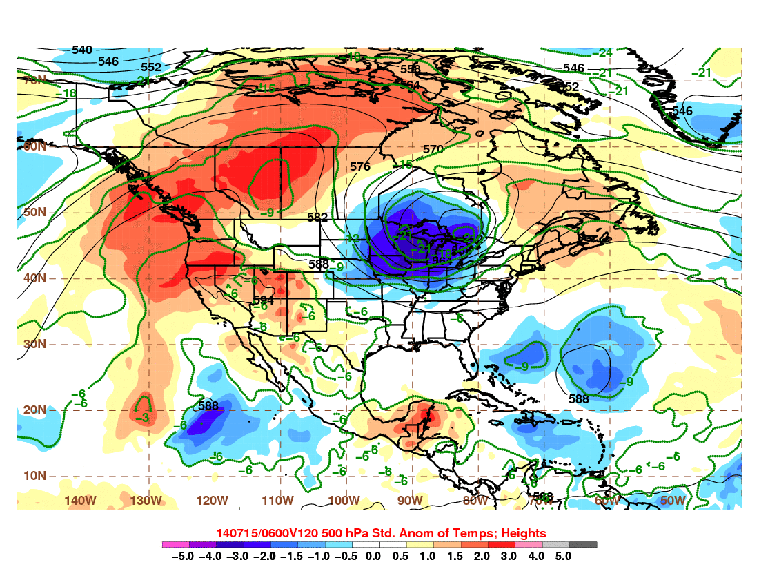
Fig 1. (Atmos Albany)