-2")
Pleasant start, but heavy rain likely Friday Night
It is not often, this time of year, that a relatively progressive passing disturbance will force the development of a low pressure system around 995mb off the Northeast US Coast. Exactly that will occur late Friday Night into early Saturday, as a mid and upper level disturbance passing through the Northeast US with some vigor moves toward New England. Forecast models indicate a high likelihood of increasing moisture as well as strengthening lift for precipitation by Friday Night — even some weak instability which could force thunderstorms — along an axis which will shift from west to east. This raises confidence in a period of heavy rain Friday Night into Saturday morning, as the low pressure system passes nearby and eventually into the Gulf of Maine.
Not all will be lost, however. Much of Friday will turn out pleasant. This morning, visible satellite imagery showed only some filtered high clouds moving into the area. High temperatures on most forecast models are expected to reach into the lower 60’s. Most notably, however, the winds which were blustery over the past few days have settled down. As a result, the 60 degree temperatures will feel much more comfortable in the warm sun as opposed to the brisk and blustery winds. Rain is forecast to move into the area after the PM Rush, and will be out of the area by Saturday’s sunrise.
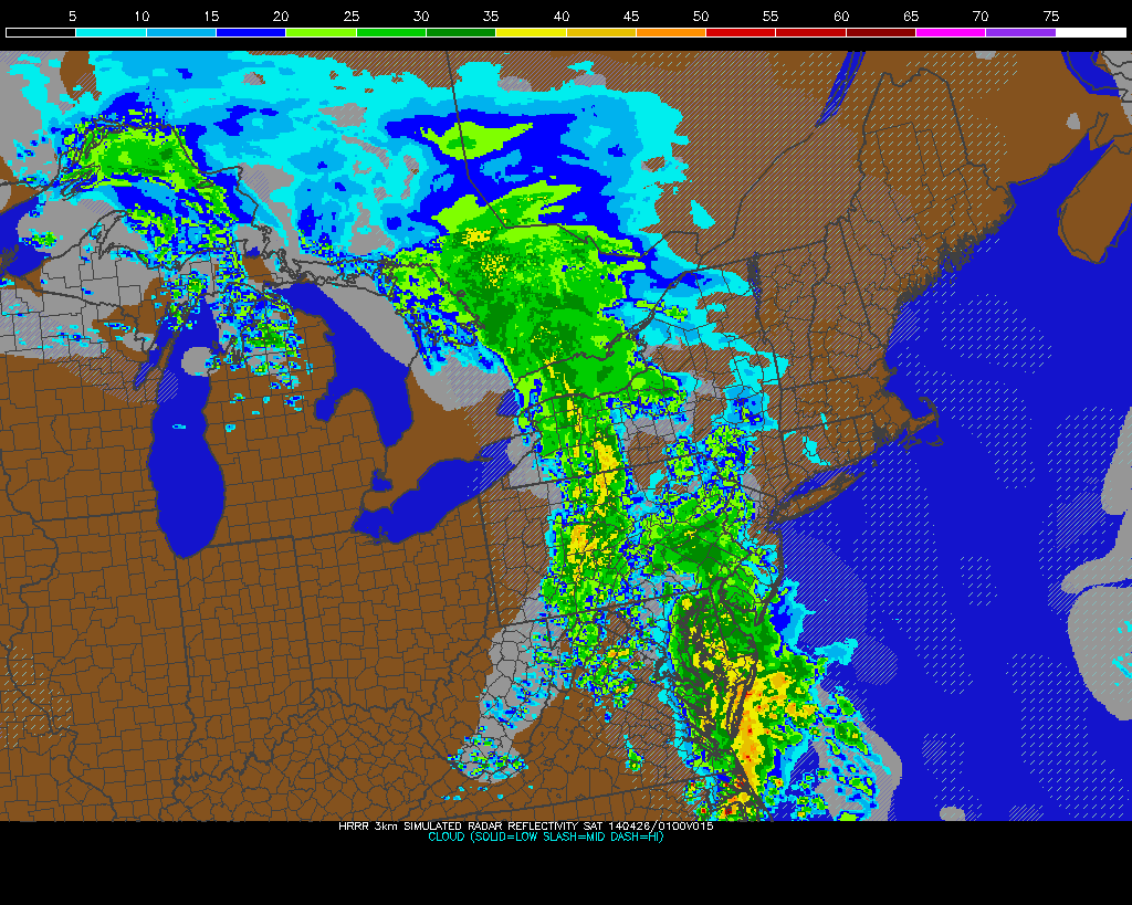
Simulated radar for tonight shows an area of moderate to heavy rain with embedded thunderstorms.