-2")
Cold air, snow showers to close out the week
This holiday week has generally been characterized by the return of colder air (after quite a warm start from the tail end of the weekend) and chances for light snow. Much of the same will continue on Thursday, as temperatures in the 20’s to near 30 will be common during the afternoon and a weak disturbance passing through aloft will spark the development of snow showers throughout the area. The weak low pressure system forming offshore and the relative lack of moisture means that precipitation will be spotty at best — but nevertheless, some flakes should fly especially across New Jersey and much of the interior. Accumulations are expected to be extremely light.
Another cold night is expected from late Thursday into Friday, as the aforementioned developing low pressure system pulls down one more reinforcing shot of cold air. Low temperatures in the teens and 20’s should be rather common by early Friday morning. Despite the light snow over the past several days, the weather pattern has been generally quiet. But beginning with a storm system late this weekend, the activity looks to kick up once again as we make our way into January.
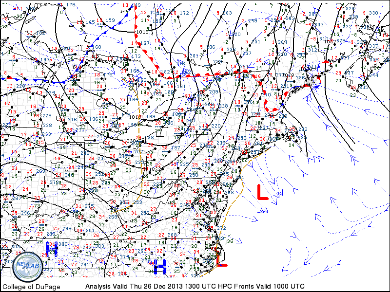
Northeast US surface analysis on December 26, 2013 showing a weak coastal low forming offshore.