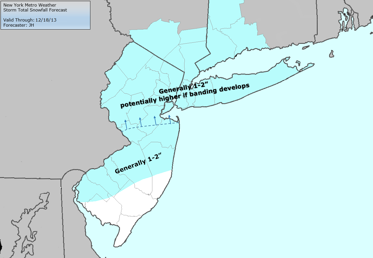
-2")
Live Blog: 12/17/13 Clipper
3:00pm Update: Precipitation which had changed over to sleet and freezing rain in many areas along the coast and near the city, as a result of a warm layer aloft, will slowly change back to snow from W to E over the next hour. Regional mesoscale analysis shows the potential for one last band of moderate to heavy precipitation as a result of increased lift from the developing coastal system and enhanced support aloft.
This band will shift eastward during the evening commute. We are expected a slippery and wintry commute in many areas, so plan extra time and expect delays.
9:00am Update: Snow has become a bit more spotty in nature throughout the area, so the roads are wet in the city and have likely been treated across the interior. Things are expected to pick up again this afternoon with periods of snow developing and moving northeast from the Mid-Atlantic states into New Jersey and New York..eventually northeastward into Connecticut and Southern New England. Forecast models have been wildly inconsistent with potential development of another coastal low pressure system later this afternoon..so as mentioned a few hours ago, confidence in that is rather low.
That said, seems to be a nowcasting-type situation developing and we’ll be closely monitoring the precipitation, pressure and height trends throughout the day. As of now our forecast remains unchanged with 1-2″ the general consensus throughout the area. All products (brief, discussion, member products) have been updated with the morning package. -JH
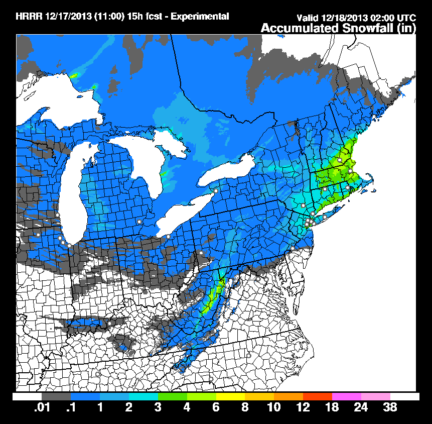
HRRR model storm total snowfall forecast through evening on Tuesday.
