-2")
Winter Storm Warnings issued as snowstorm approaches
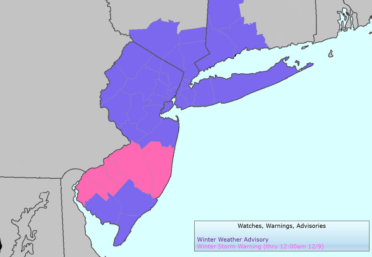
The National Weather Service issued Winter Storm Warnings and Winter Weather Advisories for the entire area on Monday evening, in advance of a light to moderate snowstorm which is expected to impact the area on Tuesday. The Winter Storm Warnings, in effect through 6pm on Tuesday evening, cover much of Southwestern and Central New Jersey as well as the major cities of Philadelphia and Trenton. Elsewhere, Winter Weather Advisories are in effect for the rest of New Jersey, New York City, Southwest Connecticut and Southeast New York. The advisories currently do not include Eastern Long Island or interior New York State.
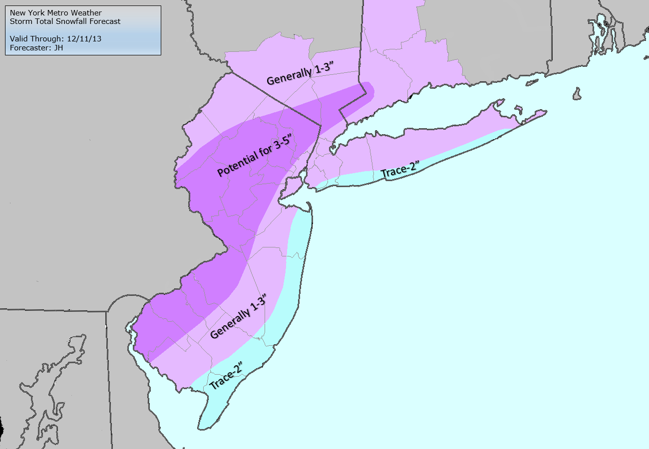
The watches and advisories were issued in advance of a forecast snowstorm, which will approach the area on Tuesday. A mid level disturbance sliding eastward, and a frontal boundary providing the focal point for enhanced lift and development of precipitation, will set the stage for the event. A band of moderate to heavy snow is forecast to develop by late Tuesday morning, but forecast models have been struggling with the exact placement of the band. Regardless of that bands eventual position, 1-3″ of snow seems increasingly likely throughout the majority of the region. But the heavy snow band, and enhanced forcing within it, provides extra intrigue for potential higher amounts. We break down Tuesday snowfall event with timing, snowfall totals, and hazards information below.
Storm total snowfall forecast (left) and NWS Watches, Warnings and Advisories (right).