-2")
Weekend winter storm to bring myriad of threats
The National Weather Service issued Winter Storm Watches on Friday, in advance of a winter storm which is expected to impact the area this weekend. Forecast models have come into better agreement on the evolution of the storm system, which begins in the Central United States on Friday. The storm will track northeastward, as an initial disturbance moves towards the Mississippi Valley. The primary surface low will track towards the Ohio Valley by Saturday morning, before a compressed height field to the north and high pressure over New England force a secondary surface low to redevelop off of the Mid Atlantic coast.
Precipitation is expected to move into the area by late morning on Saturday, with snow beginning to pick up in intensity by early Saturday afternoon. Moderate to heavy snow is expected to continue through Saturday Night. But as warm air advection (the push of warm air towards the area in the mid and low levels via southerly winds) begins to pick up, snow will change over to sleet, freezing rain and quickly rain in areas like Southern New Jersey and Southeast Long Island. Southeast winds off the warmer area waters will not help to keep cold air locked in place along the coastal plain. But inland, deeper cold at the surface will hold on for a longer period of time – meaning a prolonged period of snow. With time, in the area suburbs, the warm air advection will push over the top of the cold air at the surface, changing precipitation to sleet and eventually freezing rain.
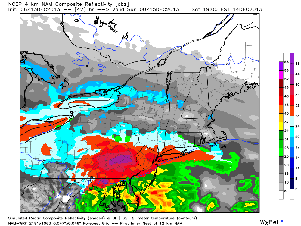
4km NAM simulated radar, showing a period of heavy snow throughout the area on Saturday before a transition to freezing rain and rain.