VIDEO Analysis: Interior Northeast Ice Possible Saturday, Snow Possible Next Week

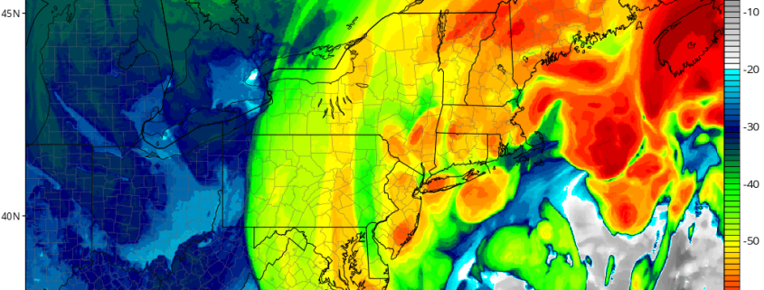
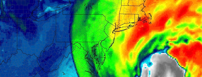
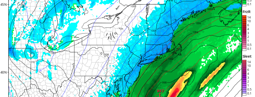
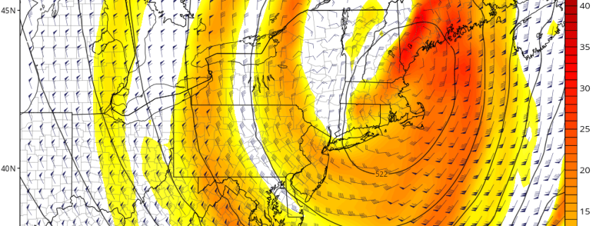
Good evening! Our latest video analysis details the large rainstorm that will be occurring from Thursday night into Friday morning, while also discussing the validity to the colder trends with this storm on Friday night and Saturday. Progressive trends aloft combined with a large Arctic dome of high pressure will lead to a lot of low-level cold advecting into the area — particularly inland — on Saturday morning, making freezing rain and sleet a possibility. The quick drop in temperature may also lead to a flash-freeze scenario.

We also discuss the potential for a snow event next week, as a large ridge will be amplifying out West with a potent Arctic shortwave amplifying downstream. These patterns often portend significant snowstorms, but there are still a few features aloft that may lead to the storm developing too late for bigger impacts — but if those features get cleaned up, the potential for snow would increase significantly.

Video Analysis: Trends and Intricacies of Upcoming Powerful Winter Storm

Good evening! It has become apparent now that a large and powerful storm system is on the way for late Wednesday night and Thursday, but this forecast is more complicated than usual. With the storm growing powerful so quickly, at a far south latitude and with a plethora of convection, we will be in uncharted territory as far as forecasting goes – in other words, common meteorology assumptions will need to be more closely analyzed and thought through.

Our latest video analyzes all of the intricacies regarding this storm, including the multiple pieces of energy involved, how a more powerful southern stream wave can change the entire forecast, how a further west track does not necessarily mean heavier snow for the area, yet a few small westward ticks could mean parts of the area receives a major blizzard. The trends in the modeling regarding the strength and interaction of these pieces of energy is also quite fascinating to watch unfold, and it’s why the GFS model made a rapid shift towards a snowier solution.

Any solution from a minor graze to a significant to major snowstorm is still very much on the table, and while a moderate “blend” may be the way to go with the forecast, it is very important to communicate all of the possibilities and how because of these complex intricacies, it’s harder to communicate them than usual.

Powerful ocean storm likely this week, impacts remain uncertain

Good afternoon! Forecast models have been honing in on the development of a major coastal storm during the week ahead for several days now, and over the past few days in particular have gotten more intense in regards to its formation. A myriad of factors will lead to a heightened chance of rapid strengthening as the storm emerges from the Bahamas and tracks northward off the US East Coast. But the track of the system, and its resulting impacts, remain highly uncertain.

As is the case with a large majority of storms that develop off the East Coast, the system’s development is the result of very intricate interactions in all levels of the atmosphere. In this case, two distinct disturbances – one emanating from the Pacific Ocean and the other meandering over the Plains and eventually Southern United States – will interact in the Southeast States. The result of the interaction will aid in the development of the mentioned low pressure system, but exactly how and when it occurs will determine where the storm tracks and how intense it becomes.

Read more

First snowfall of the season for the Northeast this weekend

About two weeks ago, it became clear that the weather pattern was set to undergo a significant shift. After many weeks of warmth, a reshuffle was underway in the Pacific Ocean, and the downstream effects of this would lead to colder air with a more wintry pattern in the North-Central and Northeast United States. Two weeks and many forecasts later, here we are. The first snowfall of the winter is set to fall in the Northeast states this weekend, including the metropolitan areas of Philadelphia, New York City, Hartford and Boston.

Forecast models, for all of their benefits, were not keen to signal the potential for snow this weekend until about 24 hours ago. Forecasters had been monitoring this potential quite closely, but a snowfall of any significance always seemed like a long shot in the Northeast States. On Thursday morning, however, it became clear that a significant trend was underway, and forecast model guidance quickly began changing the evolution of the storm system during the weekend ahead.

Read more