-2")
PM Update: Increasing clouds, becoming milder
Low clouds and fog were the main story early on Monday morning, with plenty of areas reporting low visibility. The cloudiness also kept temperatures a bit cooler to start. But by Monday afternoon, the low clouds had lifted and most areas were reporting sunshine. Temperatures warmed into the upper 40’s to near 50, which felt especially refreshing after several days of cold weather. The warmth will continue to slowly build this week.
However, with the building warmth will come a variable increase in cloudiness. With a weak storm system offshore, low clouds will increase again early from late Monday night into early Tuesday morning, with the potential for fog in the morning once again. Temperatures are expected to top out in the 50’s — but not until the late afternoon when the clouds burn off a bit.
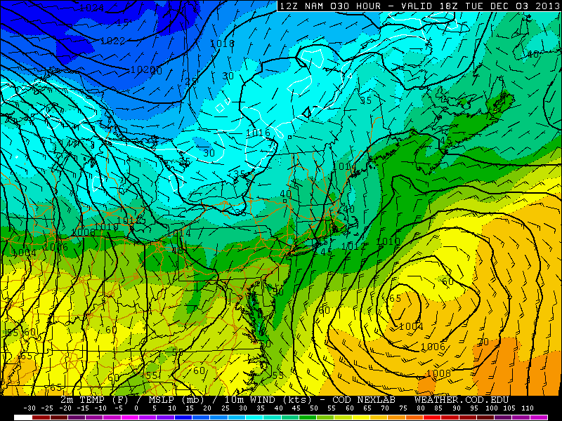
NAM model showing high temperatures reaching near 50 degrees on Tuesday afternoon, with a storm system offshore.