-2")
Forecast: New week starts cool, ends warm
The new work week began with another in a series of colder than normal mornings, as low temperatures fell into the upper 20s and lower 30s across much of the interior on Monday morning. The city and urban areas remained a bit warmer, although still chilly, with lows dropping near 40 degrees. Monday will turn out to be a pleasant autumn day, as temperatures warm into the upper 50’s to lower 60’s by afternoon. A light southwest breeze will make it feel plenty comfortable, and less chilly than the past several days which featured windier and cooler conditions.
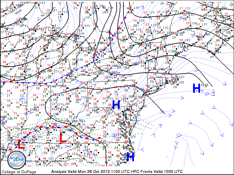
Northeast US Surface Analysis and observations from the morning of October 28, 2013 showing high pressure in control and a cold front approaching.
A cold front dropping southward through New England, however, will provide a reinforcing shot of cooler air by later Monday. Associated with a disturbance over Southeast Canada, the front isn’t expected to feature any precipitation. The wind shift, however, will be noticeable. By Tuesday, winds will have swung around once again behind the front, and will be blowing out of the north. High temperatures will once again struggle into the lower to middle 50’s — making Monday seem like a much warmer day in comparison.