Afternoon Roundup: Lingering showers, but dry air is on the way

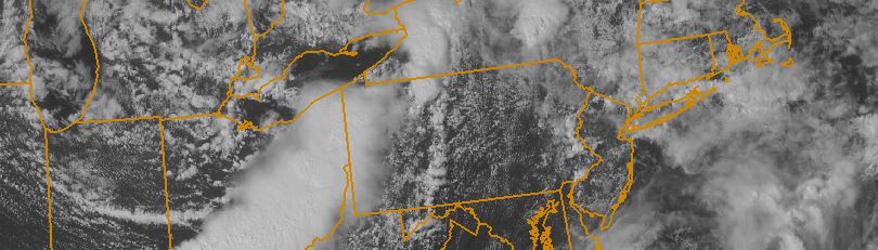
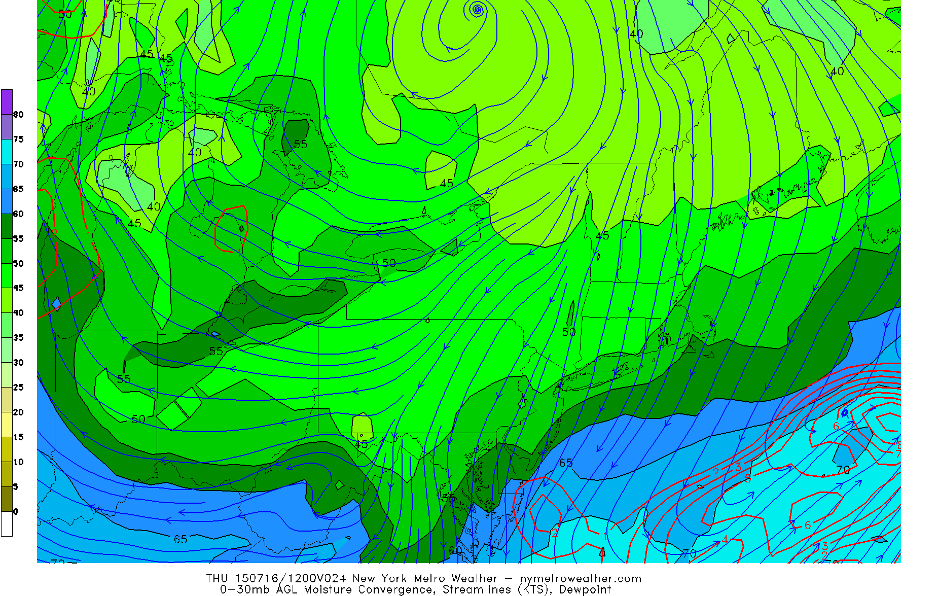
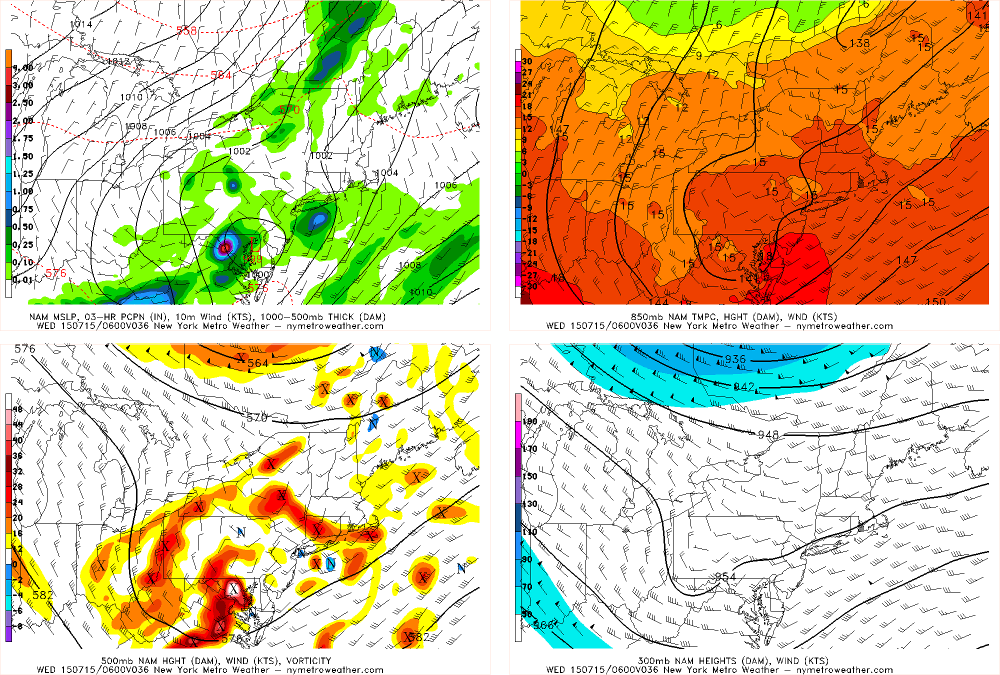
While not everyone in our area received heavy rain today, a decent chunk of our area did — some significantly so. A warm front and associated low pressure system brought plenty of lift and moisture, while an approaching cold front added to the lift and shifted our wind direction. This shift in wind direction from onshore to offshore allowed for coastal areas to have more instability. This allowed a thunderstorm with loud thunder and extremely heavy rain to form right near NYC and slide south into Brooklyn, where 2-3″ of rain per hour fell at times. Elsewhere, scattered showers fell — some heavy at times — but not nearly to the extent of this cell. Central New Jersey had more consistently steady rain over a long period of time, but not the same true heavy downpours. Extremely slow mid-level winds on the periphery of a ridge is why these storms were moving so slowly, and thus were able to sit in one spot and drop a lot of rain.

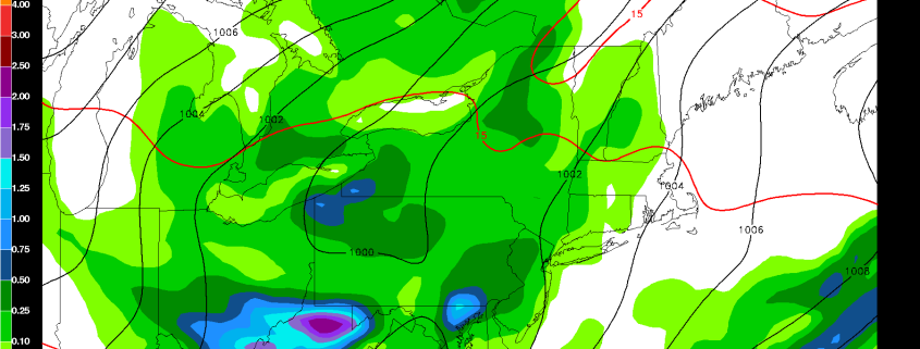
Over the next few hours, scattered showers and thunderstorms are still possible, with locally heavy rain possible. They will not be as dense in coverage as they were in the late-morning hours, however. The approaching cold front has allowed some dry air to infiltrate the atmosphere and the low pressure system actually somewhat stabilized the atmosphere after its initial downpours a few hours ago.

General weather highlights include:

  • Cold front will be crossing the area early this evening. Thus, the rain threat looks to end by around 7:00pm, and skies will gradually clear. Much drier air is in its wake — a true, Canadian dry airmass.
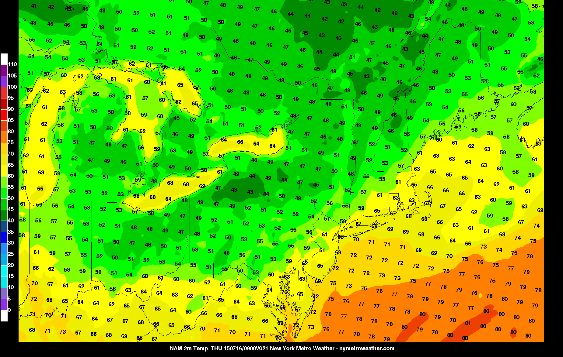
  • Winds will remain northerly and increase tonight. This will not only allow for dry air, but for much cooler air as well. Lows should drop into the mid 60s in NYC, but could fall a few degrees cooler than that in suburbs.
  • Thursday will be beautiful: sunny skies with highs in the upper 70s to around 80. Dewpoints will only be around 50, thanks to the aforementioned airmass, keeping conditions extremely comfortable. Northerly flow should also halter seabreezes as well, making it a nice beach day.
  • Thursday night may be even cooler than tonight in the suburbs, due to radiational cooling with the dry airmass and diminishing winds. Widespread upper 50s for lows are possible in suburbs. Areas closer to NYC will probably stay in the mid 60s, however.
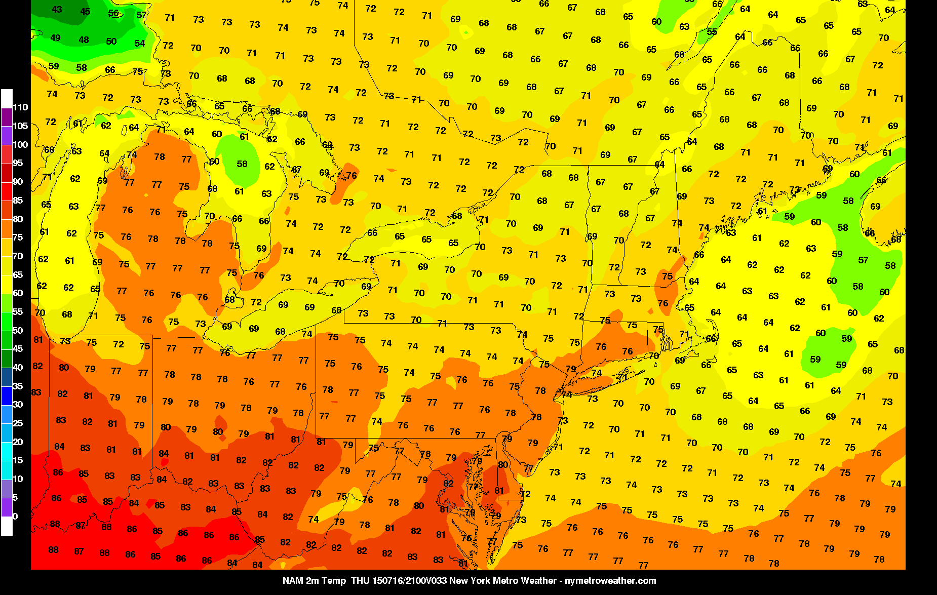
  • Friday will be another lovely day, with temperatures slightly warmer than on Thursday — probably the low 80s.
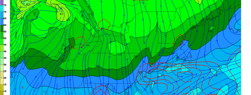
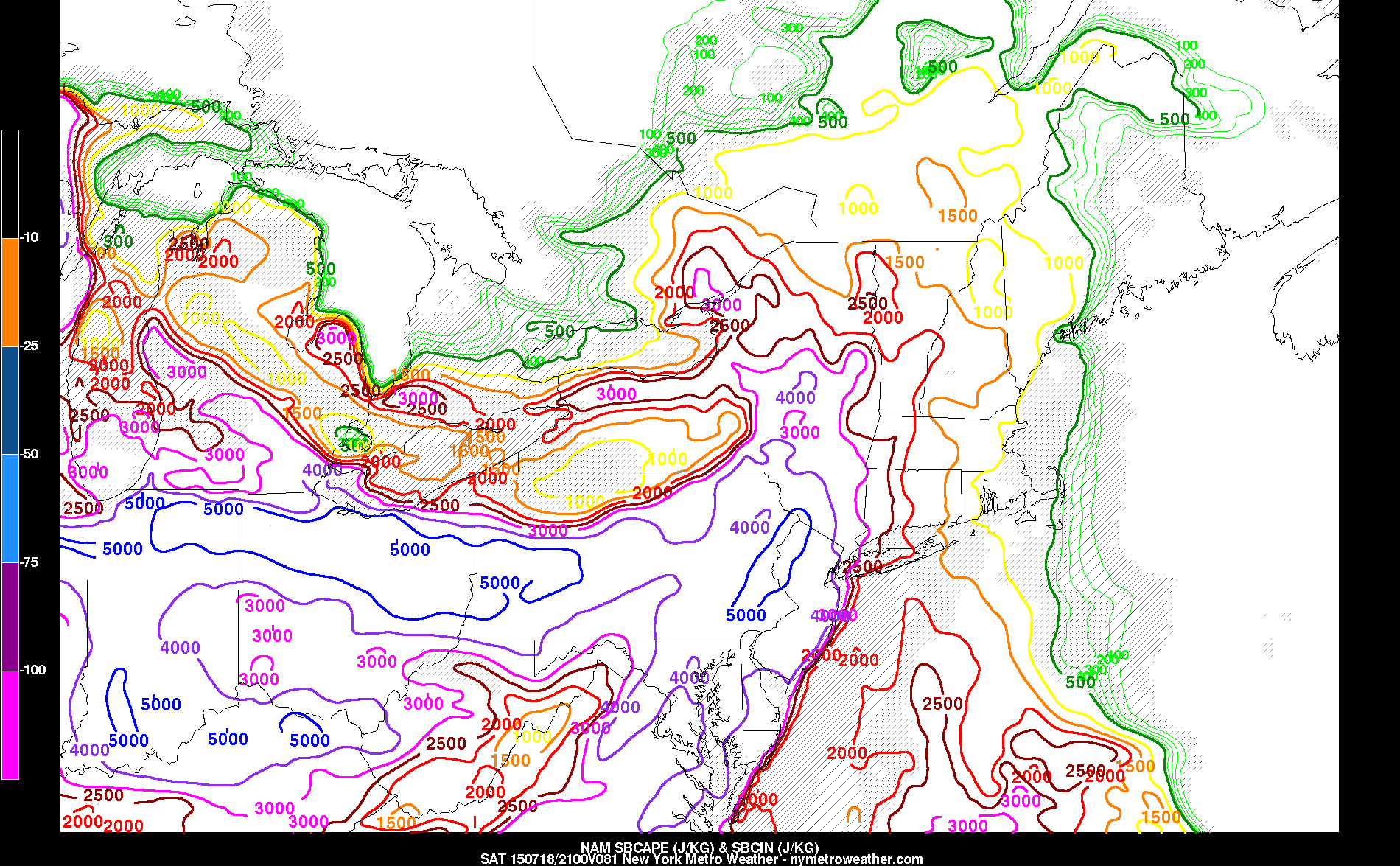
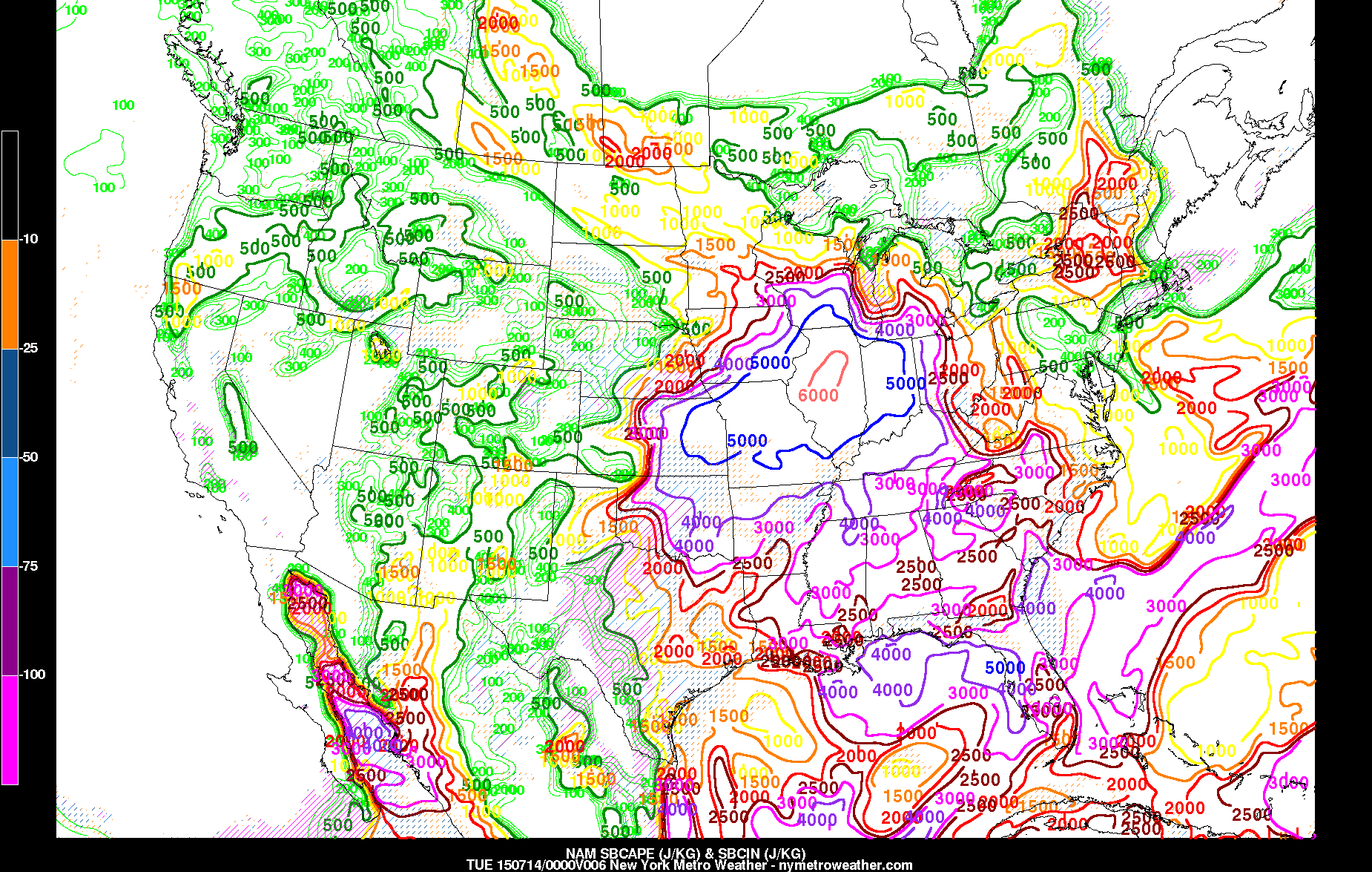
  • Although it is early, the idea of a severe weather event is starting to gain traction for Saturday. The high pressure will be departing, as a shortwave trough moves in, providing lift, while an airmass highly supportive of severe weather will be moving in from the southwest. The NAM is forecasting CAPE values off the charts. It is still way too early to say anything definitive; though if this threat still holds traction, a more detailed article will be published tomorrow or Thursday.

Evening roundup: Unsettled, humid airmass settles in

Humidity is on the rise today, and the increased atmospheric moisture content led to the development of showers and storms throughout the area this afternoon. This will be the story of the next few days, as atmospheric disturbances provide sufficient lift for the development of precipitation within a moist and moderately unstable environment. While no organized severe weather is anticipated, the moisture in the atmosphere and the lift for precipitation will be enough to trigger showers and thunderstorms capable of producing heavy downpours and lightning with localized flooding. As a mid level atmospheric trough deepens over the Northeast US mid-week, a weak coastal storm system will develop and result in an increase in the coverage and intensity of showers and storms. All of the news isn’t bad, however — the system departs by late week and the weekend looks to again by quite pleasant and warm. Some highlights from around the meteorological community are included below:

  • Showers and thunderstorms will remain possible through this evening, with a localized threat for flooding. Lightning and heavy rain will also be possible in any thunderstorms. Temperatures will remain warm overnight, with humidity remaining high as well.
  • These showers and storms may continue through Wednesday, as a low pressure area develops nearby. Increased atmospheric lifting is indicated on most operational guidance, suggesting the potential for a period of steady precipitation on Wednesday.
  • Tonight, NASA’s New Horizons spacecraft will send a signal back to earth — signifying whether it made its trip past Pluto safely. It will also send new, high resolution of the planet like we have never seen before.


Today is, without a doubt, Pluto day

For most of us on Earth, this will be our last chance to see a new planet for the first time up close and personal. Today, NASA’s New Horizons spacecraft will finally make its pass nearest to Pluto, the much debated and no longer official planet. New Horizons has spent the past 9 years in space, traveling over 3 billion miles and passing most “landmark” planets in our solar system along the way. On July 14th, 2015, it will finally reach Pluto. No spacecraft, satellite, or high resolution imagery has come even remotely close to what New Horizons will provide us with in terms of detail regarding Pluto.

Already, New Horizons is allowing NASA’s team to make some incredible discoveries and bring forth some new information. While Pluto’s size has been debated for many years, we now have a very firm estimate on the size of Pluto. NASA’s team of specialists calculated a diameter of 1,473 miles. This is slightly larger than previous estimates. Perhaps even more exciting is the prospect of high resolution imagery which New Horizons will capture.

Read more

Afternoon Roundup: Unsettled weather arrives

Today turned out to be another lovely day, with temperatures in the low to mid 80s, mostly sunny skies, and low humidity. However, the increase of thin, high clouds can often portend unsettled weather, as high and thin clouds tend to streak out ahead of storm systems.

High pressure which dominated this weekend is slowly moving offshore, and when combined with the rigorous disturbance that is producing severe weather in the Midwest, our winds will be turning towards the southeast — an onshore component — if they have not already. As this onshore flow continues to become more established, clouds and moisture will be on the increase tonight. Any showers, however, should hold off tonight or be very light and and isolated due to the best forcing to trigger lift and precipitation remaining to our west.

This disturbance finally will approach our area as the day goes on Tuesday. This will lead to mostly cloudy skies, more humid conditions, and the chance of an afternoon shower or thunderstorm. These storms will remain well below severe level, due to the greatest energy being far removed from our area, as well as the onshore flow limiting our instability.

General weather highlights include:

  • Increasing clouds tonight with overnight temperatures generally remaining in the upper 60s to low 70s. Any precipitation will most likely hold off.
  • Mostly cloudy skies tomorrow, but the morning and early-afternoon should remain dry. As the trough and associated disturbance finally moves closer to our area, the chance for rain and thunderstorms increases during the late-afternoon and particularly the evening hours. High temperatures will be in the low 80s, but it will feel noticeably more humid than it was today.
  • A warm front will be approaching late Tuesday night and early Wednesday morning, from the south. Along this warm front, a secondary area of low pressure from the initial system in the Midwest will be developing just to our south. This will cause more lift in the atmosphere, and when combined with the already moist airmass, could lead to showers and thunderstorms with locally heavy downpours and some loud thunder. The atmosphere will not be supporting severe thunderstorms with strong wind gusts, as the mid-level flow looks quite weak.
  • Wednesday looks quite unsettled, as this wave of low pressure will be causing showers and thunderstorms throughout the day.
  • Much more pleasant weather with low humidity returns on Thursday and Friday

Something relatively rare in the meteorology community today: Surface-based CAPE values look to exceed 6,000 J/KG just southwest of Chicago. This is an extreme amount of energy and instability, which will be supportive of thunderstorms producing very large hail — perhaps some 2-3″ in diameter, 70mph wind gusts, and a few tornadoes.