Friday Overview: Unsettled Weather Continues…Watching Hurricane Matthew

A large cut-off low over the Ohio Valley continues to cause some unsettled, cooler weather over the region. So far high pressure positioned to the northeast, has keep heavier rainfall over southwest of NYC metro. But with a strengthening low-level easterly jet, more band rains are likely to move in from the ocean later today. Some of this rain, may be heavy at times. Which could lead to some ponding of water on area roadways and some flooding in poor-drainage and low-lying areas.

Read more

Monday Evening Roundup: Cool AM Lows…Showers Likely Late Tonight

This morning started off chilly in many areas just outside of NYC with temperatures getting into 40s and lower 50s in many suburbs. While no record lows were set, some places down into the middle to upper 30s, which is around 10 degrees or so below normal for this time of year.  These are some morning low temperatures at these select sites around the region:

Westhampton, NY: 35

Port Jervis, NY: 35

Montgomery, NY: 37

Morristown, NJ: 37

Danbury, CT: 35

Temperatures rose back into the upper 60s to lower 70s with more sunshine this afternoon. Now clouds are on the increase this evening, as a frontal system begins approaching the region. Some showers are likely over much of the region late tonight into tomorrow morning with the cold front passing through the region. Some heavy downpours and isolated thunderstorms are possible with abundant moisture and some elevated instability. Additionally, a potent upper-level jet streak will pass to our north, placing us in the right-entrance region, which will further serve to enhance precipitation. This could lead to some ponding of water on area roadways. However, showers and any thunderstorms will be moving quickly over the area, so heavy rainfall totals over 1.00″ and localized flash flooding are unlikely.

This afternoon's GFS valid for Tuesday morning shows showers and embedded heavy downpours. A strong jet streak passing by helps to enhance the lift in our atmosphere.

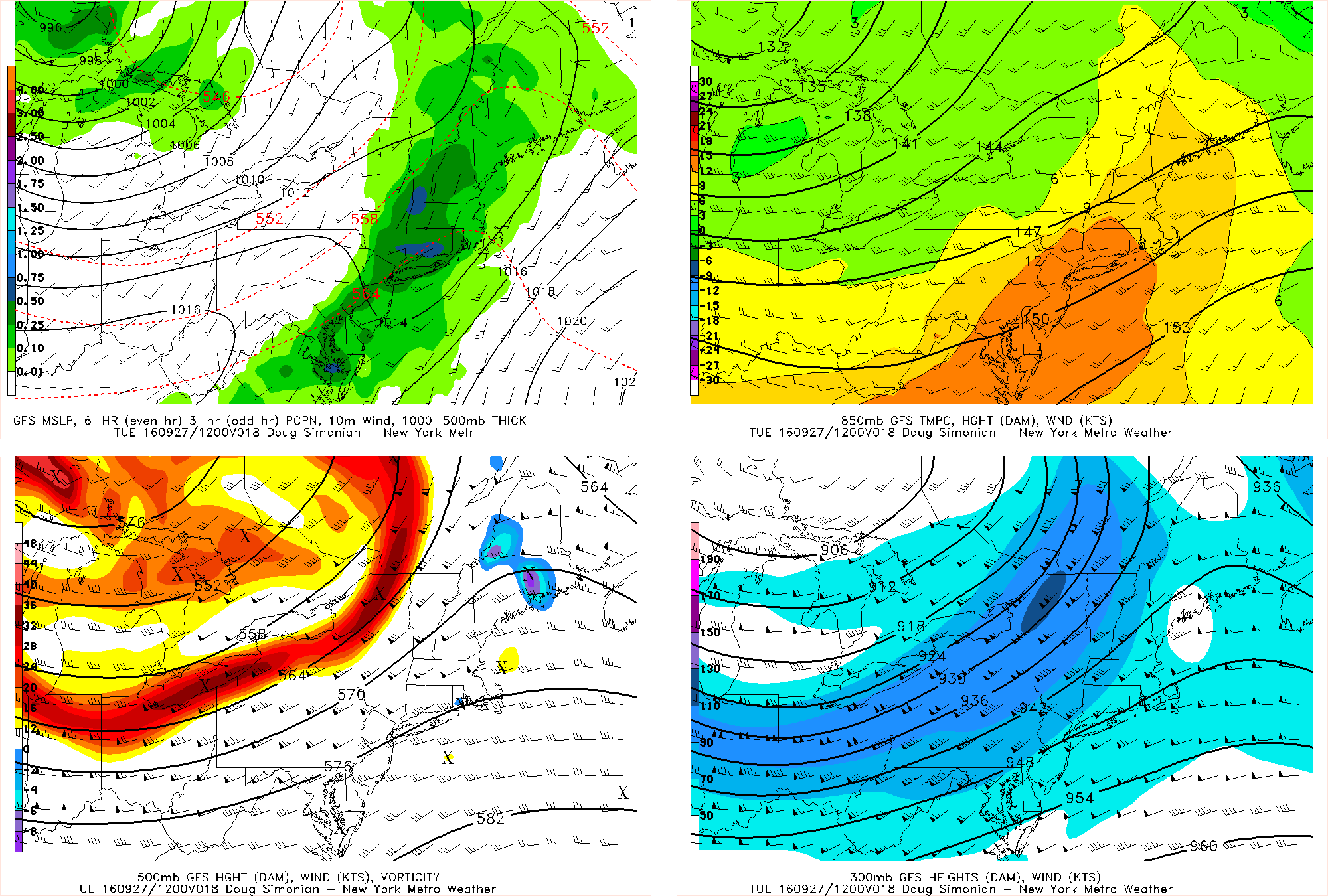
This afternoon’s GFS valid for Tuesday morning shows showers and embedded heavy downpours. A strong jet streak passing by helps to enhance the lift in our atmosphere.

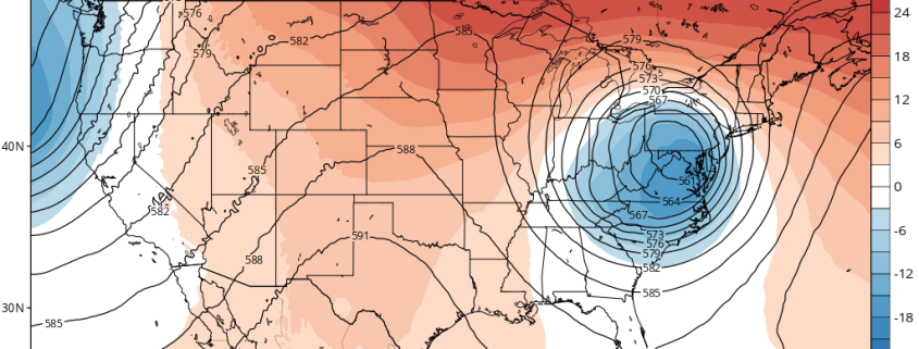
Right now it looks like the early-morning commute will be wet, but the mid-morning should primarily be dry, except over far eastern areas. Skies should clear tomorrow afternoon as the cold front passes through the region. Sunshine breaking out later in the day  should help temperatures rise back into the lower 70s. Dry weather will continue into Tuesday night. Then more unsettled weather, with some rainfall, is possible with the cut-off low lingering over the region. But it won’t necessarily be complete washout later this week, though heavy rain is possible at times. Rainfall is needed as much of the region is in a moderate or severe drought.  More forecast and technical details were discussed in our weekly outlook article and main dashboard for clients and premium members this morning.

For more forecast details on the rains later in the week, including weekly and long-range outlooks and video discussion, sign up to become a Premium member tonight!


Premium Weekly Outlook: A cut-off low brings unsettled weather and rainfall

So far this month, while there have been cool shots, we’ve seen warmer than normal temperatures dominate for a longer period. It has also been quite dry. But more seasonable temperatures and unsettled weather is looking likely for this weekly period overall. So much-needed rainfall may also be on the way, especially for Long Island which is currently under a severe drought.

Today has gotten of to a chilly start with temperatures in the 40s over most of the region. Some interior locations and the Pine Barrens dropped down into the middle to upper 30s with some pockets of frost. Sunshine will dominate much of the day and it will be pleasant Autumn afternoon overall. But some clouds will begin increasing later this afternoon, as a frontal boundary associated with a closed upper-level over Great Lakes begins approaching the region. Temperatures will still reach the upper 60s to lower 70s across most of the region.

Read more

Strong cold front will bring Autumn air to Northeast

A strong cold frontal boundary, currently situated across New York State and New England, will drop southward through the Northeast states Friday evening and early Saturday morning. While a north to south moving cold front may seem somewhat uneventful this time of year, the temperature gradient associated with this particular front is quite impressive.

Moreover, the airmass behind it is quite cold — even for this time of year — with temperatures 10 degrees below average or more, even in parts of New England where seasonal averages are rapidly falling now. The mid to upper 80 degree temperatures located ahead of the front will become a distant memory throughout most of the region by Saturday, when highs will struggle to reach the low 70s, and may not reach 70 in northern suburbs. A northerly breeze will help it feel truly like Autumn.

Read more