Thursday Overview: Warmth until Friday, then cooler this weekend

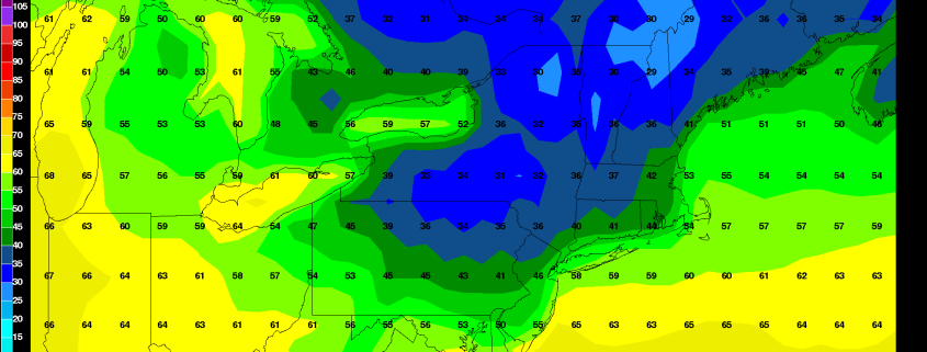
After a very wet start, the weather has improved this week. It been several degrees warmer than normal and that should continue today with temperatures in the lower to middle 80s, for much of the area. Closer to the shore, sea-breezes will keep temperatures a little cooler this afternoon, perhaps in the 70s. Mostly clear skies and light winds will lead to more radiational cooling tonight. There will likely be a large range in low temperatures from the lower 60s over NYC metro to some upper 40s for the interior valleys and Pine barrens.

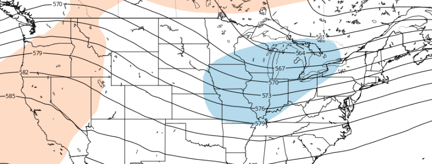
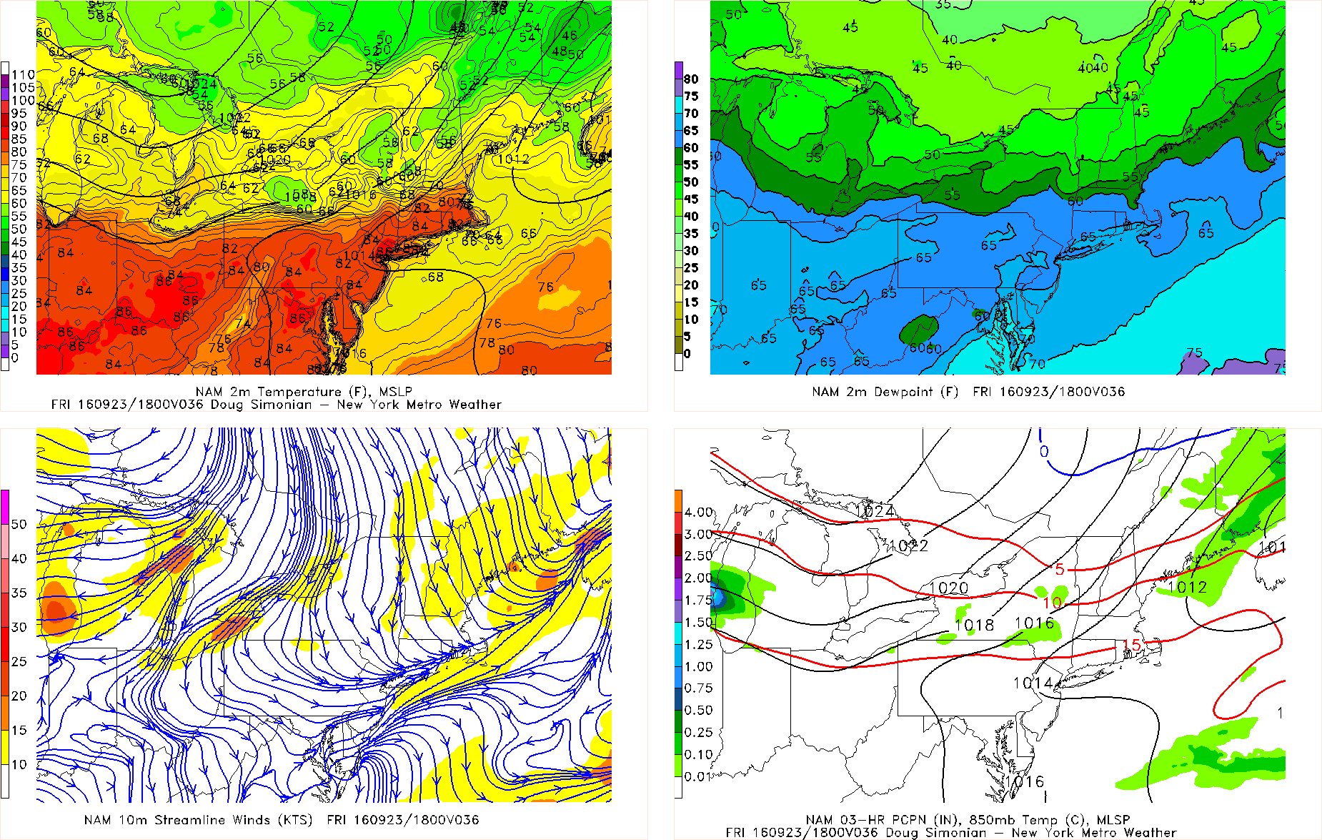
Friday will be warmer in the middle to upper 80s with more west-downslope winds, for most of the region. Some scattered showers and thunderstorms are possible ahead of a strong cold front coming through Friday night. Instability and moisture will limited, no organized severe weather or widespread heavy rainfall is currently anticipated. But behind this front, will be a much cooler, drier airmass with more seasonable temperatures and fair weather. Here are some highlights for this upcoming weekend:

Read more

Premium Weekly Outlook: Monday downpours, then drier weather returns, but a cooler weekend?

A shortwave trough and frontal boundary has move slower into region than previous expected. This has lead to drier conditions through the overnight hours Sunday. But more showers and some steadier bands of rainfall are now over much of the region this morning. Stronger forcing underneath of right-entrance of jet streak and low-level convergence along frontal boundary has increased, along with tropical moisture from the remnants of Julia off the Southeast coast, surge northward along the coast.  Some instability with a deep southwesterly flow is also aiding in development of some thunderstorms scattered or embedded within steadier bands of rainfall over region.

With marginal instability and abundant moisture, the main threat continues to be for torrential downpours with localized flash flooding, especially during the morning and early afternoon hours. Much of the area will likely receive near or 1.00” of rainfall. However, some showers and thunderstorms could train along and axis of unidirectional shear, convergence, and precipatable water values near over 2.00”, along or just ahead of the frontal boundary today. Areas at greatest risk for flooding will over poor drainage and low-lying areas. Some ponding on area roadways, especially likely as well. Significant flooding from rivers and streams isn’t anticipated due to drier conditions over the last few weeks.

Read more

Tropical downpours likely in Northeast US this weekend

Other than a few scattered passing thunderstorms on Wednesday, much of the Northeast US has been devoid of rain over the past several weeks. This is about to change, perhaps dramatically so in some spots. On Sunday, a cold front and associated potent shortwave trough with plenty of vorticity will run into a well established Southeast Ridge, and the remnants of Tropical Storm Julia — two great moisture sources. This combination of energy, dynamics, and moisture — as well as the fact that the ridge and the mid-level flow are parallel to the frontal boundary — will lead to the potential for slow-moving tropical downpours, some of which will train over each other and lead to flash flooding.

As we move towards Autumn, atmospheric troughs can deepen and amplify more than during the warmer summer season. This, combined with tropical moisture and dynamics can lead to impressive meteorological results. This particular shortwave trough is digging from the Great Lakes all the way down to the Tennessee Valley, and is even tilting neutrally or negatively on some guidance. This acts to slow down the atmospheric flow even more, leading to a prolonged fetch of moisture, lift, convergence, and thus heavy downpours.

Read more

Long Range: Cooler, active pattern ahead for Central US

Far away from the United States, in the equatorial Pacific, a propagating MJO has some ideas as to how the weather pattern will evolve through early October. Okay, maybe that’s not exactly how it works. But the development of an MJO wave will, in fact, aid in the patterns progression over the United States through the end of September. The instra-seasonal traveling pattern of convection more affectionately known as the MJO (Madden Julian Oscillation) has significant impacts on our weather, and this occurrence will be no different. You can read more about the MJO right here.

While the MJO has been stuck in a period of inactivity over the past several weeks, the overall hemispheric pattern has fallen into a bit of a lull. Wash, rinse, repeat has been the overall terminology used. Occasional cold fronts and troughs have brought periods of below normal air to the Central United States while, by and large, the East Coast has remained at the mercy of a large Southeast US and Western Atlantic ridge.

Read more