Hermine strengthens, tropical storm watches for NJ Shore

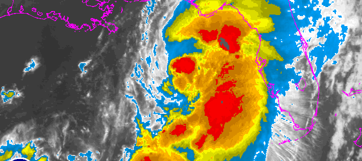
Hurricane Hermine strengthened in the Gulf of Mexico this evening, and continues to strengthen as it approaches the Florida Panhandle. Impressive satellite and radar imagery showed bursts of convection around the developing eye-wall of the storm, moving northeastward. Hermine is expected to make landfall along the Florida Panhandle before moving northeastward into the Southeast US.

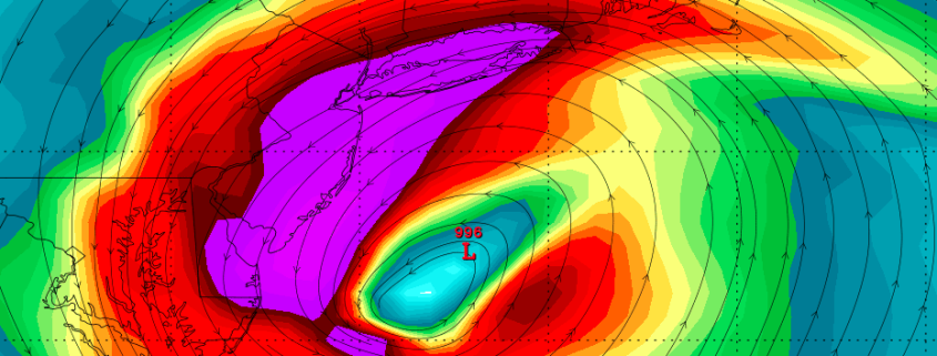
After a short period of time in the Southeast United States, Hermine is expected to move northeastward and eventually re-emerge off the Mid Atlantic coast this weekend. Forecast models are in good agreement that the storm will track off the Mid Atlantic coast while interacting with a disturbance dropping southward over the Ohio Valley, which will eventually phase with Hurricane Hermine and tug the storm back westward toward the East Coast late this weekend.

Read more

Thursday Overview: Watching Hermine for Labor Day Weekend

A wave of tropical moisture surging ahead of a cold front approaching the region, has led to periods of rain this morning. This is now beginning to taper off from west to east across the region. Clouds could break for some sunshine this afternoon. But there is still a chance of some isolated showers and thunderstorm popping up until the cold front moves through region late this afternoon. Temperatures will likely reach the upper 70s to lower 80s with enough sunshine this afternoon. Then tonight, skies will clear with high pressure building over the region. Friday will be mostly sunny with temperatures rising into upper 70s to lower 80s. Dry conditions will likely continue into Friday night. Then attention turns to Tropical Storm Hermine which is currently strengthening in the Gulf of Mexico and is forecast to make landfall as a minimal hurricane over the Florida panhandle late tonight.

Much of the latest model guidance overnight has shifted further south and east with what remains of Hermine, reducing some impacts from heavy rain and high winds in parts of the area. However, models have not been too consistent with the track of this storm near our region, over the last few days. One of these models (the GFS) has also shifted west again during its early morning run, with heavy rainfall and strong winds for the New Jersey coast. The mid-morning and early-afternoon model runs have also shifted back northwest, bringing significant impacts back to the region. If Hermine tracks closer to region, the mostly likely time frame for significant impacts, appears to be on Saturday night and Sunday. .

Read more