Premium: Winter weather impacts in Northeast US this week

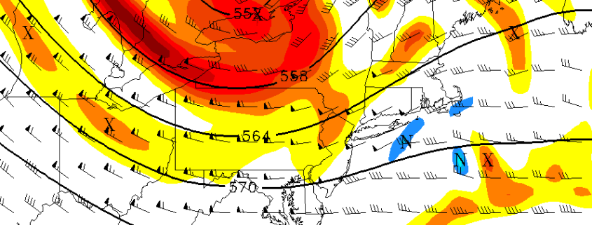
A dynamic storm system is expected to track through the Northeast United States later this week, bringing with it the opportunity for some frozen precipitation, particularly on the front end as the storm develops. This will be especially true in the interior and higher elevations, before warm air changes precipitation over to rain. Nearer to the coast, mostly rain is expected, although a brief burst of frozen precipitation isn’t out of the question in the suburbs and higher elevations there as well.

The storm system will be operating and gaining steam from “warm air advection” in the mid levels of the atmosphere. Moisture surging toward the Northeast US on Thursday will provide increasing lift for precipitation as warm air moves into the atmospheres mid levels. The atmosphere will quickly become too warm for frozen precipitation near the coast, but colder air will hang on a bit longer in the interior. This will lead to a complicated forecast.

Read more

Premium: Inland freeze tonight, incoming storm Thursday

High pressure from Canada will allow cold air to surge into the area over the next few days, an airmass will be characterized as unusually cold even for late October. After mostly sunny skies this morning, some atmospheric instability with daytime heating and moisture aloft will lead to more clouds mixing in with sunshine this afternoon. High temperatures throughout the NYC Metro Area and the Northern Mid Atlantic will reach into the middle 50’s, with continually breezy conditions thanks to a tight pressure gradient with a low pressure over the Canadian Maritimes.

Skies will clear during the evening hours tonight, and winds will become lighter overnight as instability diminishes with the loss of daytime heating, all as very cold air seeps into the area from the northwest. This will support very cold temperatures overnight and by daybreak on Wednesday, temperatures will have dropped into the middle and upper 30s over NYC and other urban and coastal areas. Many of the suburbs will drop into the lower to middle 30s, with some middle to upper 20s possible over parts of over the interior and higher elevations. This could lead to a freeze with some patchy frost in those areas that have not experienced frost or freeze yet this cold season. Therefore, the National Weather Service has issued Freeze Warnings for many of the inland suburbs tonight and even Frost Advisories for urban areas around Philadelphia.

Read more

Seasons coldest air to infiltrate the Northeast this week

The coldest air of Autumn 2016 to date will surge into the Northeast United States this week, as a deepening trough passes through the Great Lakes and Southeast Canada. After an initial surge of cold air earlier this weekend, secondary surges on the heels of multiple disturbances will arrive this week, and by midweek overnight low temperatures could reach 15 to 20 degrees below normal in some locations.

The airmass will settle in from Tuesday through Thursday before the approach of another storm system. Overnight lows on both nights will be very cold in the Northeast, especially in the interior. For agricultural interests, Freeze Watches have been issued as early as Tuesday Night– as a hard freeze may occur in some locations that have not experienced it yet this year.

Read more

The stratosphere, blocking, and a hemispheric pattern change

What exactly could a ridge in the Kara Sea, the remnants of Hurricane Nicole, and a circulation in the stratosphere all have in common? They’ll all have significant impacts on a changing weather pattern in the Northern Hemisphere over the next two weeks. Meteorology is a fickle, uncertain, and highly detailed process in almost every regard. But every once and a while, the fluid process that runs through our planets entire atmosphere can give us a show — where multiple processes come together, and they can be easily visualized and understood.

What’s occurring over the next 7 days is, by and large, a hemispheric pattern change. The progressive pattern across the United States, which has been dominated by a Pacific Jet and relatively uneventful disturbances, will undoubtedly shift. Changing wavelengths are likely to make the pattern changes effects even more dramatic. But the most interesting aspect is where, when and why these changes are occurring.

Read more