-2")
Matthew’s shifting track spares Northeast, targets Florida
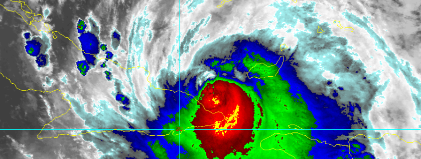
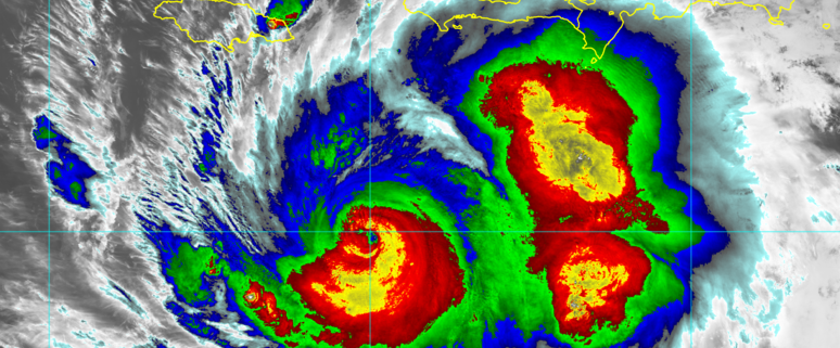
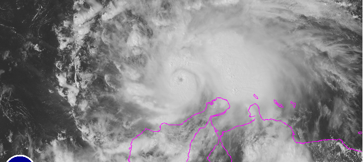
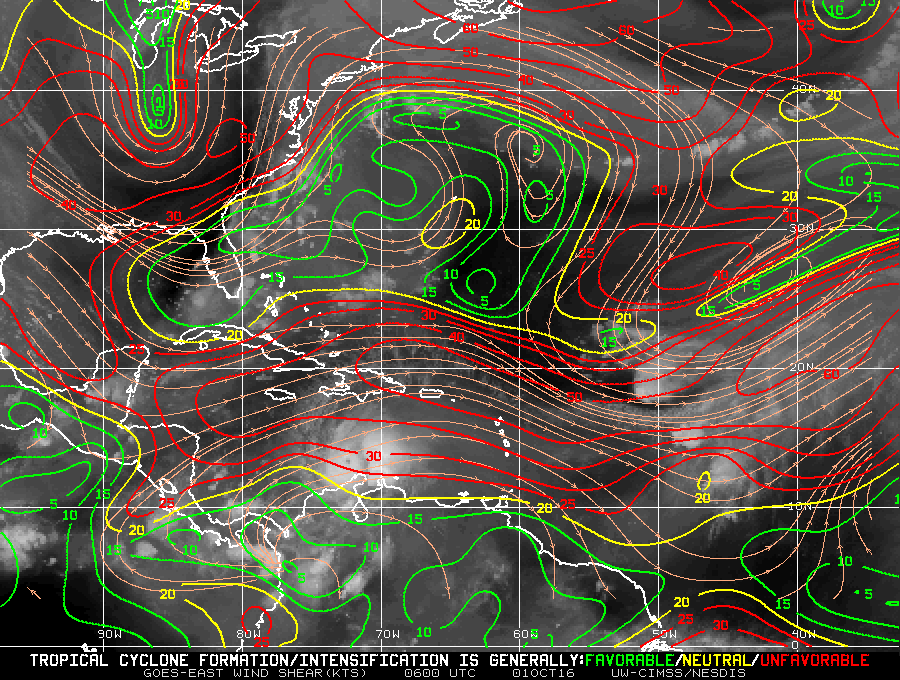
Hurricane Matthew is tracking northwest of Cuba today, strengthening and re-organizing after land interaction as it moves into the Bahamas. Extremely warm water and favorable to near-ideal upper level atmospheric conditions will support re-strengthening of the storm on its trek northwestward over the next few days. This is troubling for many reasons, but none more than the fact that while the storm strengthens, a large ridge will build to its east over the Western Atlantic. This will essentially block any eastward component to Matthews movement, instead insuring west-northwestward movement toward the Bahamas and Florida late this week.
Forecast models, in fact, have come into better agreement on the exact track of Matthew over the next 48-60 hours or so. As the storm strengthens, with favorable sea surface temperature and depth as well as favorable mid and upper level jet positioning for ventilation, it will move toward the Southeast Florida coast. The mid level ridge to the east of Matthew will guide the storm on a northwest heading, eventually with a more northward turn, near the coast of Florida.