1/16 AM All Zones Update: Tranquil Weather Today, Wetter Tuesday

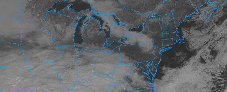
Tranquil weather continues today, as high pressure shifts east and then off Mid-Atlantic coast by late this afternoon. Plenty of sunshine is expected, with just some high cirrus arriving from the southwest, by this afternoon. After cold start early this morning, a light return southwesterly flow and rising mid-level heights will likely help warm into lower to middle 40s over much of the region this afternoon. Perhaps closer to 40 over the Interior.

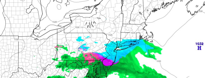
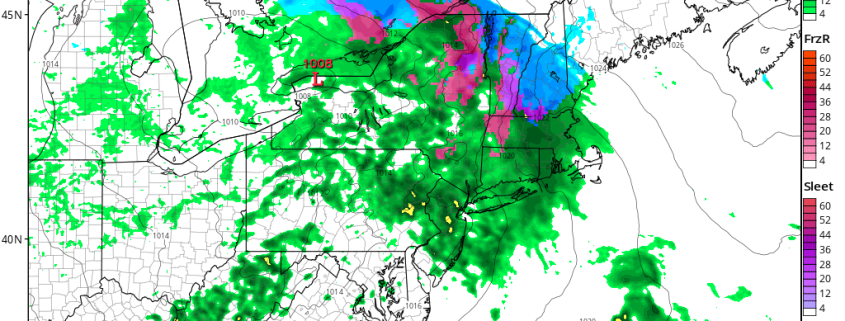
Then a storm system with a primary low tracking northwest of the region, may begin affecting the region late tonight. Clouds will thicken and increase, ahead of warm front approaching the southwest this evening. Some light precipitation cold breakout some after midnight, or early tomorrow morning. Depending on how fast precipitation arrives, there could be some light snow, sleet or freezing rain at the start, especially over Northern New Jersey, Lower Hudson Valley zones. For the rest of zones, low-level temperatures will likely be warm enough for mostly if not all rain, with southerly winds. The airmass will gradually warm later Tuesday, so any wintry mix change over to rain by late morning or early afternoon, over most of the zones.

Read more

1/15 All Zone Update: High pressure in control for now

On the heels of a weak disturbance Saturday, high pressure has built back into the region today. This high pressure will be the dominant force in the weather pattern throughout the Northeast US over the next few days as a thermal gradient, responsible for enhancing yesterdays low pressure area, sinks southward into the Middle Atlantic. Temperatures will fall colder as this cold high pressure builds overhead.

Sky conditions, however, will remain quite pleasant — with plenty of sunshine and the weather remaining mostly calm. This pattern will remain through Monday as temperatures are expected to gradually moderate. Another storm system will gradually develop well to our west over the Central United States, and while it will remain far from our area to begin with, southerly winds will begin bringing warmer air northward through the Mid Atlantic and Northeast once again.

Read more

1/14 All Zones Short Term Update: Periods of snow today

A developing low pressure system to the south and southeast of the area, along a temperature gradient in the Mid Atlantic states, will continue to develop later this afternoon and into the early part of this evening. Enough lift exists for the development of precipitation throughout the area, particularly in parts of East/Southeast PA and New Jersey.

Snow is having some trouble reaching the ground currently, thanks to dry air in the middle and lower levels of the atmosphere. Radar is depicting a large amount of virga – or evaporating precipitation – throughout Northern NJ and Southeast NY. These areas are likely to continue to remain dry, with only very light snowfall at times as the atmosphere gradually moistens this afternoon.

Read more

1/14 AM All Zones Update: Light Wintry Precipitation for Some Areas Today

A weak wave of low pressure appears to still just be nuisance in our region. Overnight models showed precipitation reaching further north into the region. But this morning, latest hi-resolution models have cut-back on the northern extent and amount of precipitation again. As dry air cause by confluence and high pressure causes precipitation to evaporate as it moves northward.

It still appears that some snow showers will around over parts of the region today with temperatures rising into lower to middle 30s. A period of steadier light snow may still possible, especially over Central NJ and Southern NJ. However, boundary level temperatures may support some sleet or rain mix in these areas as well. Many urban and coastal areas including New York City, may surface or ground temperatures to support much accumulation. So we generally expecting snowfall amounts to be under 2” for the region, with many areas most likely seeing just a 0.5” or less .

Read more