PM Zone 3 & 7 Update: Freezing rain expected Tuesday PM

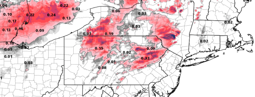
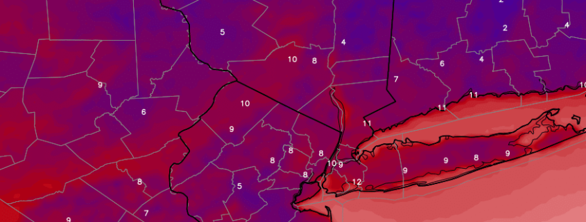
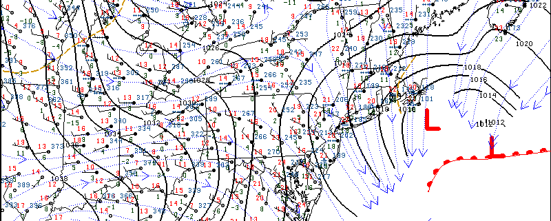
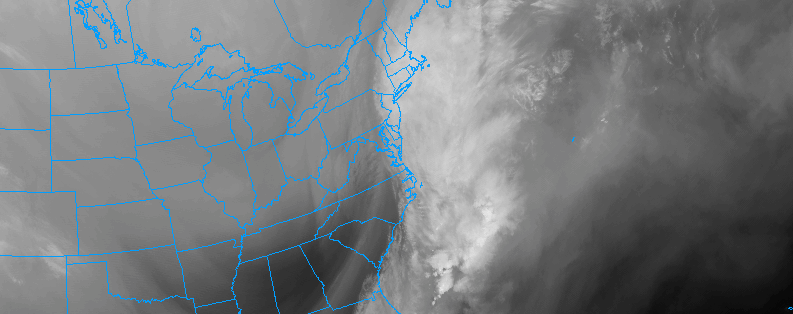
Increasing clouds this evening will continue building tonight, as a large and complex storm system develops over the Central United States. The hallmark of this storm system, in our area, will largely be southerly winds and warming temperatures in the atmospheres mid and upper levels. However, stout cold air near the surface will lead to the potential for freezing rain on Tuesday evening in the interior and higher elevations.

While southerly winds build in the atmospheres mid and upper levels, where snowflakes form and fall, temperatures at the surface are forecast to remain quite cold even as precipitation begins to fall late on Tuesday afternoon and into the evening and overnight period. This creates concern for freezing rain in the higher elevations and areas with deeper snowpack, with rain falling and refreezing on the surface for a period of time on Tuesday evening.

Read more

All Zones AM Update: Cold morning, warmth on the way

Impressively cold air settled in to the area this morning with temperatures falling below zero in many locations. This occurred at the typically favorable radiational cooling locations such as the Pine Barrens and Central/Eastern Long Island. Westhampton Beach dropped to -9F shortly after sunset, which is extremely impressive even for this time of year! Most other areas saw single digit lows, with temperatures predictably remaining warmer in the city and other urban locations.

Temperatures will remain quite cold today with an arctic high pressure still hanging on to control of the weather pattern. Blustery winds will have calmed down this morning and afternoon, and the day is expected to be pleasant overall. Plenty of sunshine will dominate the skies early with no precipitation impacts anticipated — with a gradual trend towards more cloud cover as the day goes on. The biggest threat may be black ice which could have formed on some area roadways.

Read more

Zone 2 and 8 7:00pm Update: Snow Ends over Overnight

Snow will continue moderate to heavy at times through about 10pm this evening. Strong 700mb frontogenesis and positive vorticity advection could lead to more banding with snowfall rates between 1″ to 2″ per hour. Also snow growth remains large, with very cold temperatures and lift in the dendritic snow growth region. Then snow will begin to tapering off to light snow and flurries and ending overnight. So far snowfall reports have been between 6″ to 10″. Total snowfall between 8″ -12″ over expected over Long Island and Connecticut. Some higher totals up to 14″ are possible over Eastern end of Long Island and Southeast Connecticut. Take more precaution driving on roads throughout the night, as snow and ice will tough to treat with frigid temperatures.

Read more

All Zones Update 11:00am: Snow continuing near the coast

Regional mesoscale analysis shows a developing storm system, which is continuing to move off the coast of the Mid Atlantic states and strengthen this morning. Bands of light and moderate snow have expanded and intensified over the last hour or two, aided by the development of more favorable frontogenesis and lift in the atmosphere. These dynamics will continue to remain favorable over the next few hours.

Snow will continue to evolve from southwest to northeast throughout all zones through this afternoon. The heaviest and most impactful snow will occur across Southern and Eastern New Jersey, Central and Eastern Long Island, and Eastern Connecticut. Here, upwards of 6″ of snow appears likely. Roads and travel will likely be heavily impacted by the snowfall and conditions will deteriorate as the late morning and early afternoon continue.

Read more