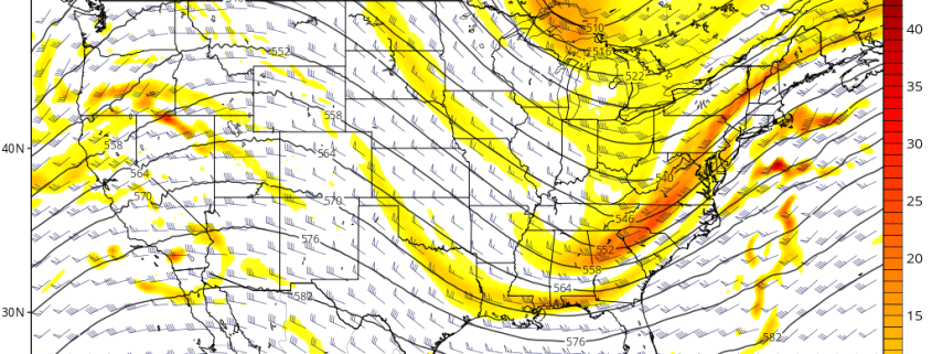
A polar shortwave disturbance will cause low pressure to develop along the North Carolina coast this evening, with a low pressure area slowly intensifying and tracking to the northeast. The storm system will remain relatively progressive, with the brunt of its precipitation remaining over the Atlantic Ocean.
However, with some lift fro, an upper-level jet streak overhead, snow is likely to spread throughout parts of the Mid Atlantic and Southern New England later tonight into Thursday morning. Most of the snow is expected to fall on the lighter side of the intensity scale, with liquid totals only expected to reach .10″ – .25″.
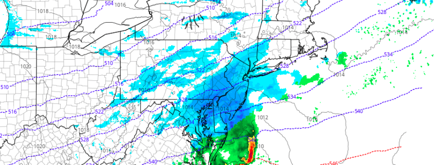
However, instability and large omega (lift) in the snow growth region will likely to lead to the formation of large dendrites. Snow ratios from this event could be as high as 20 to 1 in some areas. With that in mind, snowfall totals of 1-3″ are expected throughout much of the region. Roads could be slick or snow covered for Friday’s morning commute.
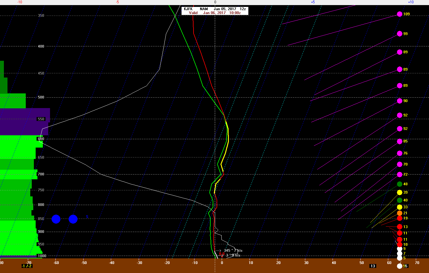
4km NAM model sounding for JFK airport showing large dendrite snow growth
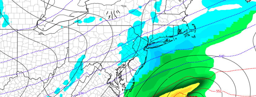
Some lower amounts are possible well inland where moisture will be more limited. Heavier banding may occur closer to the coast, especially over the NJ coast and Long Island with the potential for isolated totals upwards of 3”. Snow will taper off Thursday morning as low pressure moves away from the region. Clouds will break for some sunshine in the afternoon as drier moves into the region.
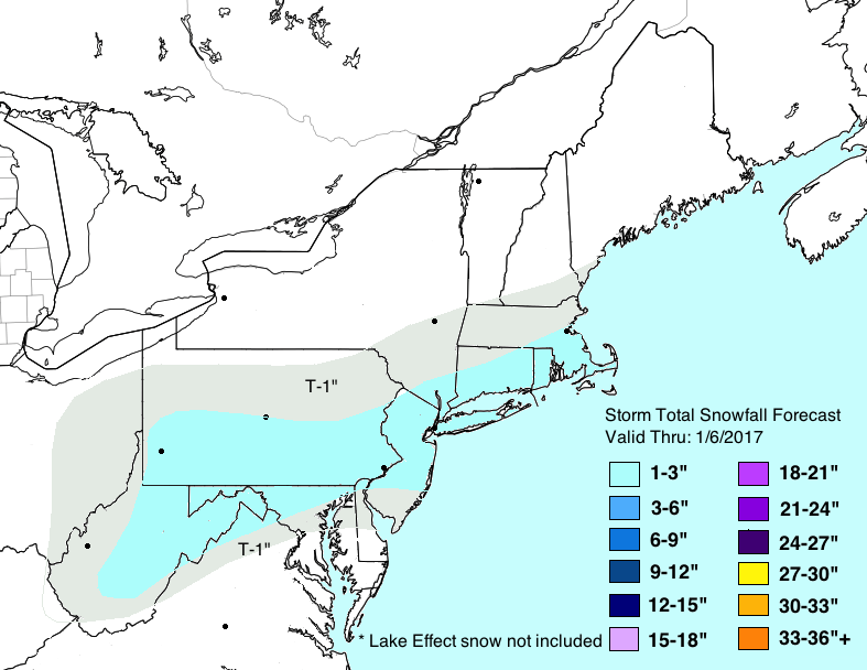
Storm Total Snowfall Forecast updated January 5th, 2017
Another storm threatens the region this weekend — more details on that coming tonight for Premium members.
-2")