Zone 3/7 (Interior) Update: Wintry weather expected on Monday

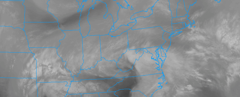
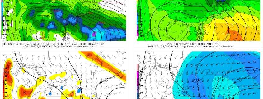
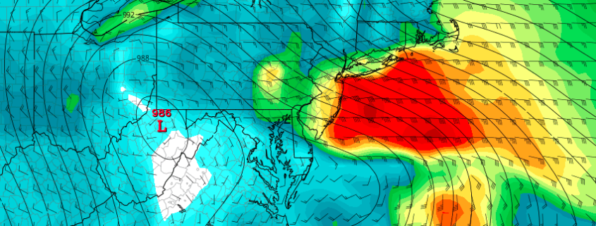
A Nor’Easter as unique as it will be strong is expected to develop throughout the Eastern United States on Monday. The storm is already in its developmental stages well to our south, and will shift northward into the Mid Atlantic states through Monday morning. A surface low pressure area is expected to then redevelop off the coast, strengthening near the Delmarva and then shifting eastwards towards the 40/70 Benchmark.

All of these things would bring one to believe a winter storm is on the way. Think again! A warm, modified, Pacific airmass is in place prior to the storms arrival (have you been outside recently?) and the main focus of the storm will be torrential rain and wind near the coasts. However, the storms dynamics and cold air aloft will work to create wintry possibilities inland, even despite the warm air at the surface to start.

Read more

Public Analysis: Heavy rain and strong winds likely on Monday

A large storm system will develop throughout the Eastern United States on Monday, organizing first in the lower Mid Atlantic region and then shifting northeastwards. A large upper level low will form in the atmosphere, with impressive atmospheric dynamics shifting from the Southeast states up the East Coast. The dynamics of the storm are impressive: A High Risk of severe weather has been issued by the Storm Prediction Center in Georgia and Florida today.

Gradually, a surface low pressure is forecast to develop from the Delmarva coast northeastwards off the coast of the Mid Atlantic. A large area of moisture will surge northwards up the East Coast, with significant lift in the atmosphere tapping into this moisture and aiding in the development of very heavy rain. Rainfall totals of 1-3″ are possible — with some flooding in low lying and poor drainage areas.

Read more

1/21 All Zones AM Update on Significant Storm for Monday & Tuesday

As we discussed, previous article significant storm will impact region early next week. This storm will could turn into major Nor’easter with heavy rainfall, strong gusty winds, and some coastal flooding during the high tides. Even some snow and sleet is also possible for some of the Interior locations. More discussion on some details on each potential impacts below for the all the zones.

Rainfall: Some rain could arrive by Sunday night. But the steadiest and heaviest rainfall will be late morning/early afternoon on Monday through early Monday night, with strong low-level jet moving northward through the region. Then low pressure transfer from inland too off the coast, weakens and occludes, rain will be somewhat lighter and more intermittent late Monday night and Tuesday.

Read more

Significant storm next week will bring rain, strong winds

A powerful upper level trough is forecast to develop in the Eastern United States next week, within an amplified upper level height pattern. A strong disturbance is forecast to eject eastwards from the Western United States, and eventually amplify into the Southeast United States during this upcoming weekend. Thereafter, the disturbance will move up the East Coast while slowing down — and allowing a surface low pressure to amplify.

Forecast models have jumped around a bit with the positioning of this surface low pressure, but recently have come into better agreement on the track, taking the surface low inland over the Mid Atlantic states and then off the coast. A considerable amount of modified, warm air exists ahead of the storm system — so the threat with the system is not winter weather. Instead, an anomalously moist atmosphere and very strong jet dynamics are expected to create the potential for torrential rain and very strong winds near the coast.

Read more