Public Analysis: Significant Snowstorm Likely Tomorrow

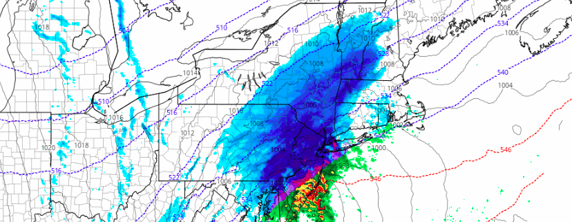
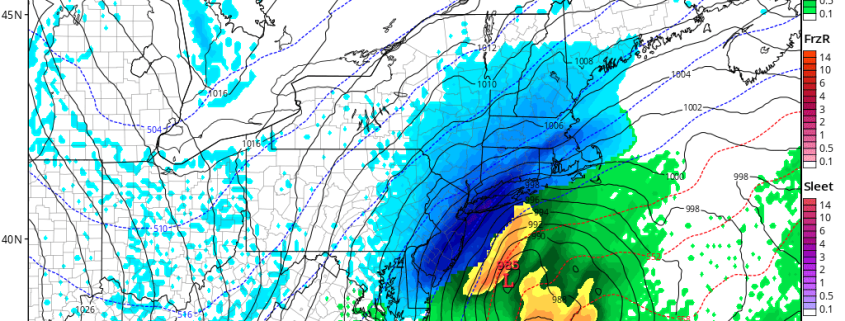
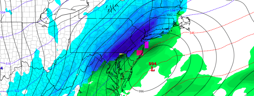
After tracking this potentially significant system over the past couple of days, we have seen some sizeable differences showing up on the computer models regarding potential impacts and accumulations, but this afternoon’s computer model guidance has come into line and it is looking quite likely that the entire New York metro area will be seeing seeing a significant amount of snow during the next 24 hours with a variety of potential impacts.

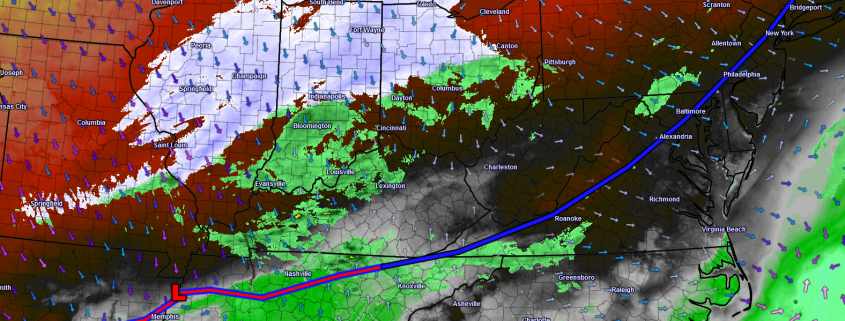
As was talked about on Monday, we have our two key pieces of energy that have to interact and come together this evening in order for our storm to take shape and really begin to intensify. If we look on the 500mb chart below, which is essentially what’s happening up in the atmosphere at roughly 18,000 feet, we can see our two distinct features highlighted in pink. Our first piece can be seen over Kansas City, Missouri this afternoon which has generated the beginnings of our storm over Arkansas and Tennessee with precipitation starting to break out all the way up into Illinois/Indiana/Ohio. As our second feature begins to dive south from its current position to the north of Bismark, North Dakota and interacts with the piece of energy in Missouri, the low pressure currently in the south will begin to speed up and track into northern Tennessee this evening. More precipitation will begin to blossom to the north of the low pressure area as time goes on. This low should steadily deepen as it tracks through Virginia by the early morning hours and bring the onset of the precipitation to the southern New Jersey by 2-3am. This area of snow and rain should gradually move up from southwest to northeast and since we have temperatures in the 50s-60s this afternoon, the initial precipitation may be in the form of a rain/snow mix due to residual warm air. As the precip starts to come down at a heavier rate, a switch to heavier snow/mix is likely for much of the area.

Read more

2/8 Afternoon Zones: Significant snow likely Thursday

Significant snow is expected on Thursday, as a low pressure system moves from the Mid Atlantic to a position east of the New Jersey coast. The low pressure system will deepen rapidly, as a result of increasingly favorable dynamics in the atmosphere’s mid and upper levels. As the storm moves off the coast of New Jersey, bands of very heavy precipitation are expected to rotate inland, resulting in widespread heavy snow.

The event will begin as mixed precipitation, especially in Southeastern New Jersey and along the area coasts. Elsewhere, the mixed precipitation should transition fairly rapidly to snow, which will quickly become steady and eventually very heavy. Dynamic cooling will change rain and mixed precipitation to snow gradually in all areas, slowest over portions of Southern New Jersey on Thursday morning.

Read more

AM All Zones Update: Significant Snowfall Expected Late Tonight into Thursday

A warm front will likely make little progress northward this morning, before a cold front moves through during the midday hours today. Drier northwest winds behind this front, will cause low clouds and fog to clear for more sunshine later this morning and afternoon. Temperatures will still rise into the 50s and some even lower 60s this afternoon, with a downslope flow. Then a colder airmass will begin moving into the region tonight.

Read more

Afternoon All Zones: Significant snowfall increasingly likely Thursday

Forecast models have trended in favor of a stronger, more impactful storm system moving through the Mid Atlantic states on Thursday, and confidence is increasing in a significant snowstorm for a large majority of the forecast area. The potential exists for 9-12″ of snow in parts of the area, and higher amounts cannot be ruled out where bands of heavier snow develop.

The story of the storm system begins over the Midwest states, where a disturbance in the mid levels of the atmosphere develops on Wednesday. This energy moves eastwards from the Midwest through the Ohio Valley, and eventually to a position off the Mid Atlantic Coast. As it does so, interaction with a disturbance in the northern jet stream will cause the energy to deepen.

Read more