Good afternoon!
The cutoff low that we talked about late last week has indeed trended a bit closer to the coast, which means more significant/prolonged impacts than previously thought, as model guidance has trended towards a weaker and more progressive area of high pressure during the past few days. Overall, this means that the threat for locally heavy rain, some gusty winds, and possible minor coastal flooding has increased.
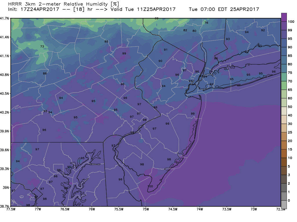
With much more cloud cover and and cooler temperatures ushered in from winds coming in off of the Atlantic this afternoon, today has been yet another glum and dreary day across the entire NYC metro area. Underneath this thick later of cloud cover, temperatures have struggled to get out of the 50’s this afternoon, with only a few stations in Northern New Jersey, Southern New York, and portions of Connecticut reporting highs in the low 60’s.
As we continue through the day, not much change is expected at all with regards to cloudiness as we near sunset. Some areas of light showers may be possible, but with a wedge of drier air in the low levels of the atmosphere, no significant rains are expected through the rest of today. With heavy cloud cover and the prolonged easterly winds from the Atlantic, lows should remain in the 40’s to low 50’s across the entire area this evening, with far northern sections having a shot a seeing some slightly warmer temperatures.

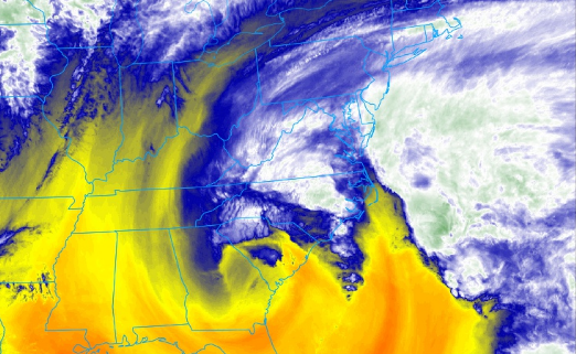
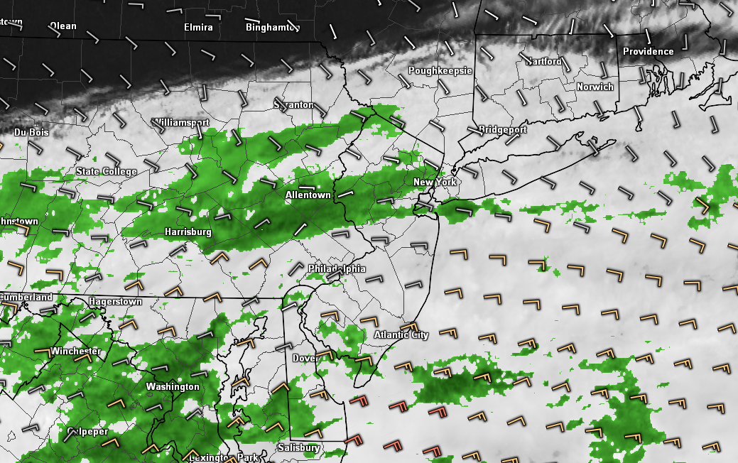
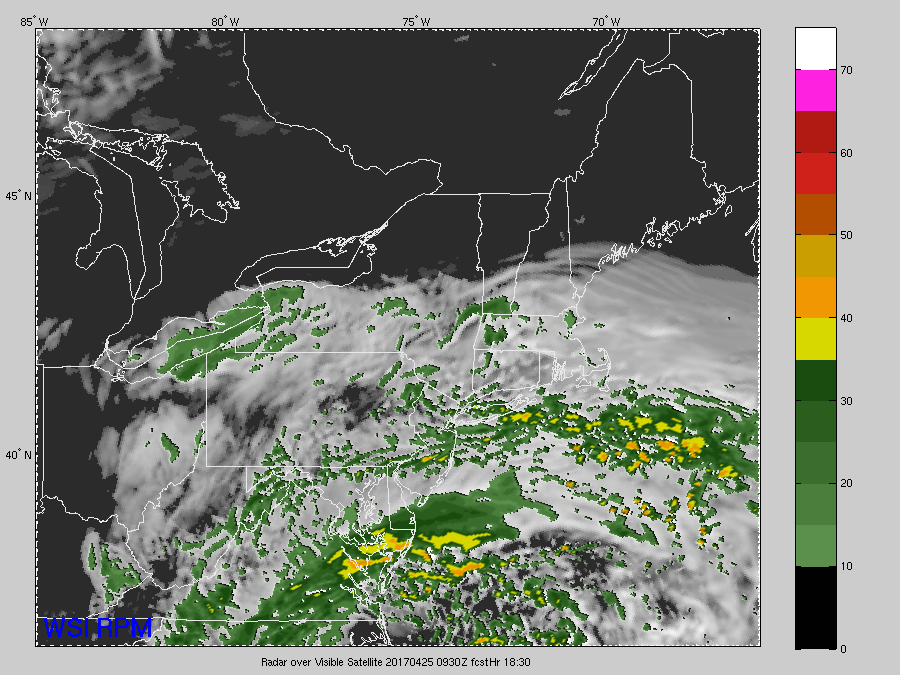
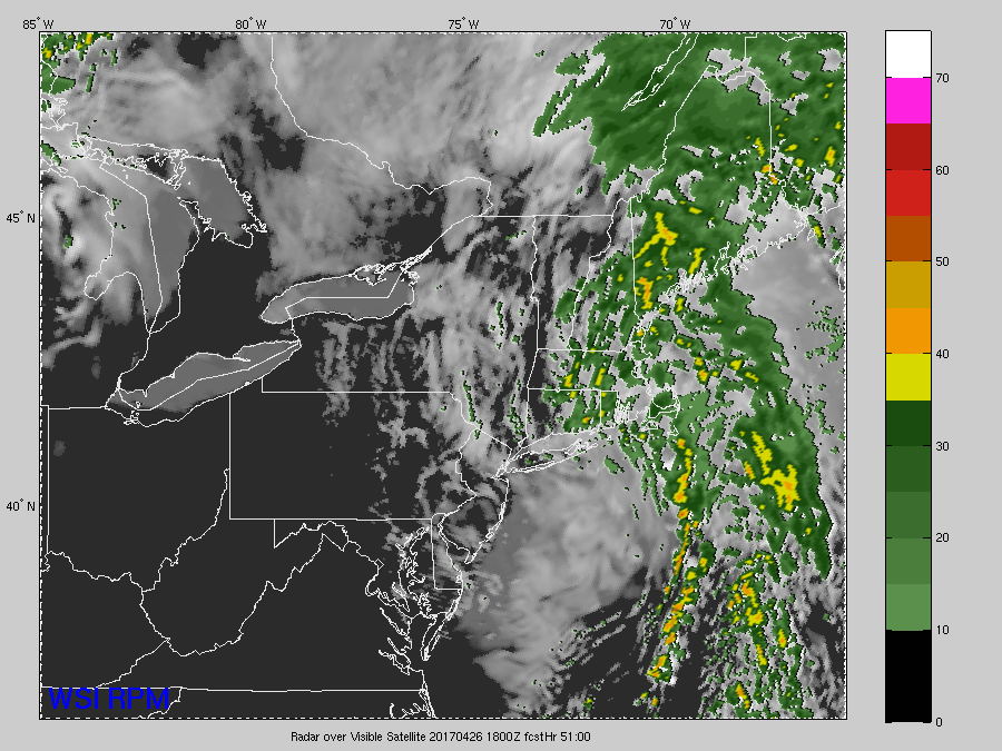
Latest regional radar mosaic, visible satellite imagery, surface winds, and surface temperatures showing the beginnings of the coastal lows influence on our area’s weather (Courtesy of GREarth)
Tuesday Into Tuesday Night
As the coastal low begins to strengthen late this evening and into very early Tuesday morning, the easterly winds from the Atlantic should begin to strengthen quite a bit. These easterly winds will bring in moisture from the Atlantic, and also the risk of some heavier showers during the early morning hours. With the increased moisture and the strengthening low levels winds, some of these heavier showers could produce brief heavy downpours and some brief gusty winds. As the morning continues on, areas of continued showers and some areas of fog along the coast are possible with abundant low level moisture.
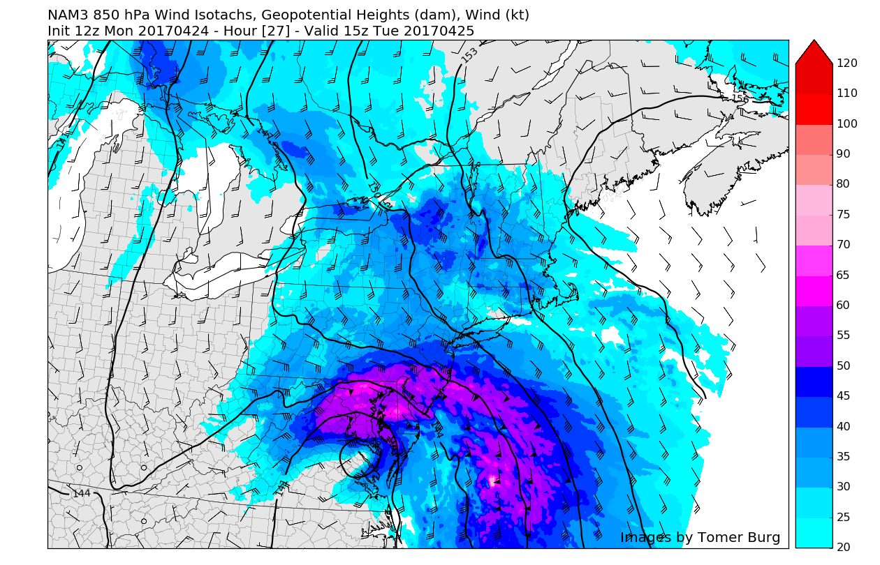
Once we progress into the early afternoon hours, things should begin to go downhill with much more steady rain likely across the entire metro area. With the core of the low level jet starting to work its way up the coast by around 11 am, heavy downpours and windier conditions will increase from south to north. Conditions will likely remain steady or slightly worse as the afternoon progresses and the low pressure area continues to creep northward. Latest high resolution model guidance indicates that the precipitation with this system may be more convective (or spread out) in nature, instead of a uniform “shield” of moderate rain, so rainfall amounts may vary quite a bit during the afternoon and early evening hours.
As the storm continues into tomorrow evening, the low level jet should be directly overhead and this should bring the heaviest impact for our area. Heavy rains should be streaming in from the south/southeast during the evening hours, with locally heavy downpours possible. Some gusty winds of around 35-45 mph will be possible in some of the heaviest downpours, as stronger winds just above the surface are able to mix down.
Overall, we will have to monitor conditions closely tomorrow afternoon and evening as there is a small chance at some localized flooding in poor drainage areas and in locations that are caught underneath any possible training of heavier showers. When all is said and done, rain totals should be around 1-2″ across the region, with some locations possibly seeing amounts near 3″. Please listen to your local National Weather Service tomorrow afternoon for any possible Flash Flood Warnings that may be issued.

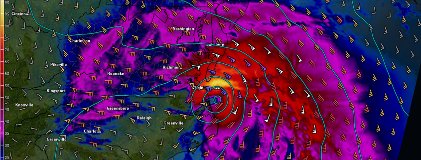
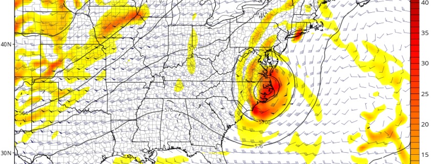
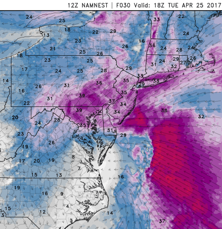
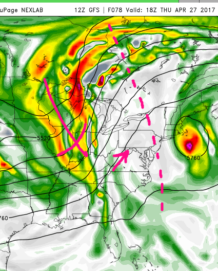
12z 3km North American Model showing heavy rain funneling in over the area tomorrow evening with the low level jet (wind barbs) directly over the NYC area (Courtesy of GREarth)
Wednesday and Thursday
Early Wednesday morning the cut-off low pressure system should be just to the east of the area and weakening at a steady pace as it begins to fill in with dry air. This should work to dissipate the remaining precipitation on Wednesday morning from west to east, but some remaining clouds and light showers will be possible during the afternoon. Temperatures on Wednesday will be highly dependant on whether or not the low pressure system can weaken enough to allow the remaining cloud cover to burn off and let the sun break through. Current indications are that the cloud cover may stick around longer towards the eastern half of the area, thus limiting temperatures to the mid to upper 50’s, where locations to the north and west of the NYC area may see highs in the low 60’s.
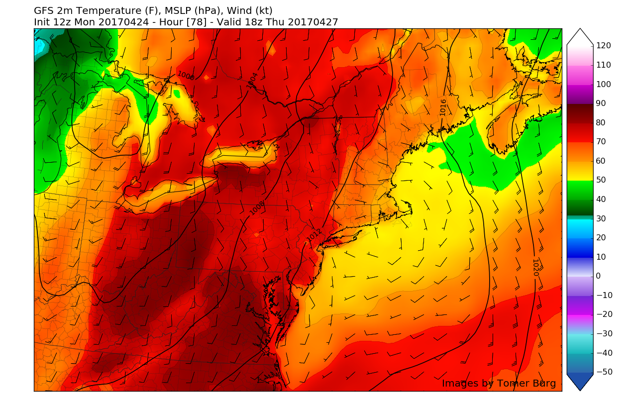
Compared to tomorrow, Thursday should be a much improved day as ridging in the mid levels of the atmosphere begins to build in over the area. This should allow winds to shift to the south/southwest during the day on Thursday and allow temperatures to reach much more seasonable levels for this time of year, with highs possibly reaching the low to mid 70’s across interior sections. Coastal locations in NJ, CT, and Long Island may have to deal with a cooler offshore flow, but since that is a ways out right now, it remains uncertain.

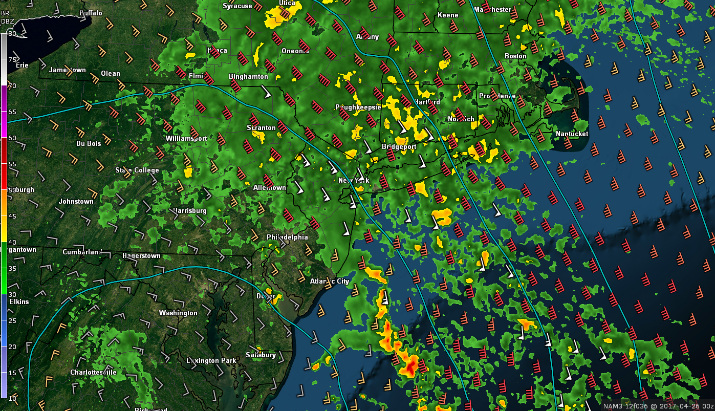
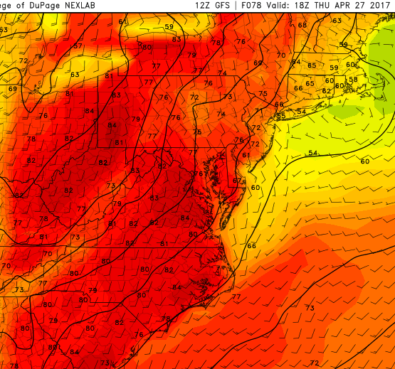
12z GFS showing a much more seasonable and pleasant day across the entire area with highs in the 70’s and light winds from the south
Extended Range
The brief lull in activity should be short-lived later this week as multiple systems out to our west begin to head east underneath high pressure in Canada. These systems have the potential to bring wet and potentially stormy weather once again in the long range, with even the chance at some thunderstorms once the pattern becomes more conducive. In addition to the more active weather, we could also see the return of backdoor cold fronts which could make an appearance late next weekend or into early next week, but model guidance has been inconsistent over the past few cycles, so we will have to monitor this over the coming days.
With the potential for more heavy rain and some possible flash flooding tomorrow, make sure to check back for future updates!
——————
For more information and posts like this one, make sure you sign up for Zone Forecasts — where multiple detailed articles, videos, and interactives are posted each day. Also, come interact with our staff and many other weather enthusiasts at 33andrain.com!
Have a great evening!
Steve Copertino
-2")