Good Afternoon!
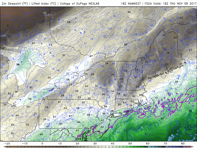
The Arctic front that we have been talking about for around a week now has finally cleared the entire Northeast, leaving well-below normal temperatures in its wake. Earlier this morning, the front blasted through the region with some rain and snow showers, some of which were heavy up towards the central locations of upstate New York. These showers were quickly undercut by much more dry and dense Arctic air from Canada and promptly dissipated. Todays high temperatures were actually set in the early morning hours just ahead of then cold front, with most locations peaking in the lower to middle 40’s. After the front blasted through, temperatures promptly dropped a good ten to fifteen degrees across the entire area, with temperatures in the upper 20’s to lower 30’s being reported from most stations. Temperatures just behind the front change quite a bit with height, which has allowed stronger low level winds to mix down to the surface and cause conditions to become quite blustery, with gusts in the 25-35 mph range this afternoon. This has allowed for wind chills in the metro area to fall into the lower 20’s and teens. As mentioned earlier. the Arctic air has brought in a significantly drier airmass, so any shower activity into this evening will be confined to locations near the Great lakes, where the temperature differential will support the growth of some gusty snow squalls.
The area are of low pressure that brought the Arctic front through the area begins to occlude and weaken while pulling east, the pressure gradient between the Arctic high and the low pressure will decrease significantly, leading to winds steadily decreasing by sunset. As the winds calm and high pressure takes over, we should have near-ideal conditions for steep radiational cooling to take place across the entire Northeast. This will mean that lows will quickly drop off into the teens and even single digits for locations off to the north and west. These temperatures will likely break record lows for many stations across the Northeast, with some readings likely being 15-30 degrees below-normal for this time of year! Any locations that have not yet had their first freeze this Fall will certainly experience a hard freeze this evening, with any vulnerable plants quickly succumbing to the below-freezing temperatures.
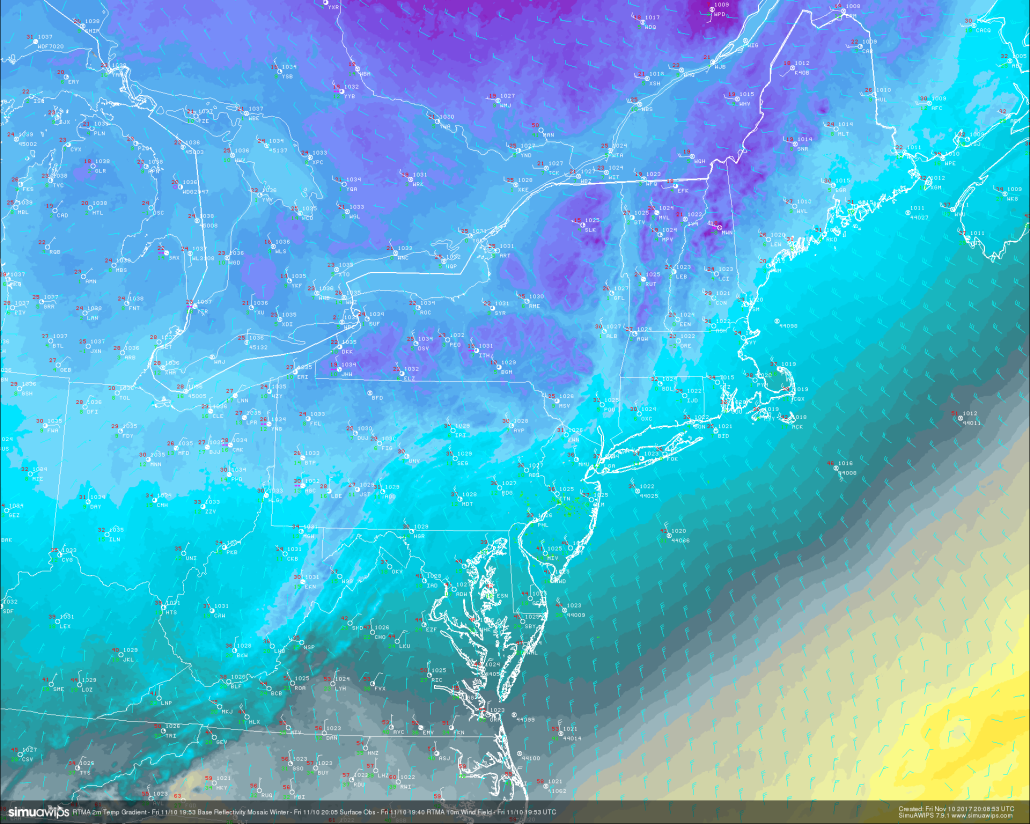
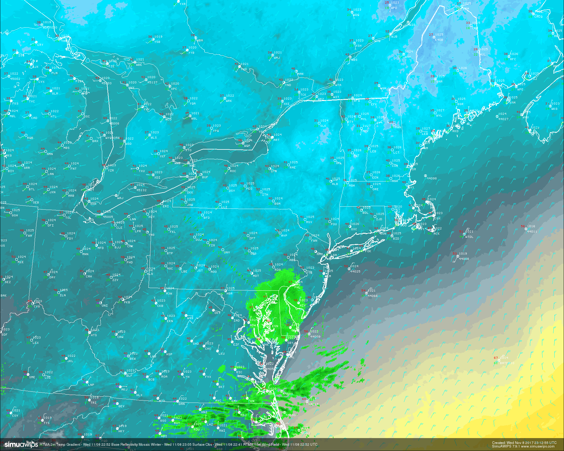
RTMA temperatures showing the near-record cold readings across the area in conjunction with the gusty winds behind the Arctic front
Saturday morning should start off quite cold and clear with the area of high pressure developing right over the Northeast. Winds will likely be much calmer than they are this afternoon, so we may start off a little more pleasant than originally thought. Mid level temperatures will begin to increase a bit, but still be cold enough that much of the Northeast experiences somewhat below normal temperatures tomorrow with highs likely staying in the middle to upper 30’s, with some locations hitting the 40-degree mark. The day as a whole should be relatively calm as a more west-east oriented jet stream sets up aloft, which should shift winds to the east/northeast as the day goes on. Later in the evening, the area of high pressure should be located just offshore of the Mid Atlantic coast, which will be the area more of an onshore flow. This could cause some low level moisture to work into coastal sections of NJ, CT, and NY, but the very low dewpoints in place may keep much of this marine airmass at bay. Regardless, expect another cold night with lows likely dropping back down into the lower 30’s and upper 20’s farther north and west, where radiational cooling will be prevalent. As a side note, the somewhat increased moisture and calm winds may allow for patchy frost to develop, especially across the interior.
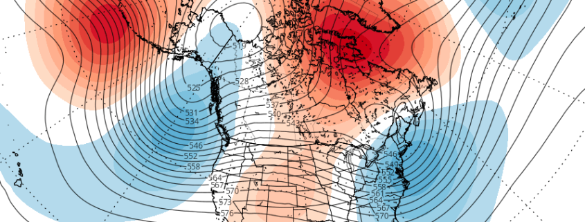
High pressure will likely still remain just offshore by Sunday morning, with clear skies and cool temperatures likely. As we head into the afternoon hours of Sunday, a weak disturbance will be caught in the very quick west to east oriented jet stream that we talked about. Without any kind of blocking to slow this system down and let it organize, it will likely remain sheared out and weak as it nears the area later in the day on Sunday and Sunday night. This disturbance will likely cause a slight increase in temperatures during the day Sunday, with hgihs likely hitting the lower to middle 40’s. An increase in clouds is also expected as the day goes on Sunday afternoon, with some light showers possible across the southern locations of the Northeast and Mid Atlantic states.
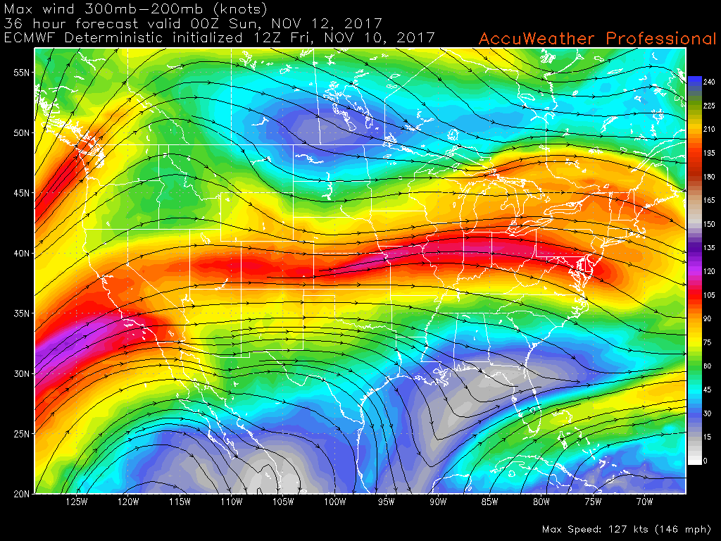
This afternoons ECMWF model showing the very quick west to east positioned jet stream. This pattern has no blocking to slow down any mid level disturbances to allow them to organize and strengthen.
As we head into the beginning of next week, the west to east jet stream will likely stick around, allowing for a large area of mid level ridging to develop across the Central part of the United States and into southern Canada. This should bring temperatures up a bit, with highs likely rebounding back into the upper 40’s and 50’s through Wednesday or so. This area of riding and quick mid to upper level flow will also prevent any major rain events in the medium range, so expect at least the first half of next week to remain calm and dry.
Long Range
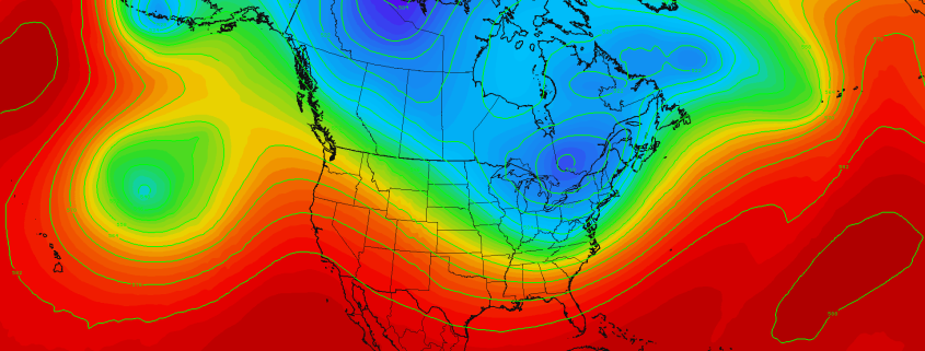
As we get deeper into next week, we may see a pattern shift towards more blocking near Greenland, which would not only slow down the flow across the country, but also allow for below-normal temperatures to start to creep back into the country. The models and their ensembles have been keying in on this type of blocking pattern to set up for about a week now, and things may kick off as early as next weekend. In addition to the blocking near Greendland, some higher heights over the North Pole may also help to drain cold air southward by next weekend and beyond, which could allow for cooler temperatures and even a few wintry precipitation events to exist near the Thanksgiving time period over the Northeast. While this has been advertised for a while on a variety of the models, this is still over a week out and things could very quickly change due to the chaotic nature of the jet stream over the Pacific. Regardless, we expect an increased chance for below average temperatures and above-normal precipitation over the east starting the end of next week and heading into Thanksgiving. This is a developing pattern, so make sure to check back for further updates!
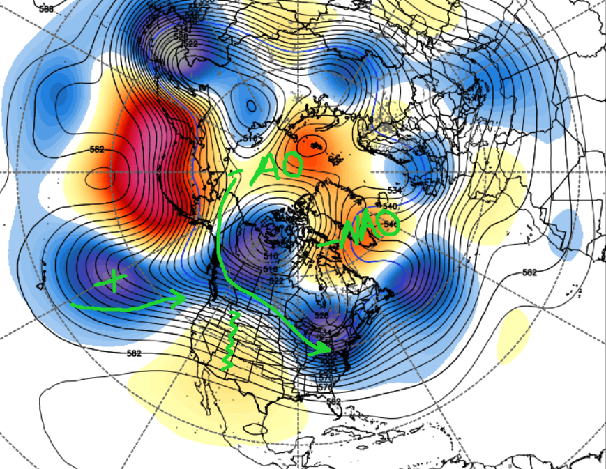
Long Range ECMWF Ensembles centered on next weekend illustrating an active pattern with potential cold air intrusion.
For more information and posts like this one, make sure you sign up for Premium Forecasts — where multiple detailed articles, videos, and interactives are posted each day. Also, come interact with our staff and many other weather enthusiasts at 33andrain.com!
Have a great night!
Steve Copertino
-2")